This year for Spring Break we decided to work our way through parts of Arizona. It’s not too far that we couldn’t drive and yet it was far enough that we felt we were in a completely different area (which…to be honest we needed). We started off in Tucson and headed all the way up to Williams and The Grand Canyon before dropping back down to home. It was such a nice trip and it had me wondering if Arizona is a secret oasis that none of us are talking about…or if I was just enamored with the different scenery, the multiple seasons we experienced (in just one week), and the incredible might of Mother Nature’s presence in Arizona. Who knows really.
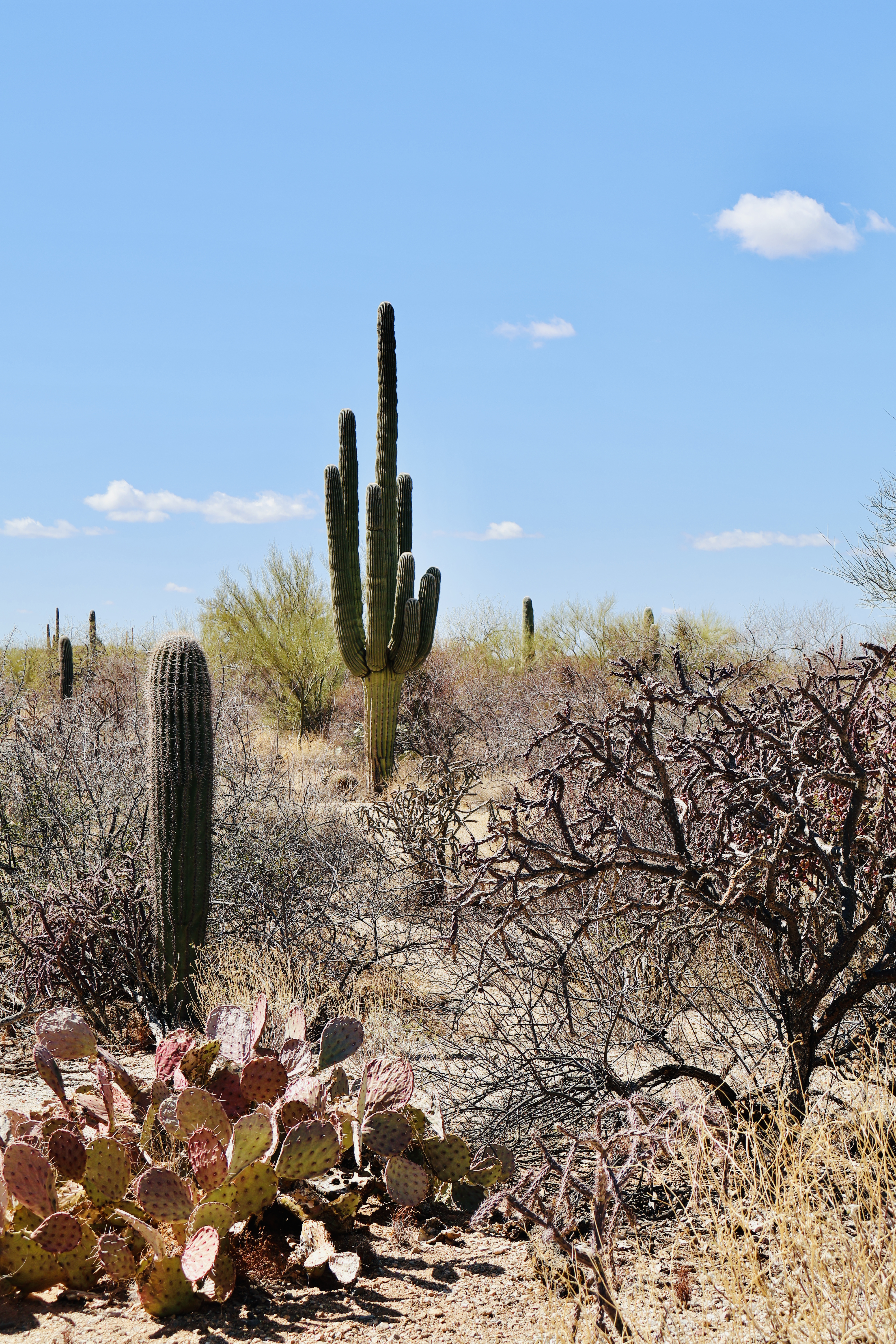
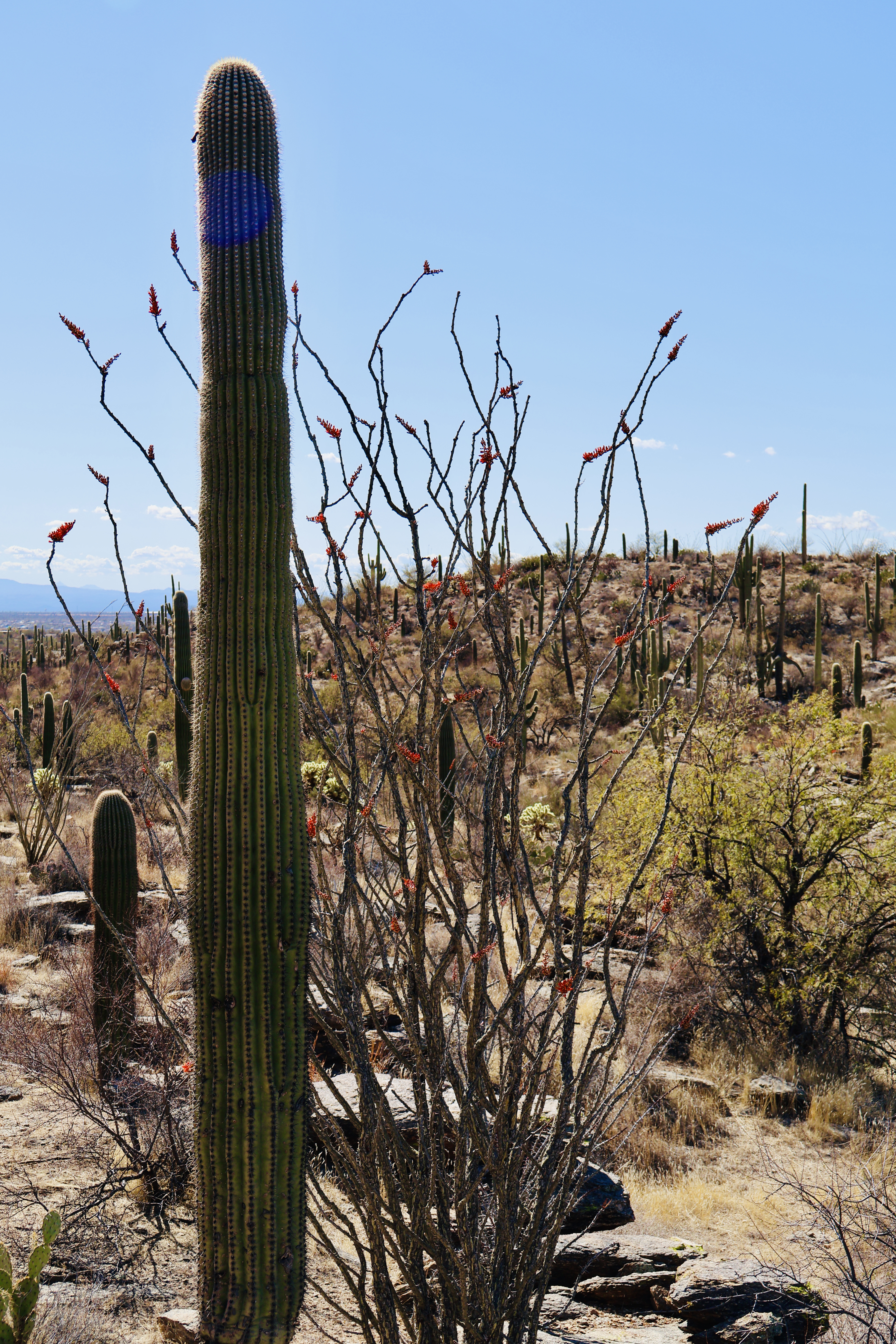
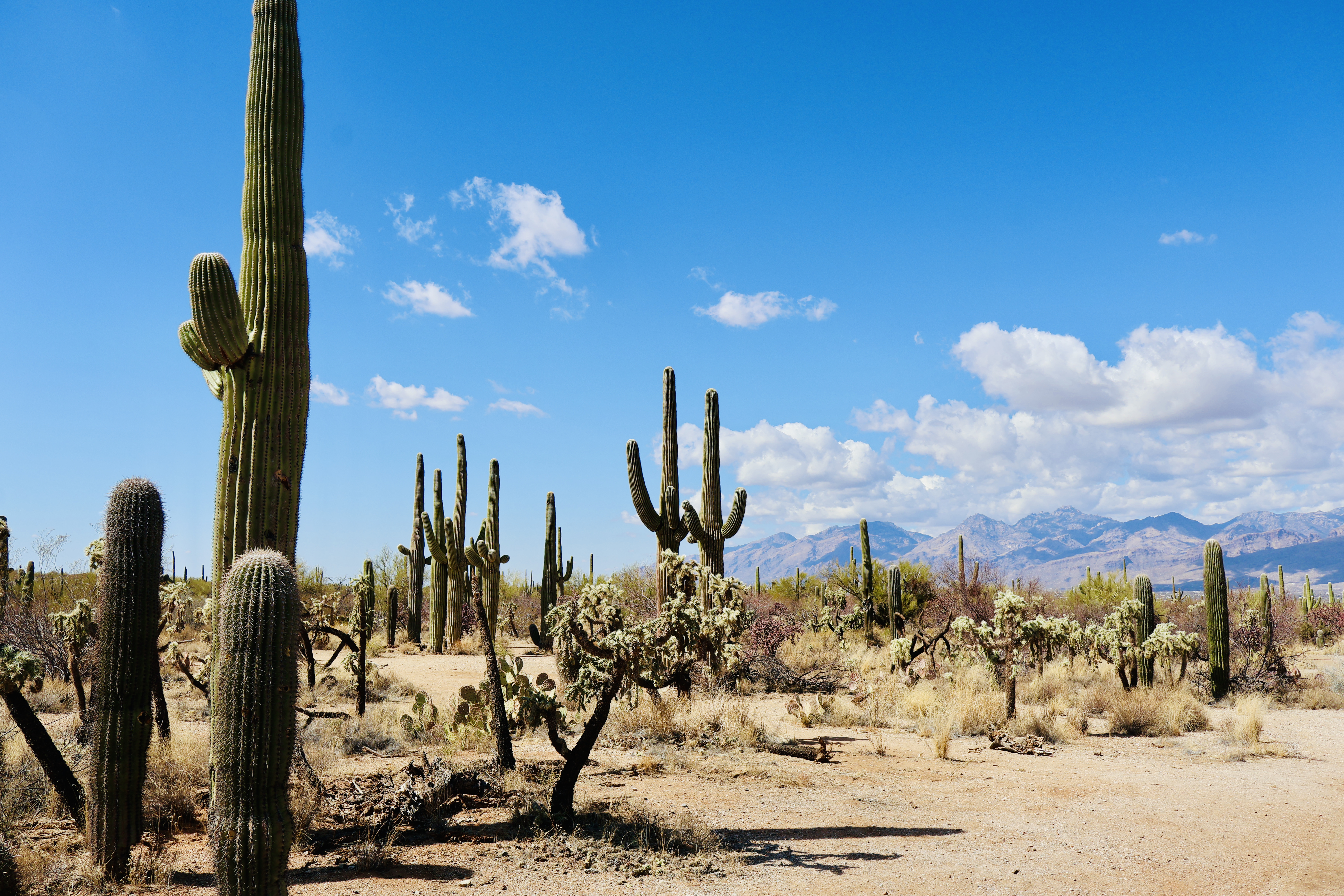
So, to start with we headed to Saguaro National Park. The Saguaro is the cactus we all think of when we think of cactus. They stand tall, they have arms, and the give the desert vibe that you picture with Arizona/Desert (it is not typically found in the California region of the desert). The Saguaro really only grows in certain locations (all below 3,000 ft) and the Sonoran Desert of Arizona is one of those locations. These absolute monsters of cacti can grow over 40 feet tall and live for a very long time (well over 150 years). They are slow growers, taking almost a decade to even grow to ½ a foot tall. The “arms” do not always grow, however if they do, they don’t tend to start to grow until 70-100 years old and they are grown to increase the fertility of the plant. The cactus itself grows both flowers and fruits and can store and incredibly large amount of water. Considered a keystone species, the actually growing location and process, as well as the impact on the wildlife around it is fascinating (no seriously- I found the way mother nature works and how everything ends up working together absolutely fascinating).
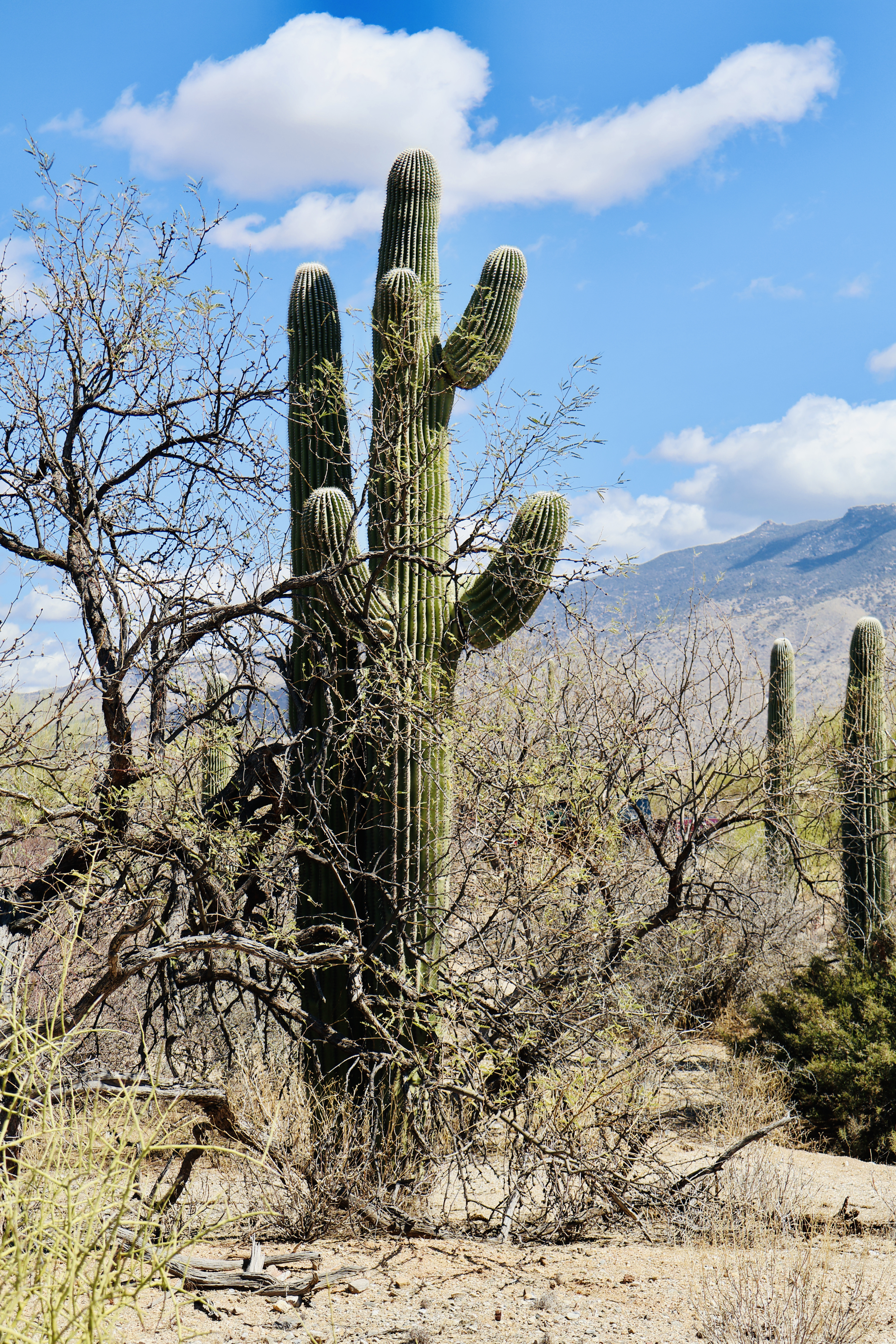
The inside of the Saguaro is akin to a rib cage- though the ribs are similar to hardwood in the composition. They do have a prickly thorn outer covering- the spine. These can grow up to 3 inches long and do some damage. The flowers produced on a Saguaro are white and typically open after sunset and the fruit is a red, is typically ripe in June, and requires a pole to harvest due to how high up it tends to be.
Within the Saguaro National Park, you drive to various stopping locations where you are able to get out and hike trails and see the variety of both Saguaro Cactus and many other variations of desert plants. We spent a good couple hours driving and walking through. There is almost 2 million Saguaro’s within the park, not to mention the wide wide variety of other cactus and plant life. Be careful of wildlife (though we didn’t see any while we were there). It’s truly incredible to see (which is a common theme for this trip overall).
Our second day in the Tucson area was full of history- from completely different timelines. We started the day at The Titan Missile Museum – the only site of the three sites of the Intercontinental Ballistic Missile program still in existence and open to the public to tour. And that tour is both for the work site and an entirely preserved Intercontinental Ballistic Museum (which we will now call ICBM because typing that out every time…whew). There are actually only two preserved launch sites in the world from the Cold War- the one in Arizona we visited and one in Russia. This was designed by the treaty. Both sites have dummy missiles and other measures to ensure that they are non-operational (and those measures are checked regularly by satellite).

The Titan II was the largest ICBM ever in existence by the U.S. Air Force. It was massive- an absolute weapon of true destruction. Located at 3 separate sites (all spaced out by a certain number of miles and each with its own dedicated Silo and base), these missiles were operational for a total of 24 years. The big innovation of the Titan II was storable propellant, which allowed a faster launch time.
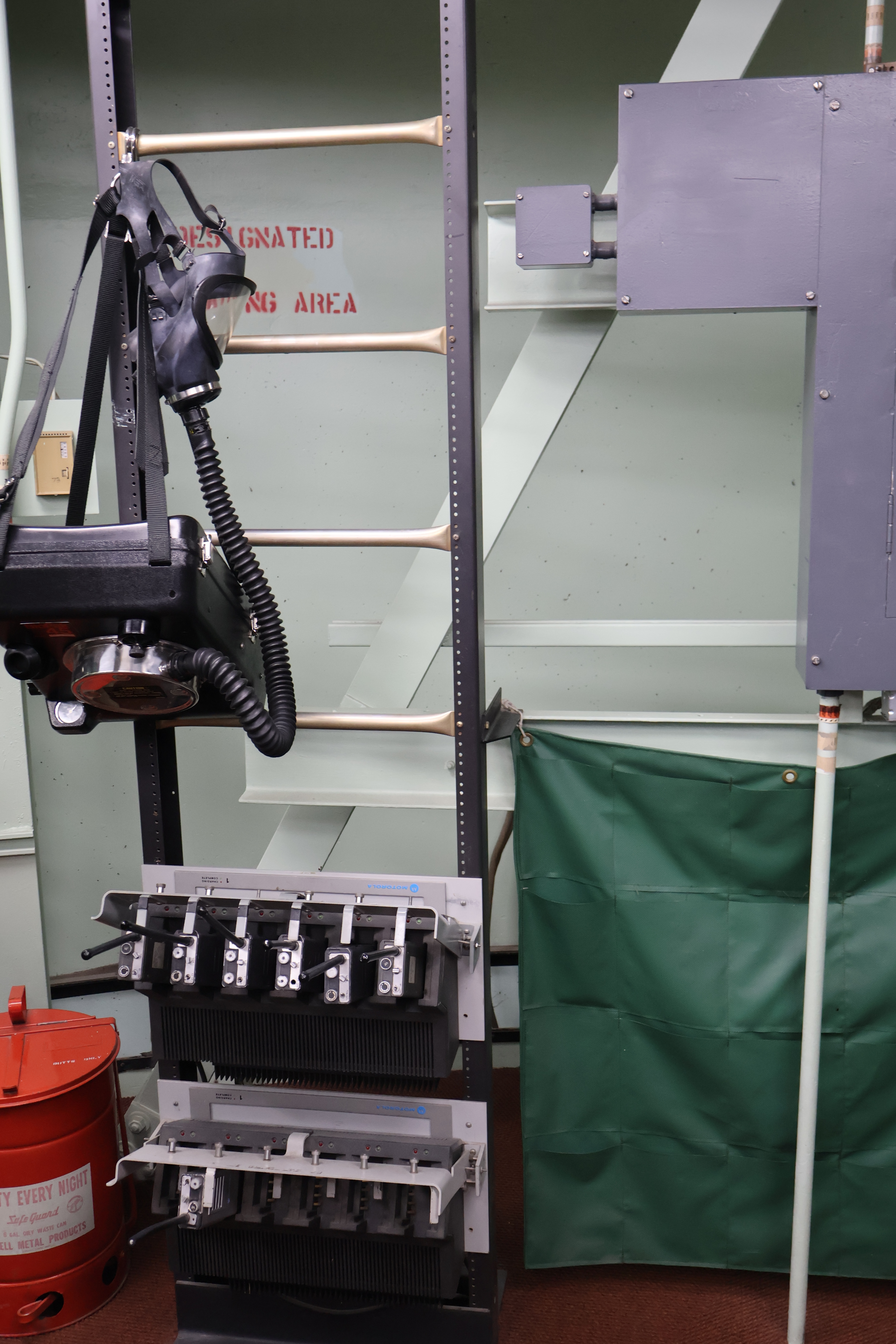
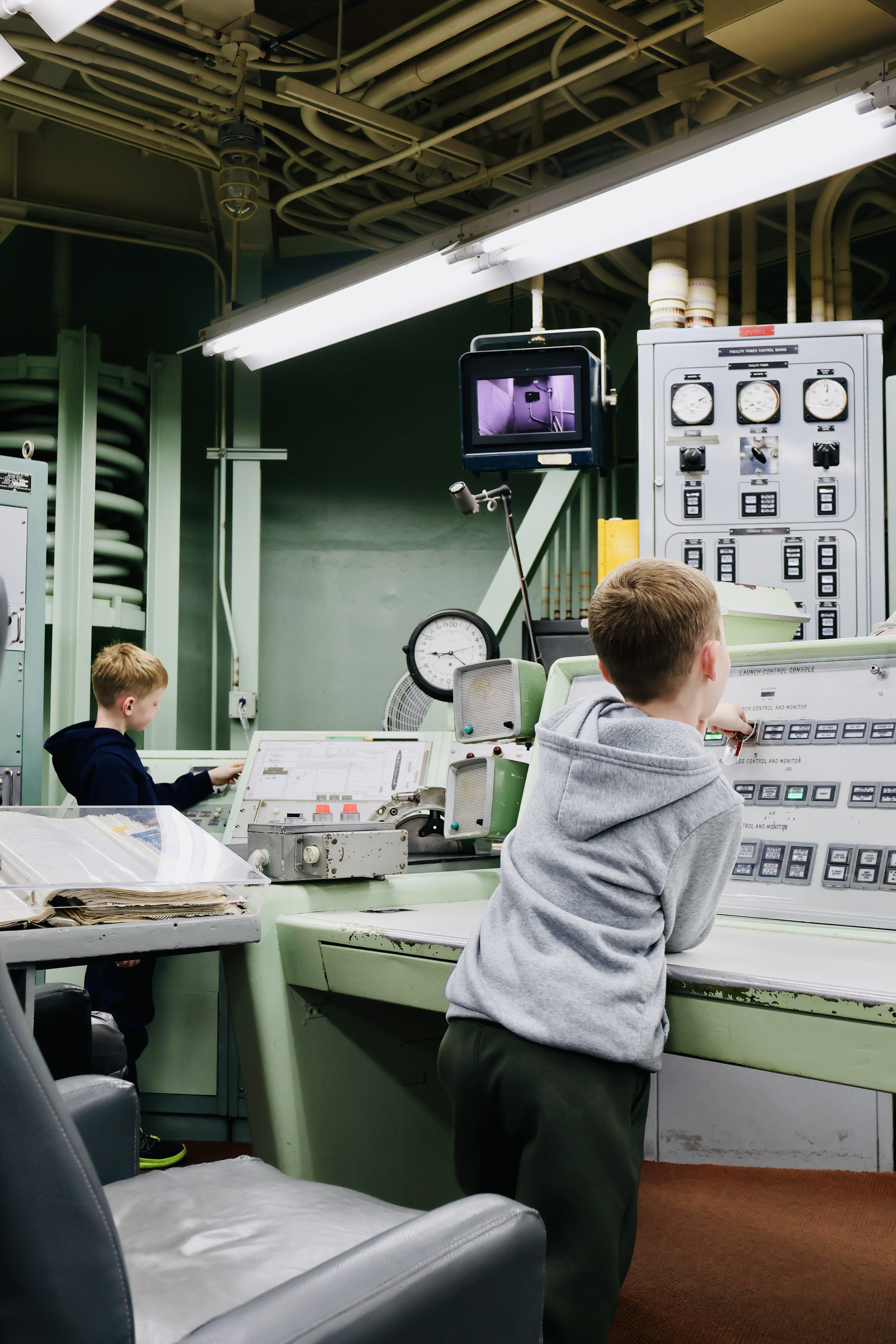
First activated in 1963, the silo sight (Titan II Launch Complex 571-7) was manned 24 hours a day, 7 days a week. The whole idea of this was not only for safety purposes, but also as a deterrent. Both sides had these weapons during the Cold War, and if both sides were continually at the ready to deploy them, then both sides wouldn’t…in theory. We booked the tour that was able to take us down into the silo to see both the bottom side (well more like middle- its massive) of the missile, as well as into the office where the soldiers would sit on shift and deploy the missile if the worst should happen. Please note- this tour they do an example deployment and it’s…something. We learned the measures that would be taken when a new crew came on shift- from the four phone calls that had to be made, the evasion tactics should the soldiers be attacked or followed. No soldier was allowed to be alone within the site due to the potential of spies. It truly was a secure site. We also (as I stated) were able to do a “launch” of a missile, seeing all the steps from start to finish, to see what lights on the various control panels would light up (they are all exactly as they were/would have been while active), and then hear the sounds. It was very enlightening.
Once the silo stood down in 1982, work was started to try and turn it into a museum. This took a lot of work as the missile belonged to the Air Force, but if it was run as a museum, it would be local jurisdiction, not to even begin to mention the treaty between countries and the complicated relationships there. A lot of work was done to the missile in order to make it inoperable and provide assurances that it could not easily (or ever) be repaired and fired. The museum itself opened in 1986.
I will be honest- I was a bit hesitant about heading to this museum- I just didn’t know much. I came away with a whole new level of respect and understanding and awe. I highly recommend visiting it as it’s one of those unique spots that pays homage to a very important part of our recent history.
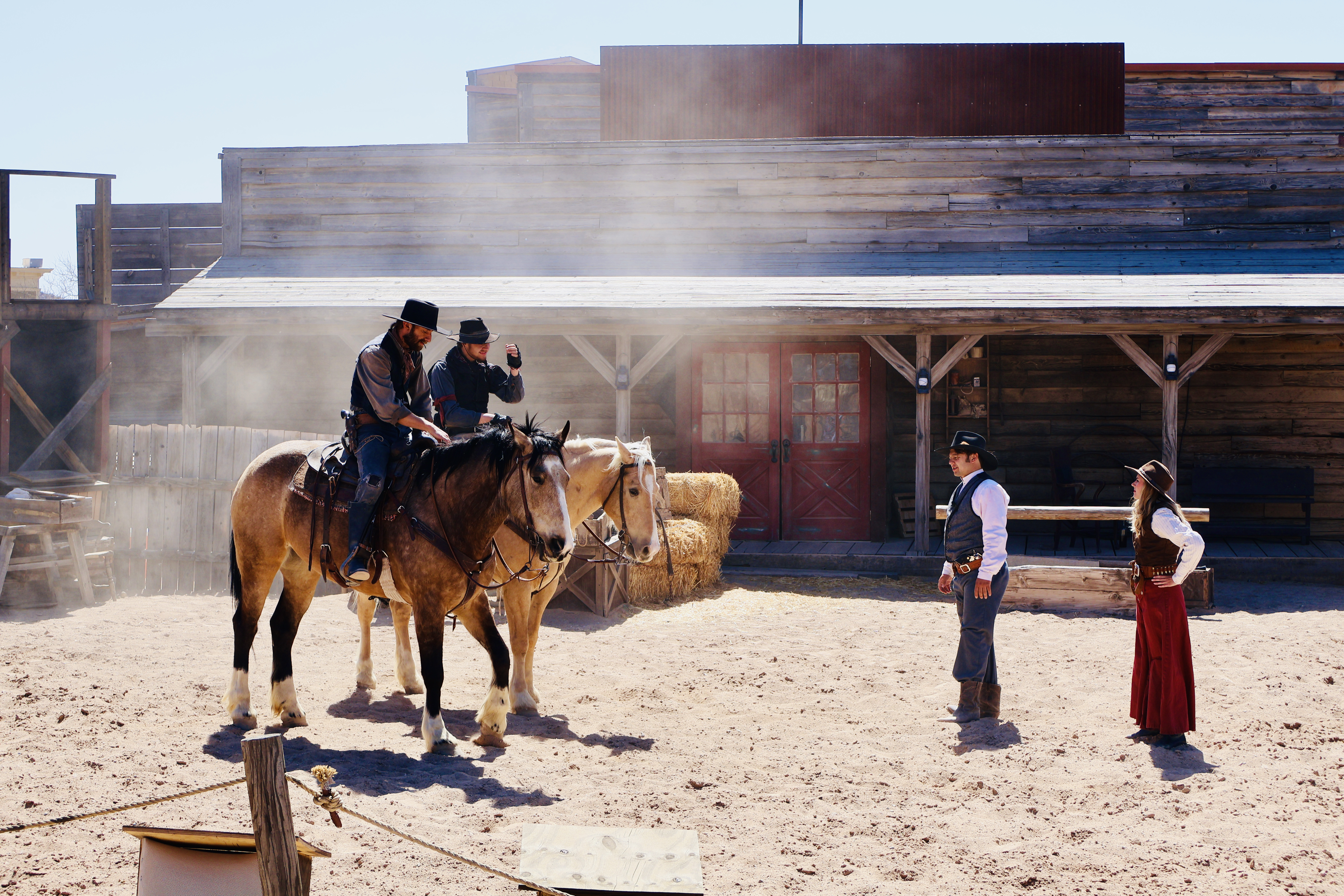
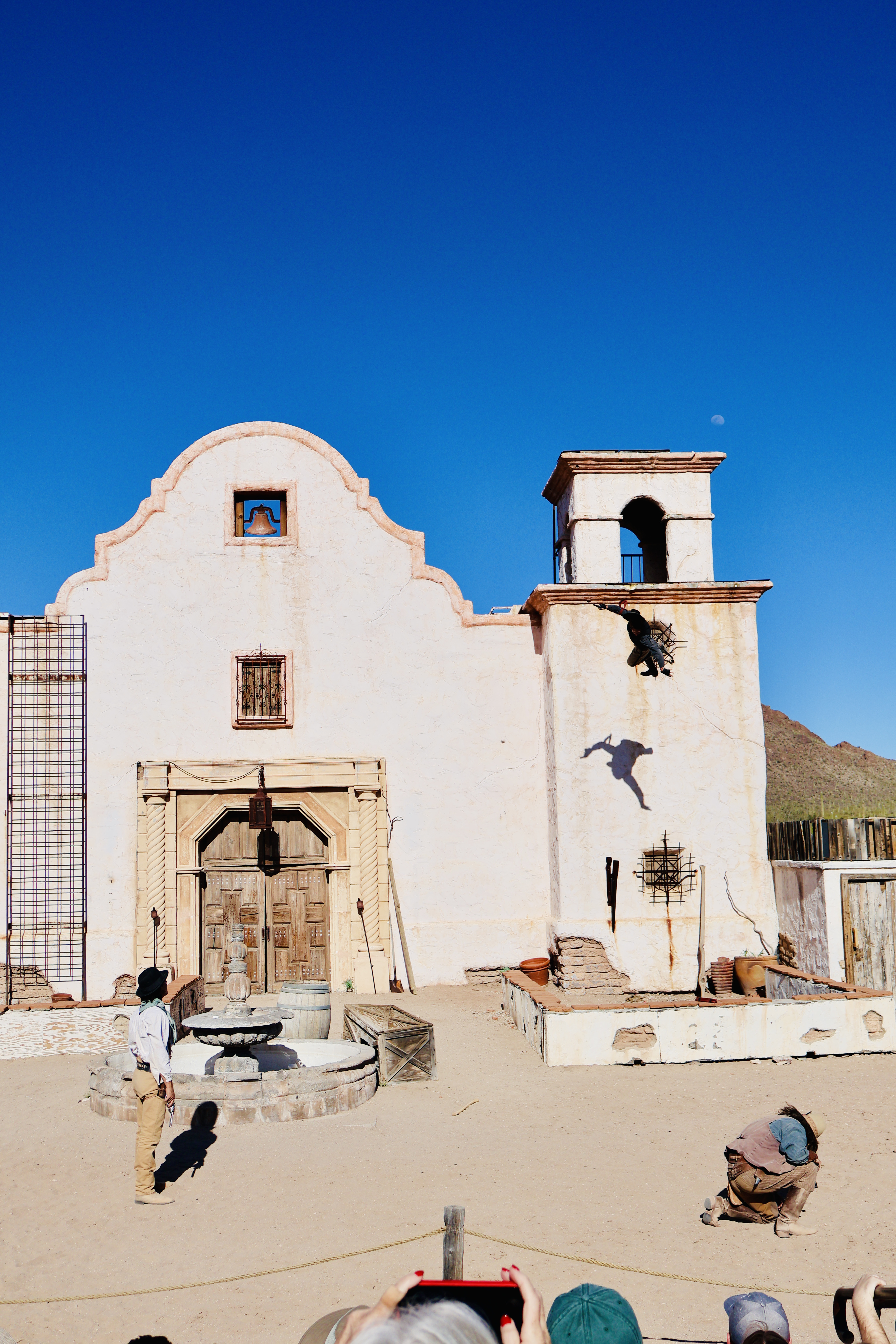
From the Cold War era, we headed even further back and visited Old Tucson. Let me say- this is an amusement park. It does have some historical value and it is often used as a movie set (there is a building dedicated to shows and movies that were shot there, several of which we all know of); I would actually say it is similar to Tombstone, except it doesn’t have the significance of the history, this is more movie than historical. I don’t know if that makes sense or not. Fun fact- Jersey Shore filmed at Old Tucson- the gender reveal wild west show for Mike Sorrentino’s newest child. Which the actors at Old Tucson talk about.
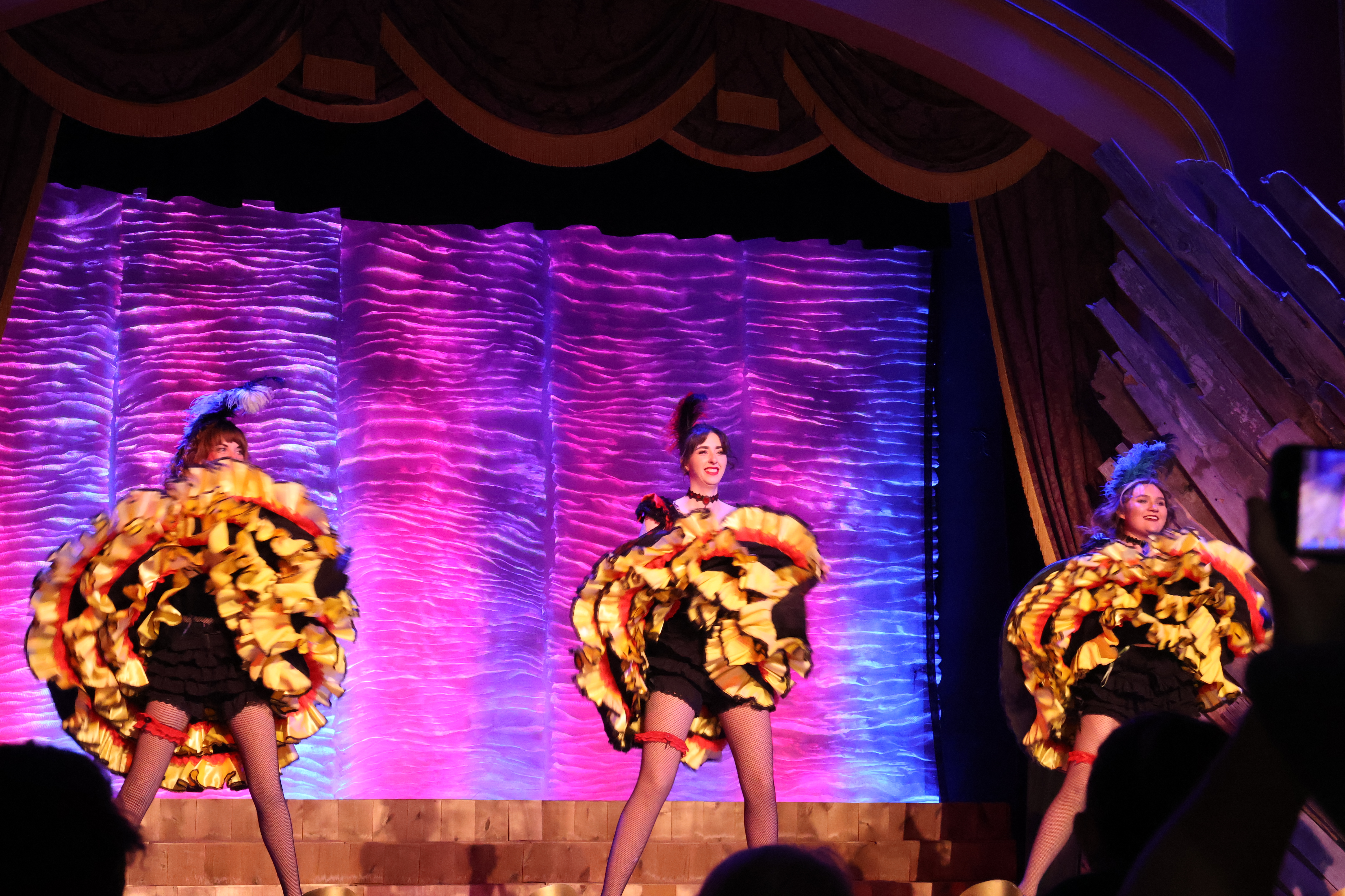
Anyways, we spent an entire afternoon at the park, catching a gunfight show, a can-can girl dance show, a stagecoach ride, train ride, and more. We literally wandered through the entire park doing EVERYTHING (minus the carnival games). This felt a bit more relaxed than Tombstone- in that you’ll be sure to see a gunfight and the actors, but it isn’t a constant overwhelming event. We also attended the stunts show at the end of the day that the actors put on to teach how they pull of the stunts in the different shows and movies. Easily my favorite as the actors have a lot of fun with audience interaction. Highly recommend!
Finally, on our way out the final morning we stopped into Biosphere 2. Biosphere 2 was built to demonstrate that closed ecological systems could work and thus move the concept of human life in outer space forward. It was built in the late 1980’s, and inhabited in 1991 for 2 years (as a closed environment with no outside involvement), and then a second time for 6 months. During it’s time, it was the subject of A LOT of discussion and controversy. I don’t quite know how to get into all of the nitty gritty as there is SO MUCH and I have a lot of feelings on it (some fascination, some hesitation, some upset). The organization that initially brought about Biosphere 2 ran into a lot of problems, some of which never were acknowledged, and it has now become a location of environmental research, rather than closed environment. Amidst the drama, it became a research facility, transferred to its current home run by the University of Arizona and turned into both a research facility and a museum.
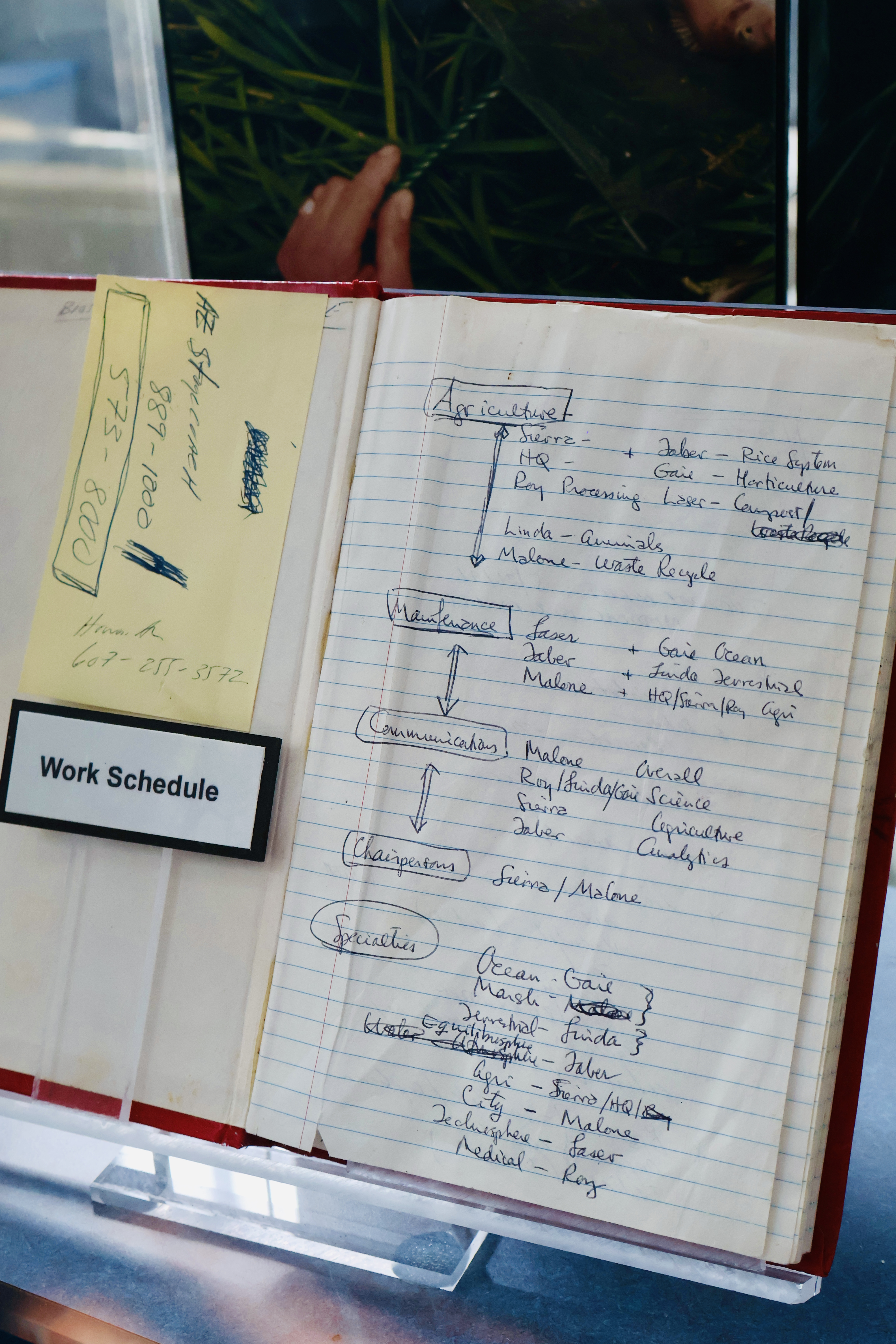
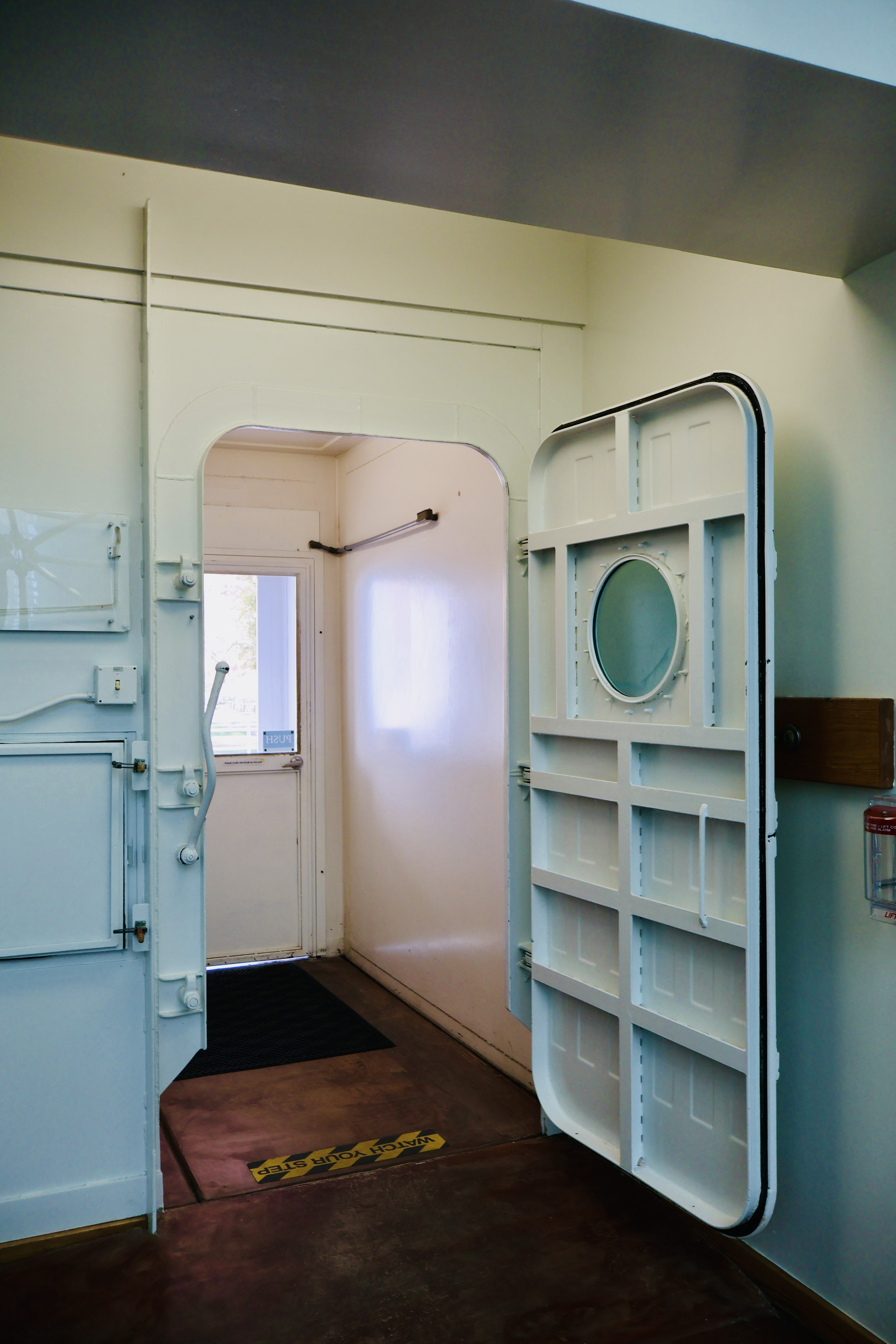
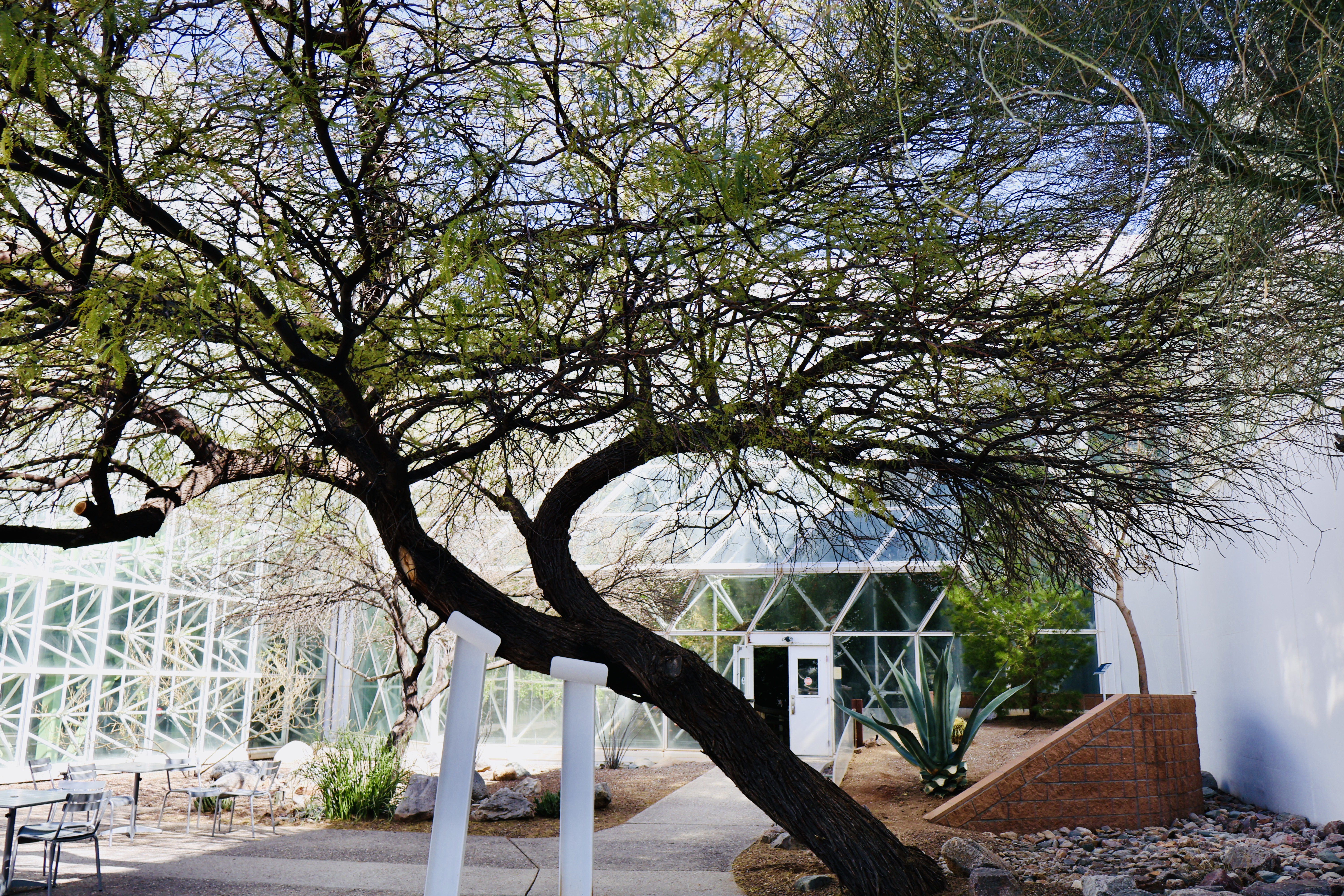
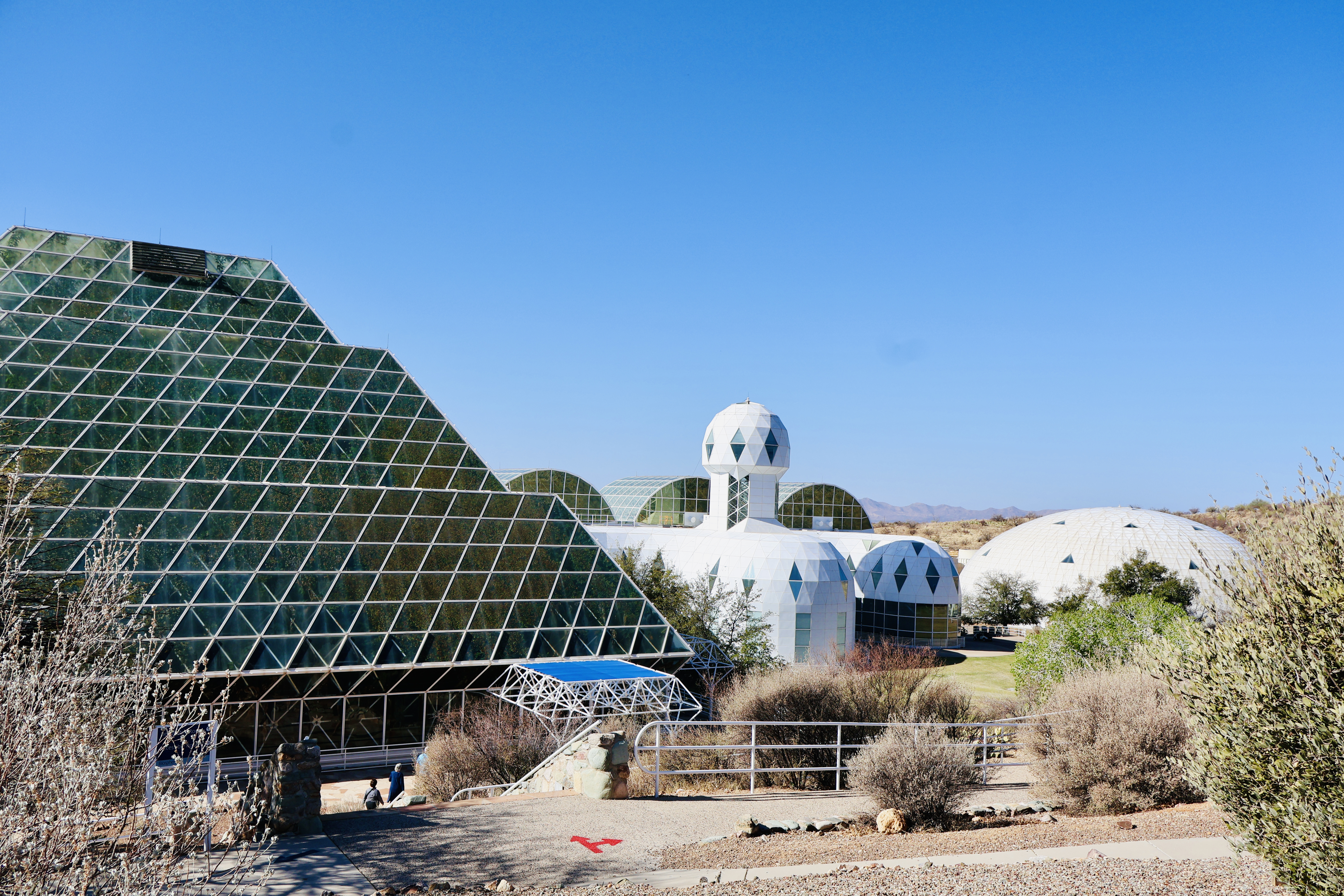
We really enjoyed our morning wandering through the different biospheres, learning not only of their purpose during the closed environment experiment, but also the purpose they serve now, and the research being conducted. I highly recommend stopping by this really unique piece of history and science research.
That wrapped up our time in Tucson- a truly great stop for us!