A Cuppa Cosy Summer Holiday 2022 – Upper Peninsula

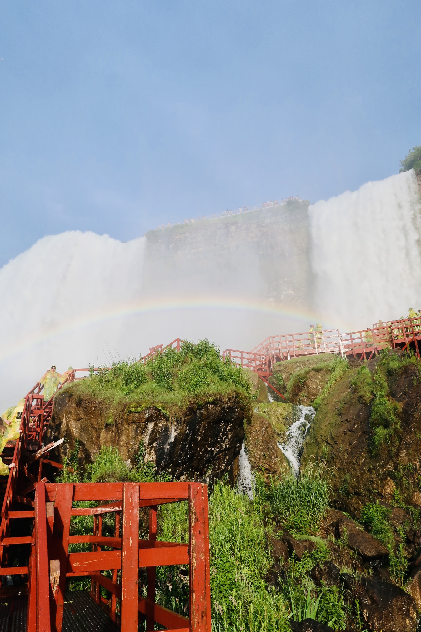
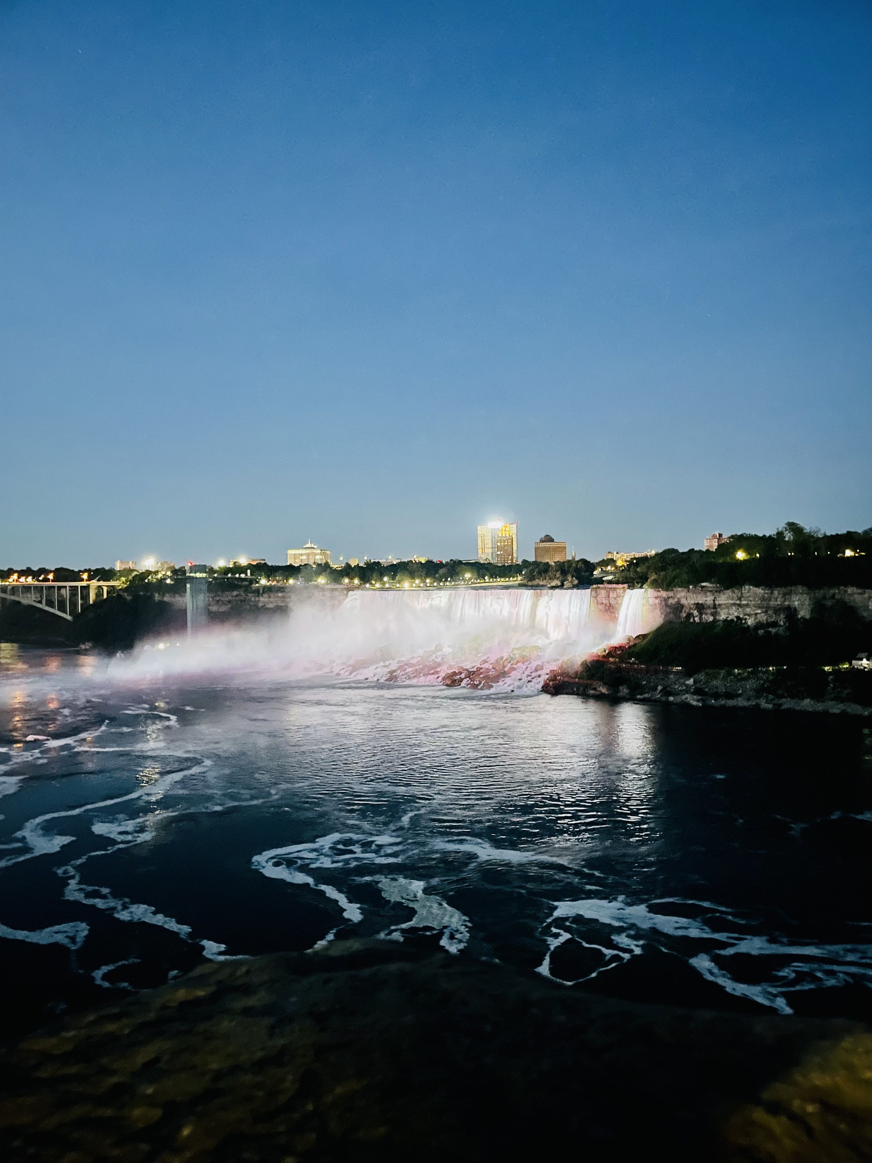
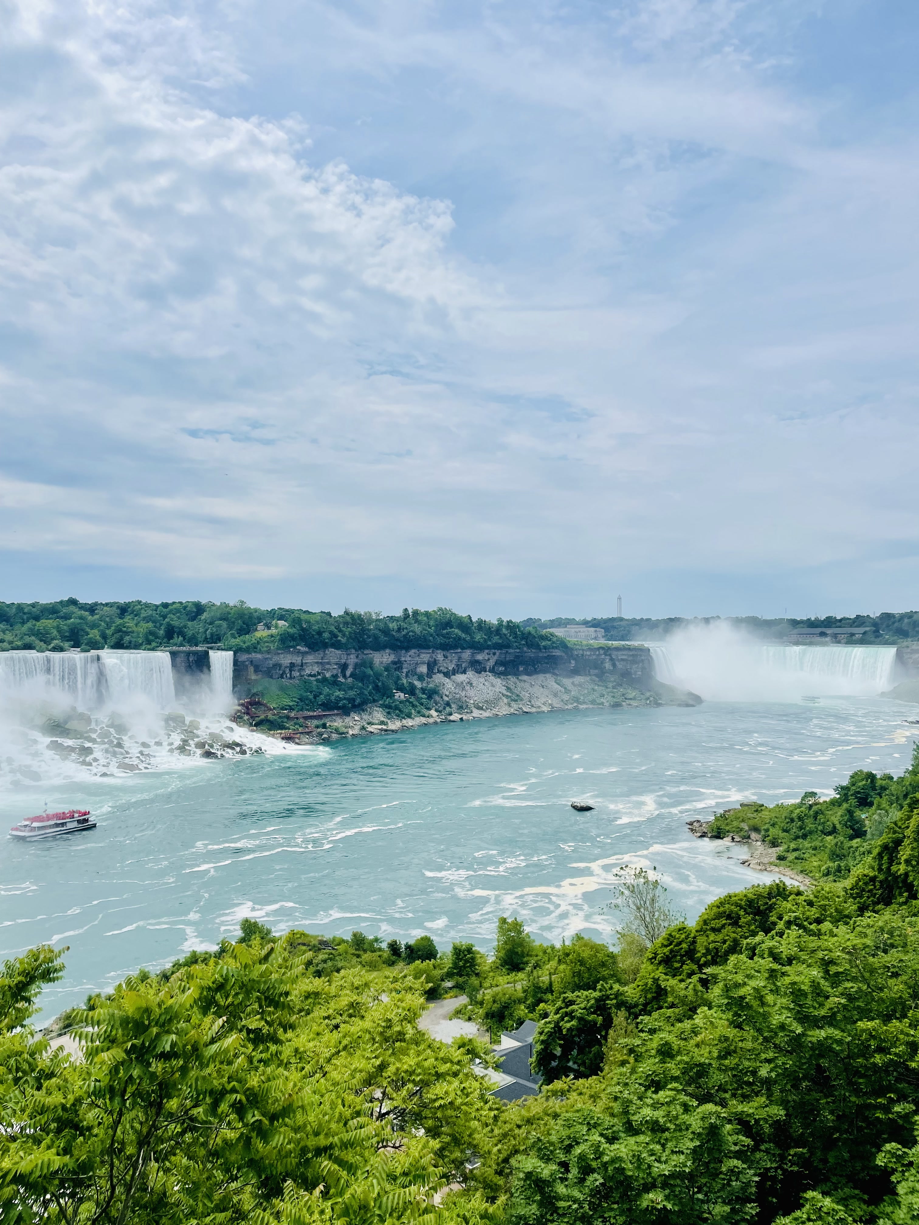
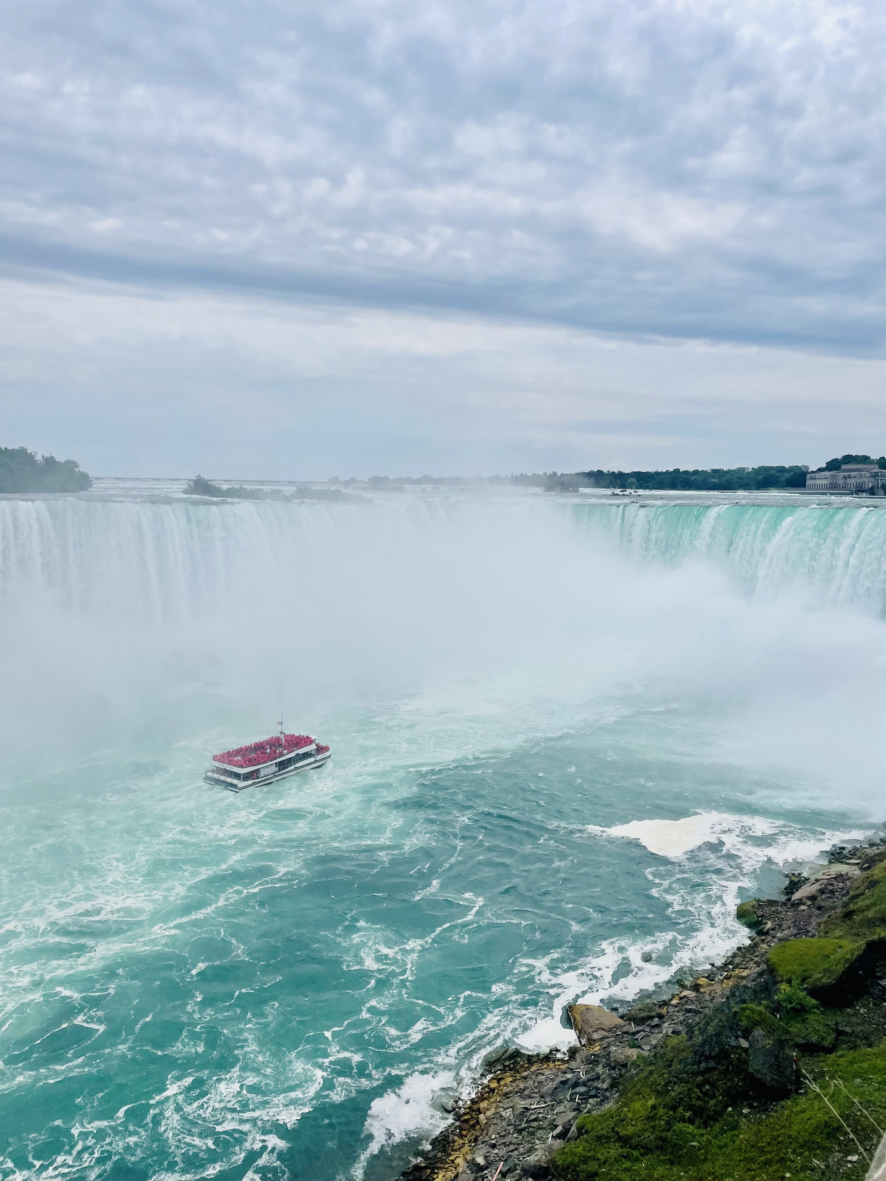
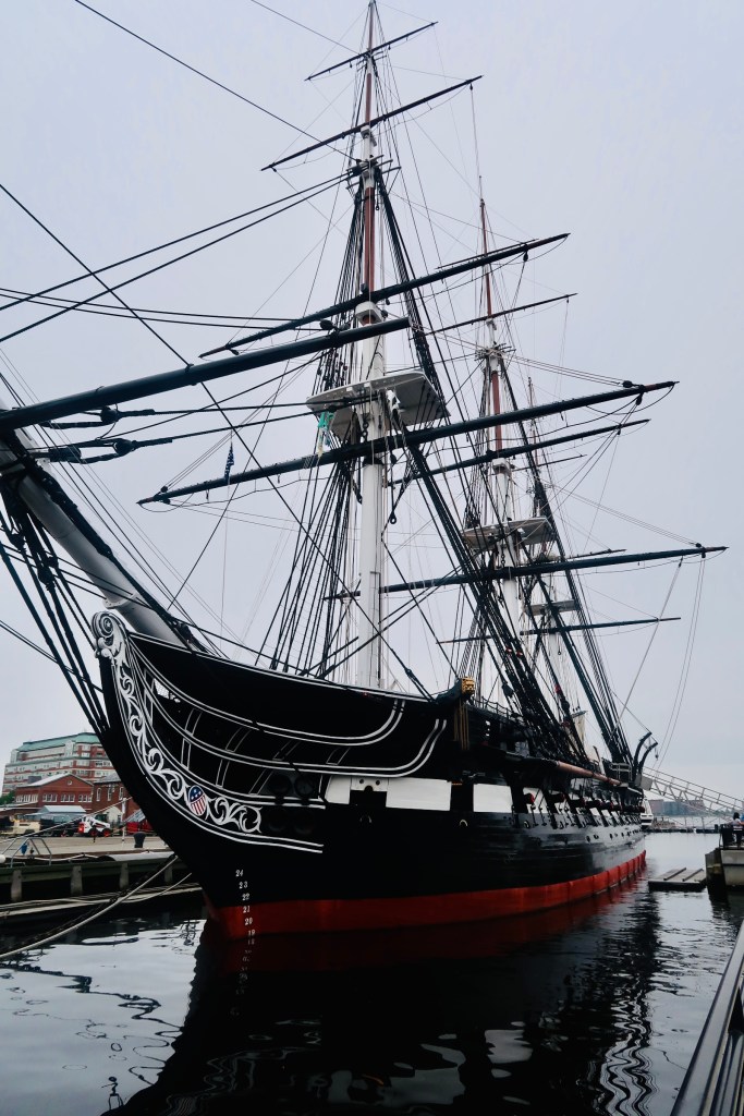
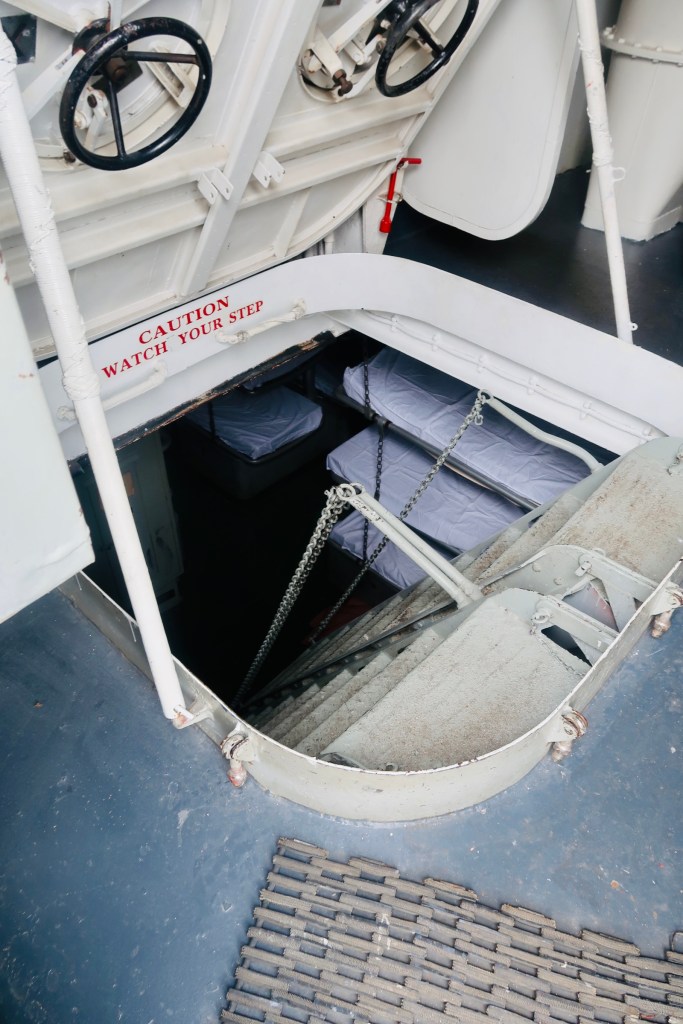
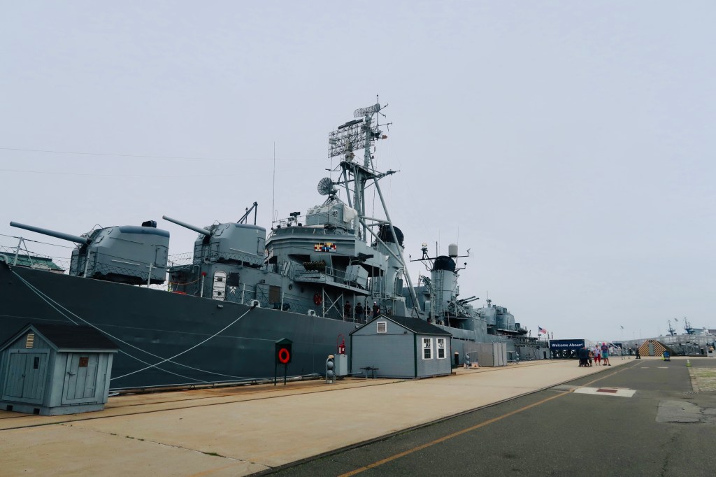
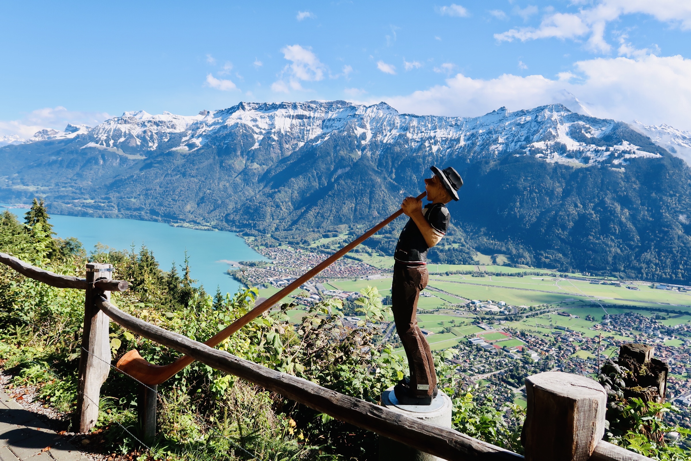
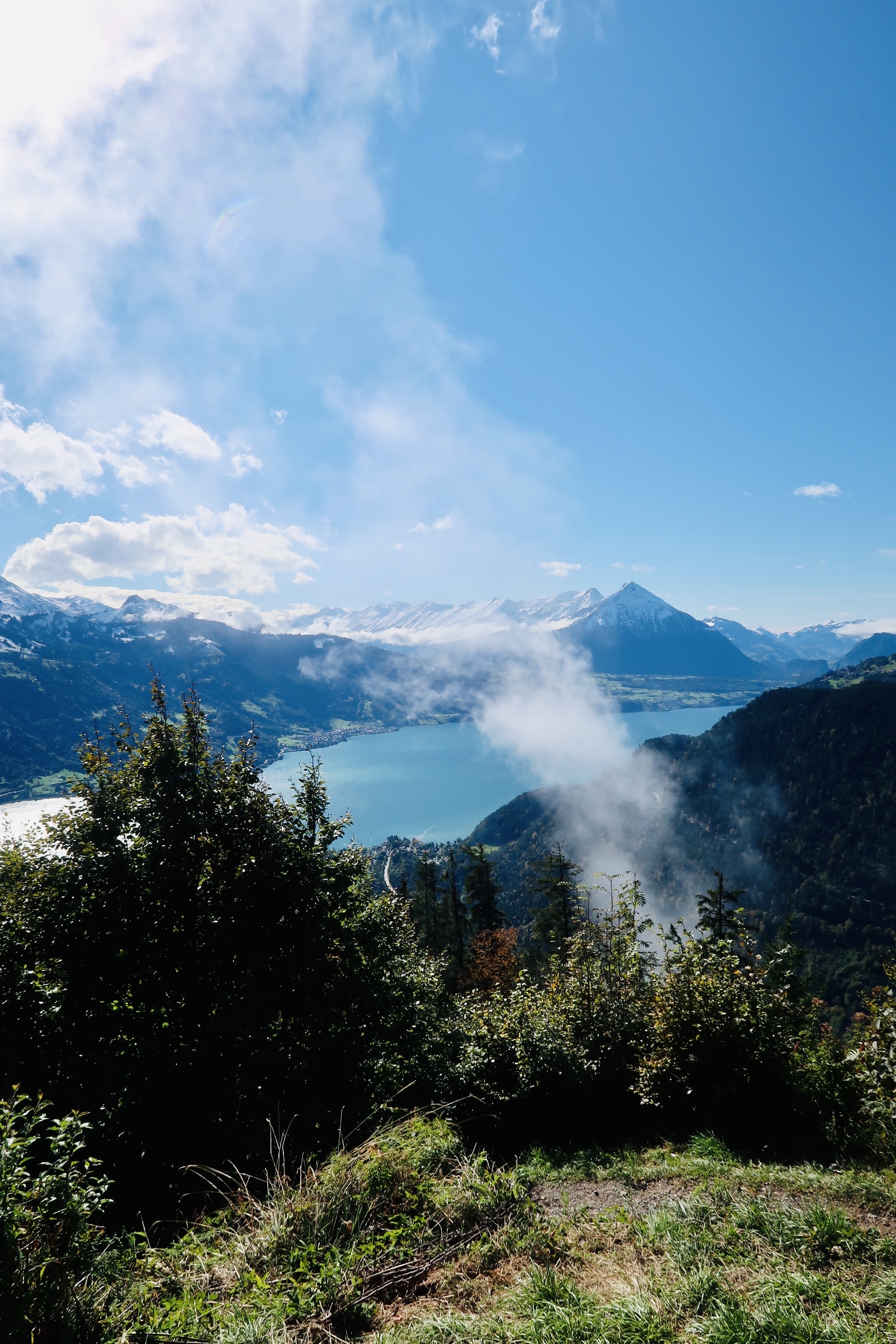
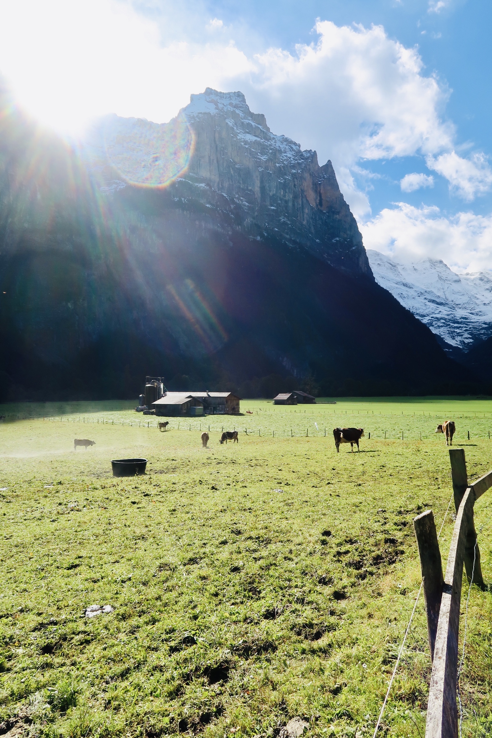
The post I’ve been waiting on…. the top of all of our travels this Summer, the crème de la crème as it were…The Upper Peninsula. Where have we been so far? Well, we started in Niagara, Ontario, then headed over to Detroit, Michigan, before heading up North to the Upper Peninsula of Michigan…. a real gem of a spot. We spent two days (three nights) here and visited the not so hidden (but still kind of hidden) gem of Mackinac Island. Easily my favorite place of the entire trip. But more on that in the post. 

Before we begin, I want to say something really quickly (this seems to be how it always goes…). We visited three “cities”: St. Ignace, Mackinaw City, and Mackinac Island. Because the region is so close together (in a way, obviously all three are separated by water) most of the history of the cities are intertwined. In fact, there is quite a bit of movement and overlap in each town’s history. I’ll begin by talking about the shared history of the “region” and then narrow in as we visit each spot together. 

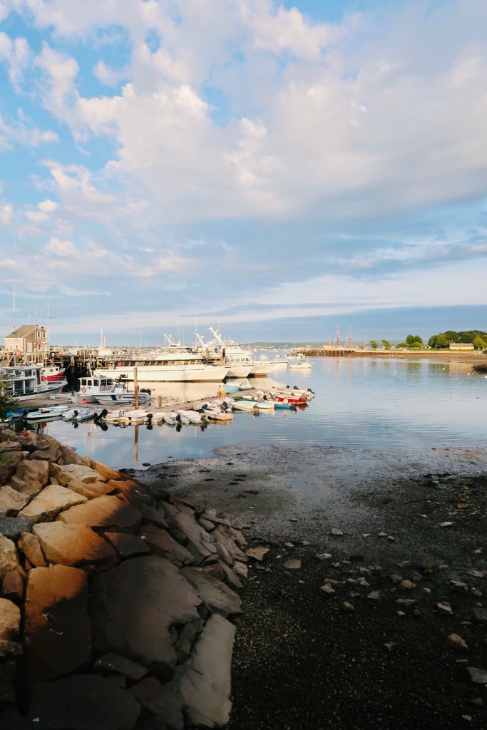
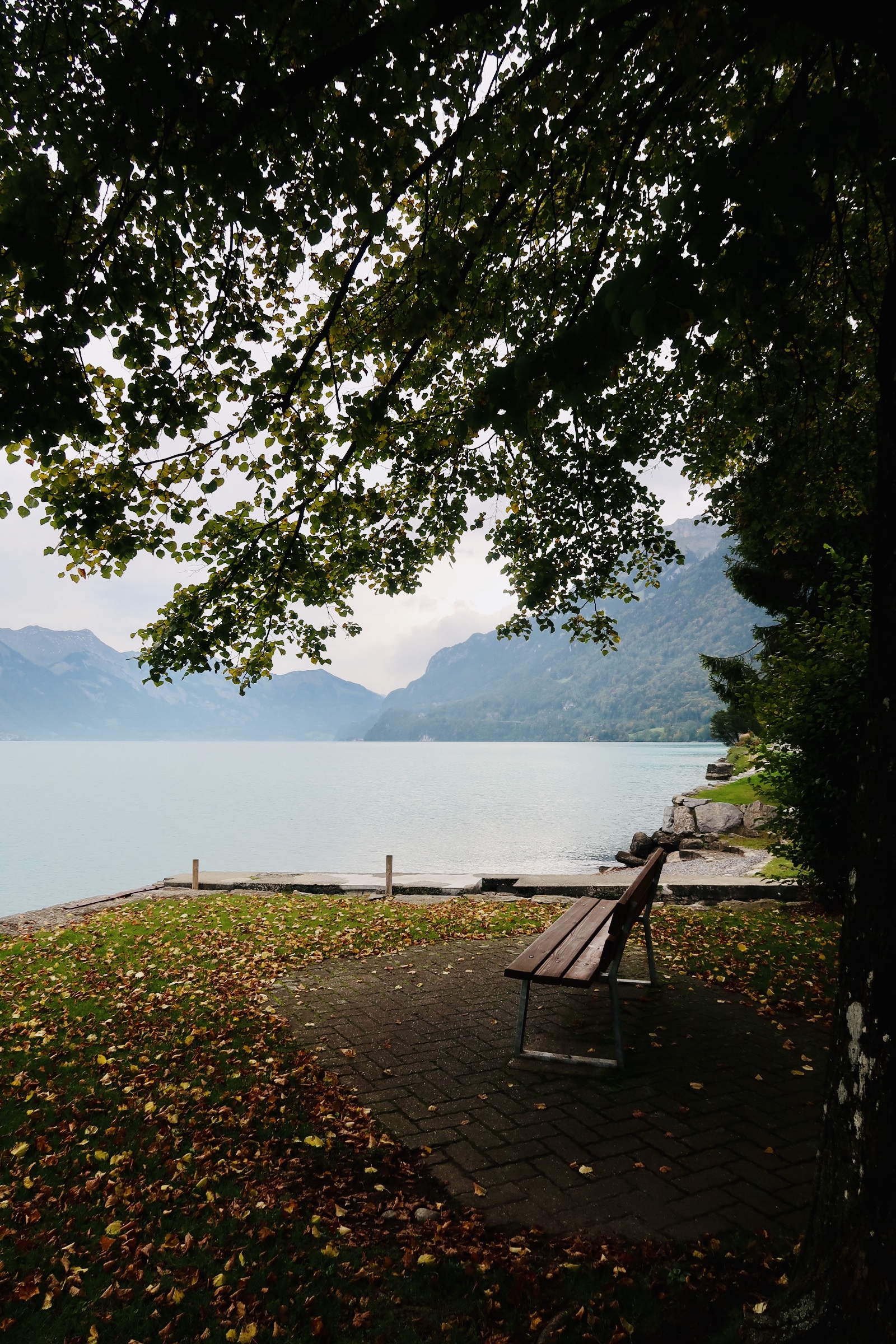
I also want to say- we stayed in St. Ignace at a Holiday Inn right on the lake. First off, I highly recommend St. Ignace as a “home base” of sorts. It’s less populated and much quieter. The ferry was a bit emptier (both ways) as not as many people are coming/going from that city. We also really liked our hotel. I know it’s a pricey region, but I recommend checking out St. Ignace as a place to stay. 

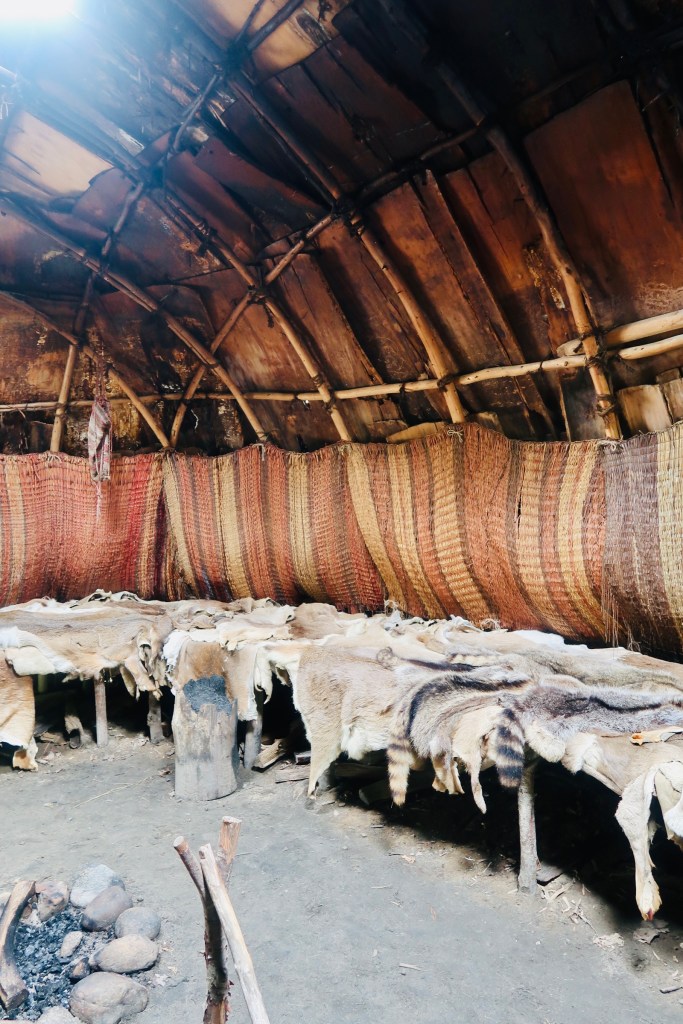
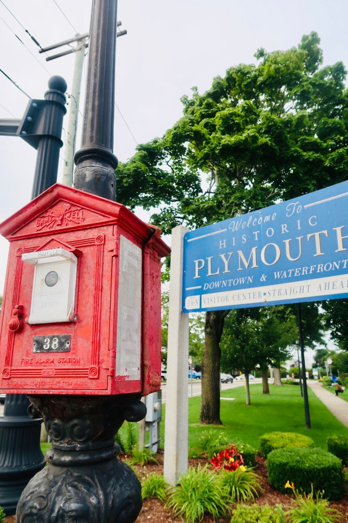
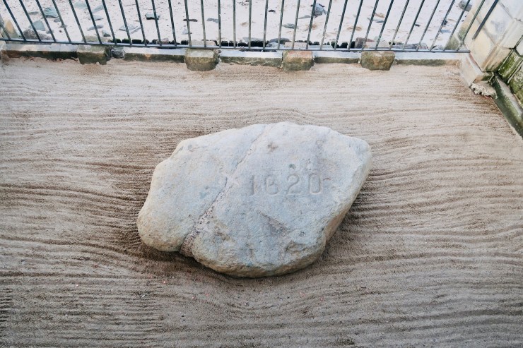
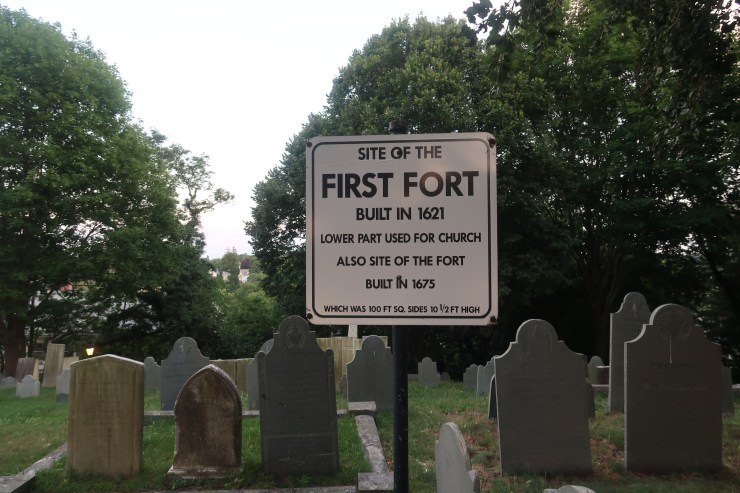
So, this region is vastly claimed by the Anishinaabe people, made up of the Ottawa (Odawa), Ojibwe (Chippewa), and Potawatomi. These three tribes made what is known as The Council of Three Fires and they ruled the region they called Michilimackinac. There is actually quite a fascinating history that we learned about more tribes beyond those when we were in St. Ignace, to include Seneca, Mishinemacki, Huron, Iroquois and more. The first Europeans traveled to the region in the 1630’s, with a Catholic Mission and a priest by the name of Claude Dablon. The mission started on the island of Michilimackinac (Ojibwe “Big Turtle”) but was moved to St. Ignace in 1671 and then turned over to Jacques Marquette. The mission remained active in St. Ignace until 1705 when it was abandoned. In 1679 the first “official” fur trading post, Fort de Baude, was created by Louis Hannepin and it was active until it closed and moved to Fort Detroit in 1697. In 1715 we see the first European settlement in Mackinaw City, Fort Michilimackinac, which is actually moved to Mackinac Island in 1781. 

There’s a “basic” overview of the early beginnings of the region. So much history in some of these places!

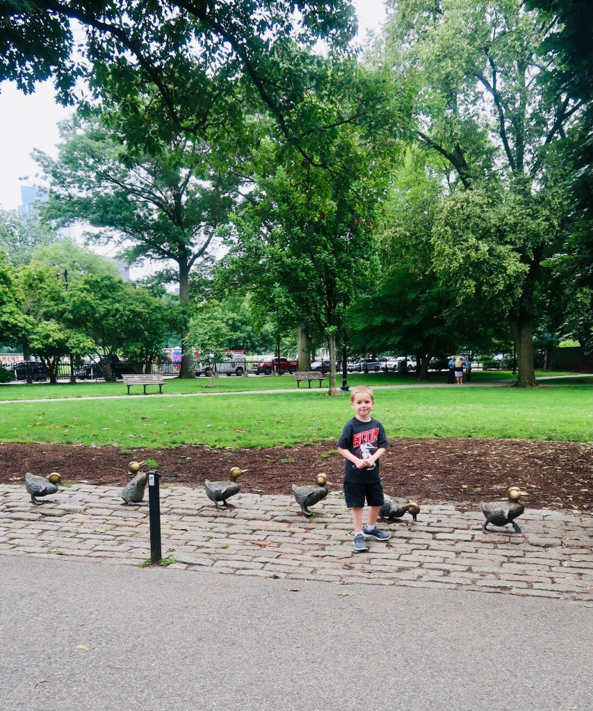
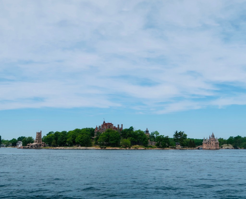
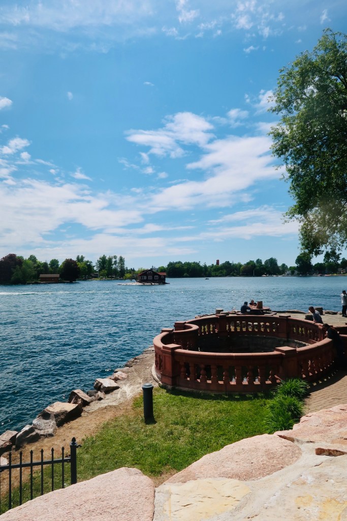
Our first day in the area we rose bright and early to catch one of the first ferries from St. Ignace to Mackinac Island to spend a day on the island. Before I get even into more history and what we did/saw/explored, I CANNOT stress enough that this is a place that HAS TO BE VISITED. You HAVE to explore the island and see it all. It’s incredible. Easily one of my top/favorite spots. Seriously. I will never not share about it; I will never shut up about it. Just incredible. Beautiful. 

So, the Anishinaabe people thought the island itself looked like a Big Turtle, which is a good creature in their history, so they named the island “Mitchimakinak” meaning…Big Turtle. When the French arrived in the 1630’s they turned the name into “Michilimackinac” and then the British (in 1780) shortened it to what we now know as Mackinac. During the French & Indian War the British took control of the Island and Fort, creating Fort Mackinac (remember- they moved Fort Michilimackinac from Mackinaw City). At the end of the War, the Island was given to the USA with the Treaty of Paris, but British continued to keep forces there until 1794. During the War of 1812, the British took back control of the War and held on to it through another battle before relinquishing it back to the US with the Treaty of Ghent in 1815. 

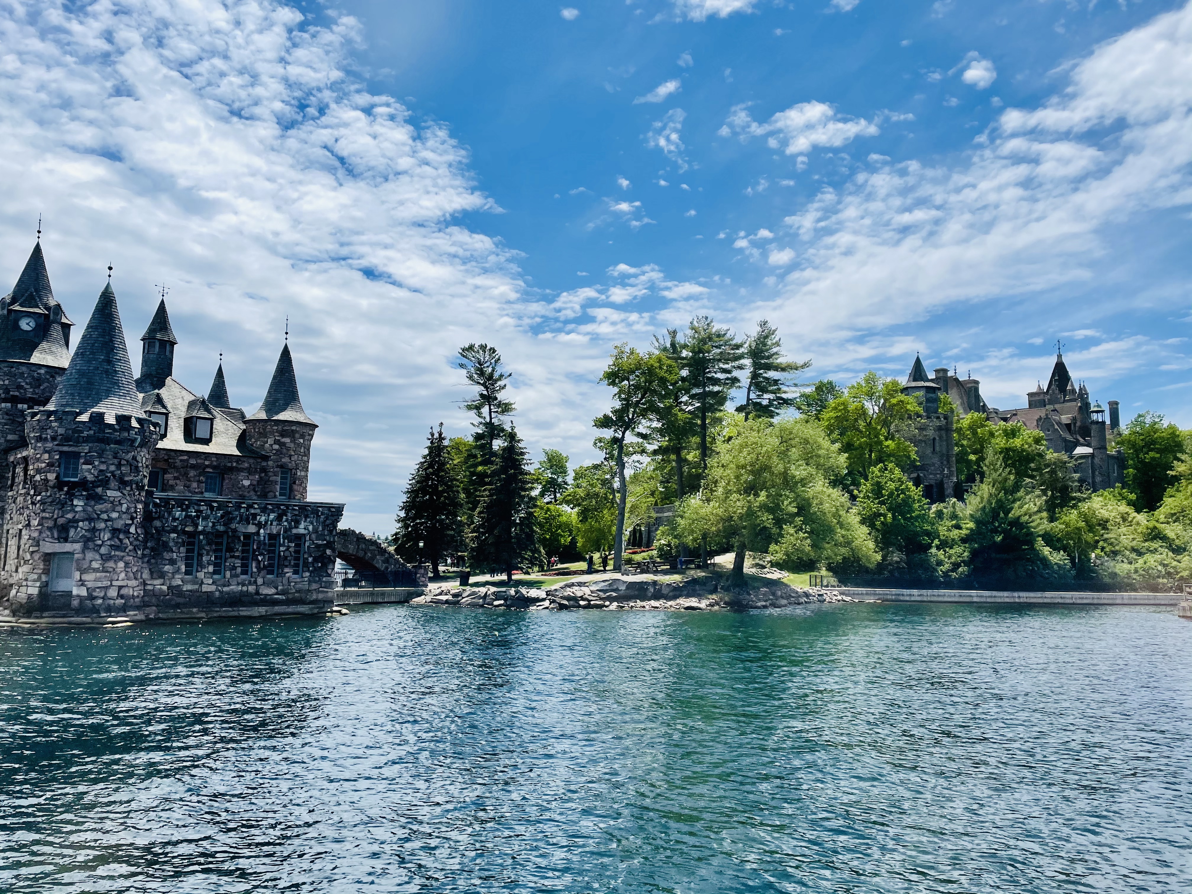
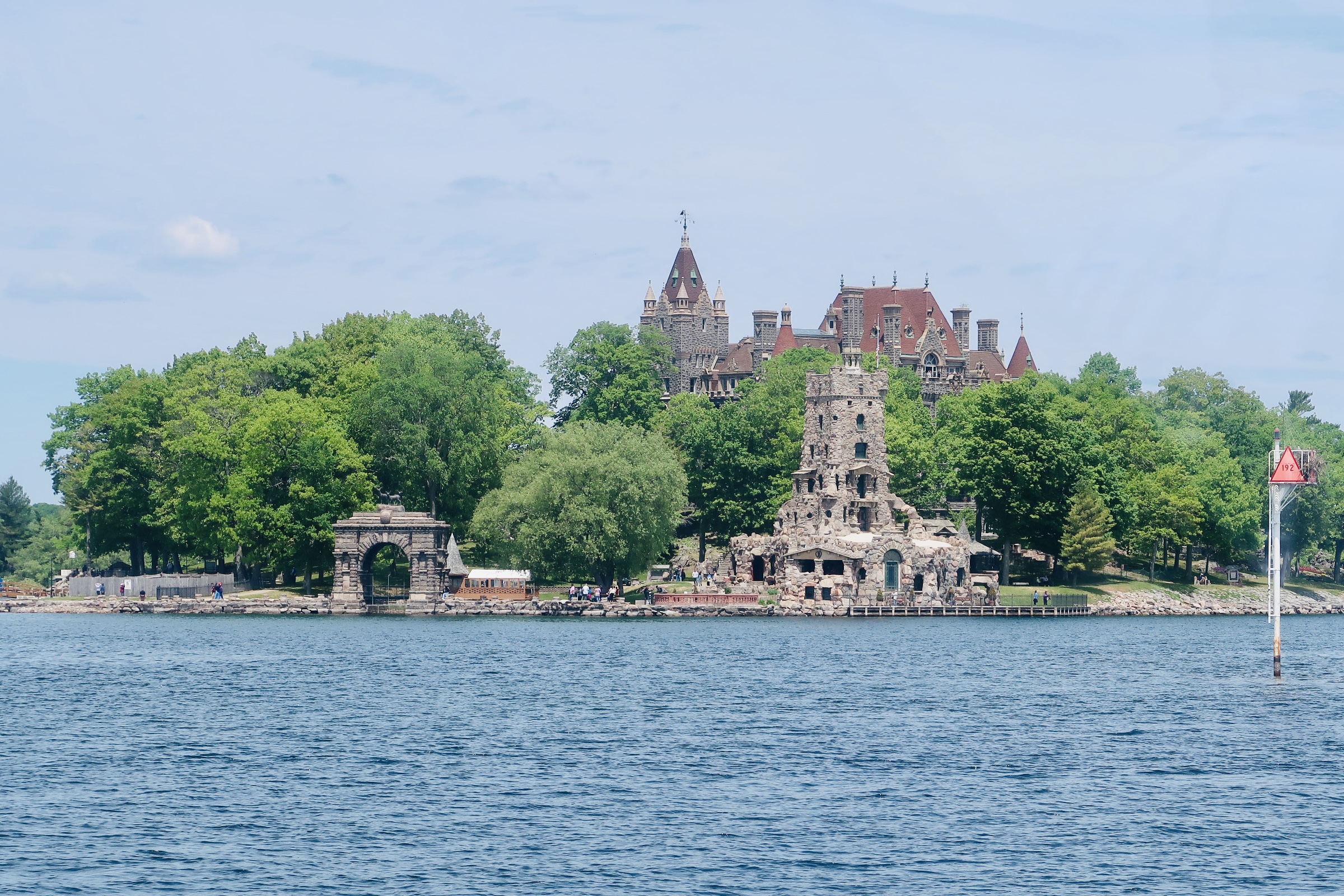
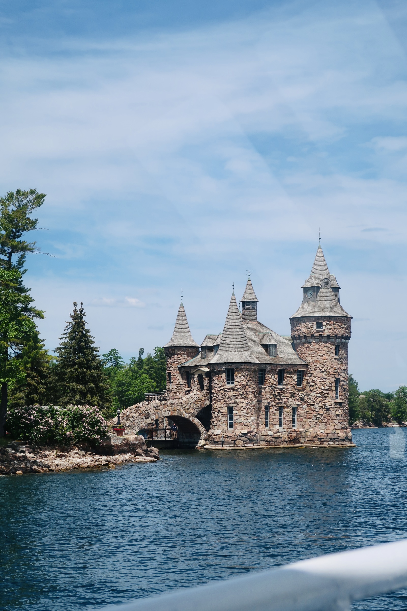
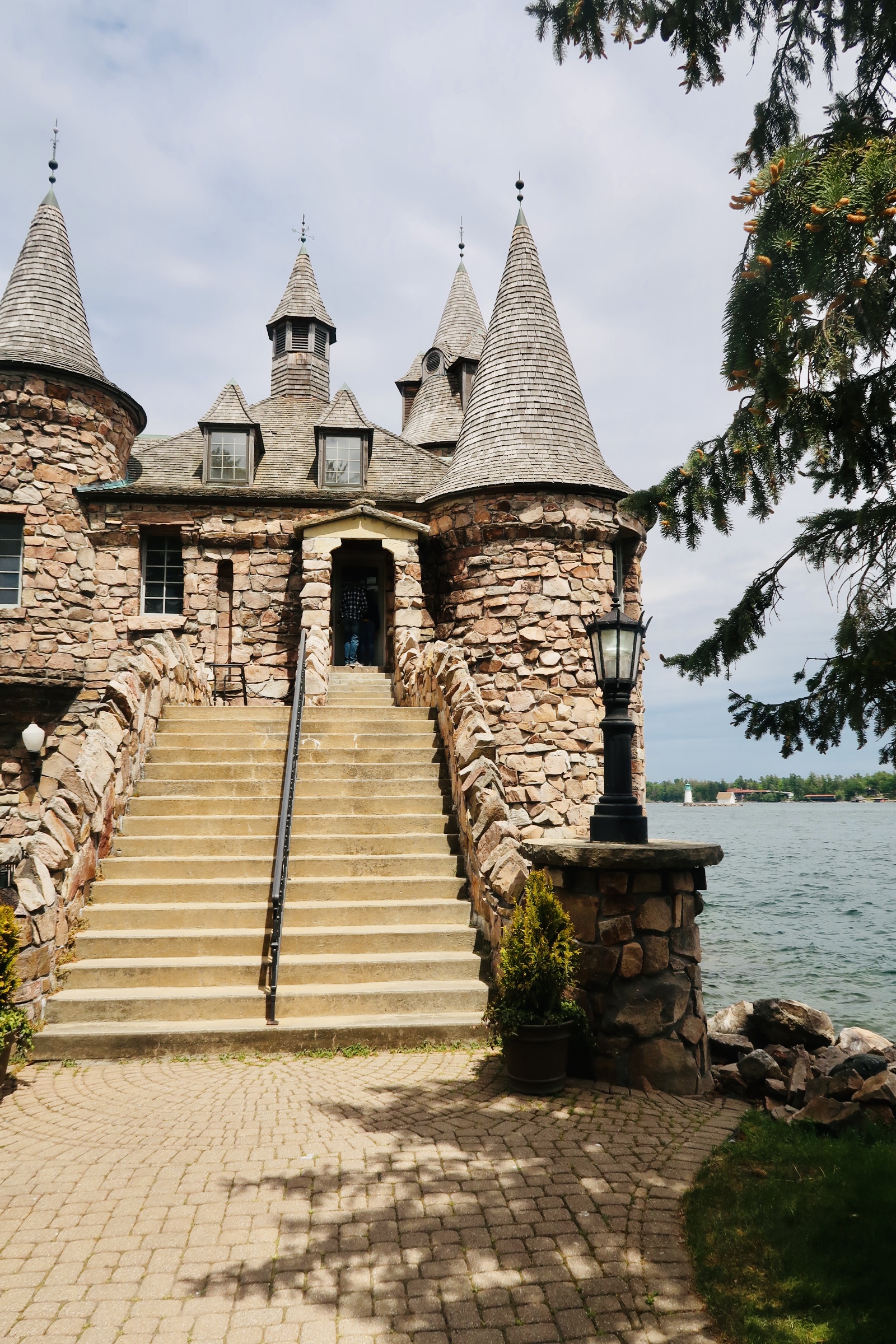
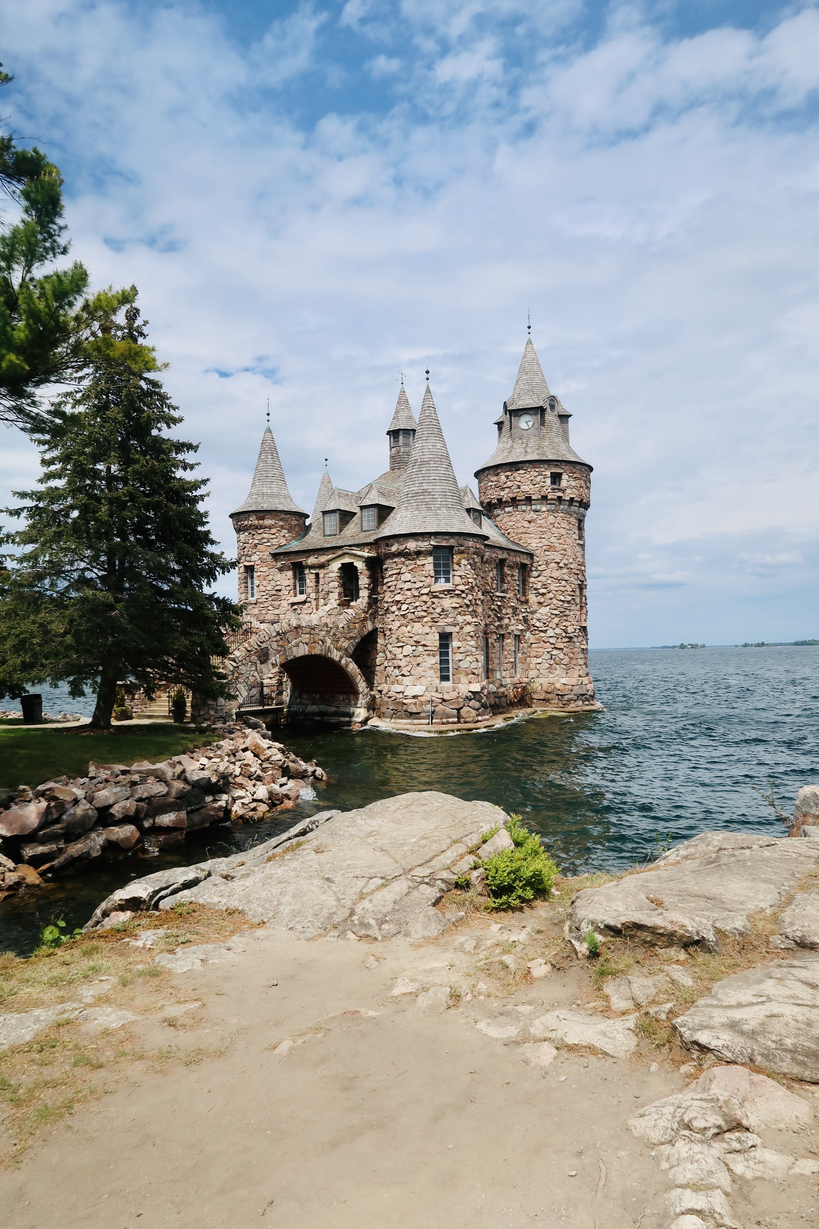
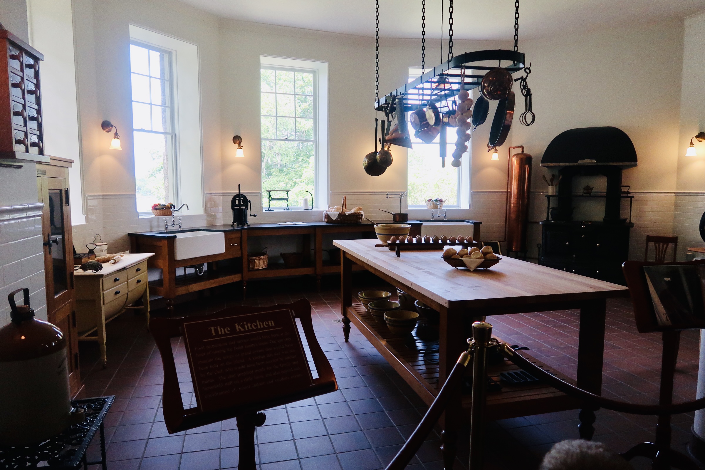
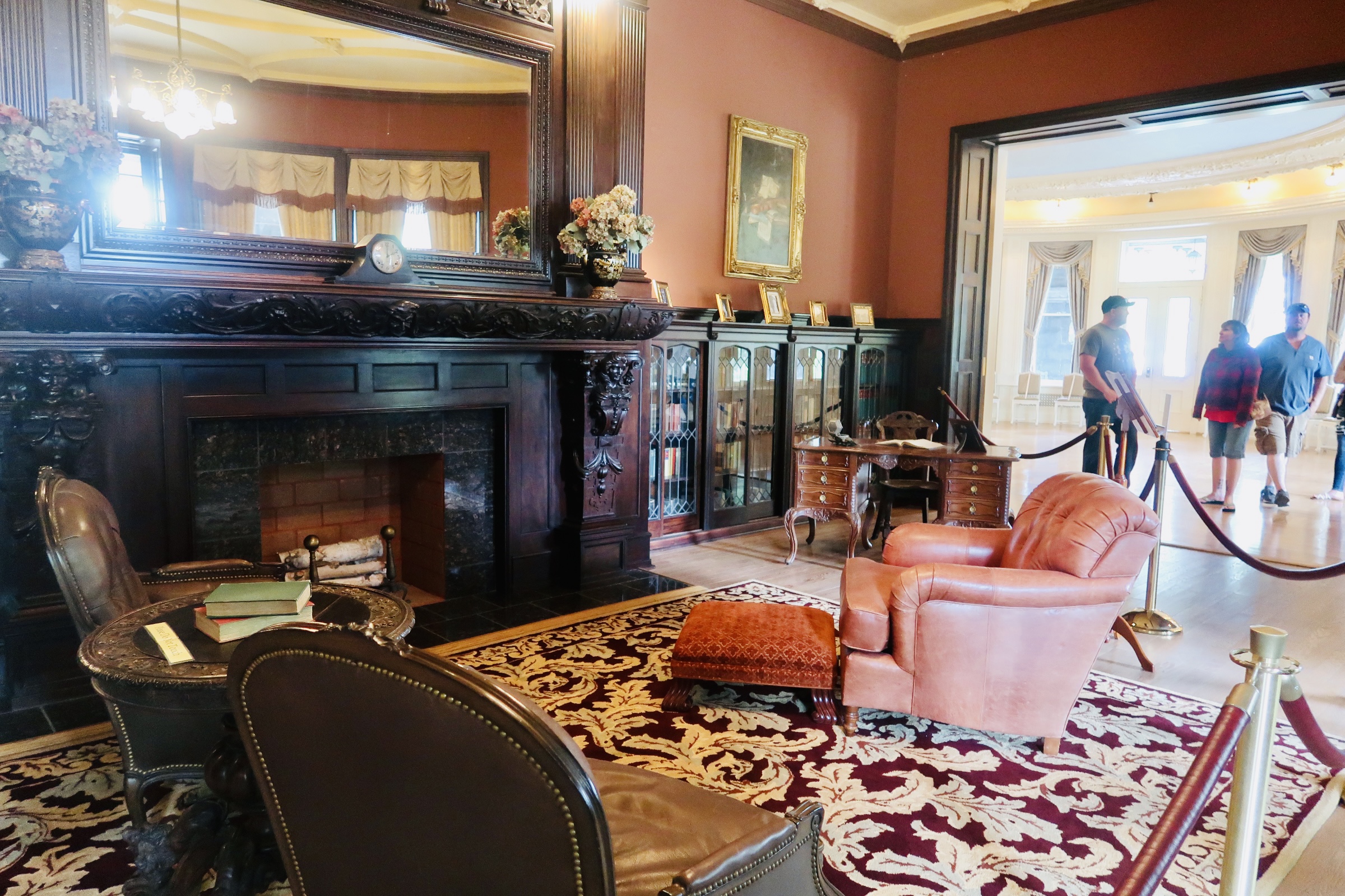
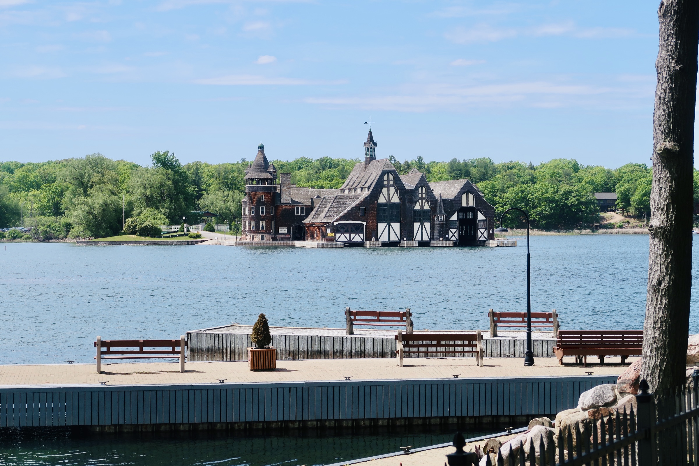
Around the mid 19th century, when the fur trade was starting to decline and sport fishing started to rise, Mackinac Island started to see a rise in tourism. Hotels started to be built (including the famed Grand Hotel) as well as summer “cottages”. Soon after stores and restaurants started to pop up on the main street to meet the demands. However, most of the island was still owned by the Federal Government and in 1875, thanks to lobbying by hometown senator Thomas Ferry, they declared that portion to become the second National Park (after Yellowstone). It only stayed a national park for 20 years when the land was transferred from Federal Ownership to State Ownership, and it became Michigan’s first state park. In 1898, after complaints by local residents over concerns to health and safety, all motor vehicles were BANNED from the island except for emergency services and snowmobiles. Only one other exception has been made, and that was Vice President Mike Pence’s motorcade. 

The island itself has a circumference of 4.35 miles and it’s about an 8-mile perimeter. You are able to walk or bike or hire a horse drawn carriage and explore the entire perimeter of the island on the M-185- the only state highway with no motor vehicles. The entire Island is designated a National Historic Landmark (as of 1960), but there are also 9 sites within the island that have the National Register of Historic Places designation. 

Ok, let’s talk logistics here…

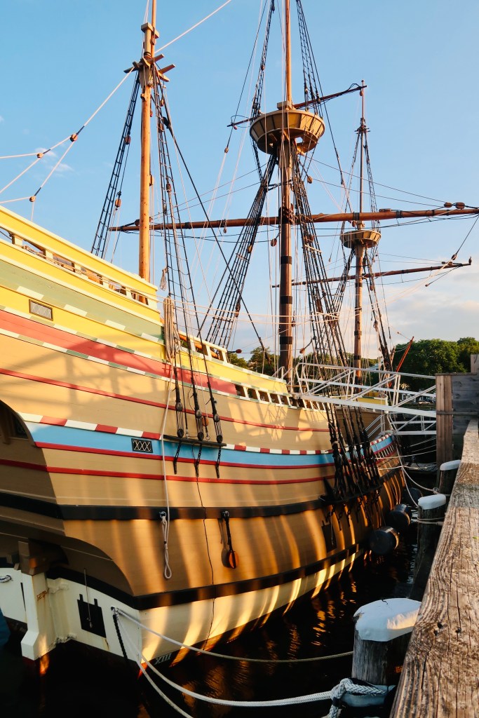
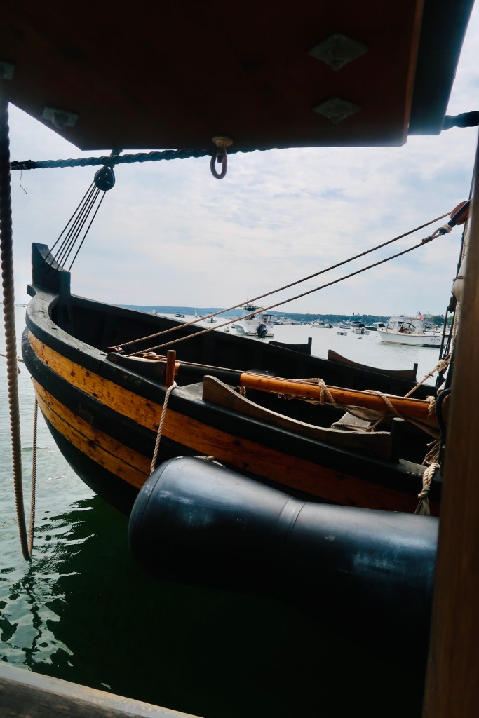
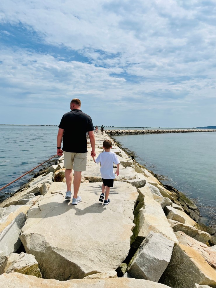
We rented bikes to see the island. It only felt right- rent a couple bikes (plus a bike trailer for the boys) and just ride off into the sunset (except not really it was morning). There are several bike rental shops right off the ferry docks and they are all within the same, reasonable, price range. The real difference we saw was whether they included a bottle of water or other amenities or not. So, we picked our bikes up straight off the ferry and headed down Main Street. It is truly something to see- this whole village and not a single car of any sort. Sure, there was a golf cart or two transporting luggage or supplies from the dock to a hotel, but by and large you walked, took a horse taxi, or biked. 

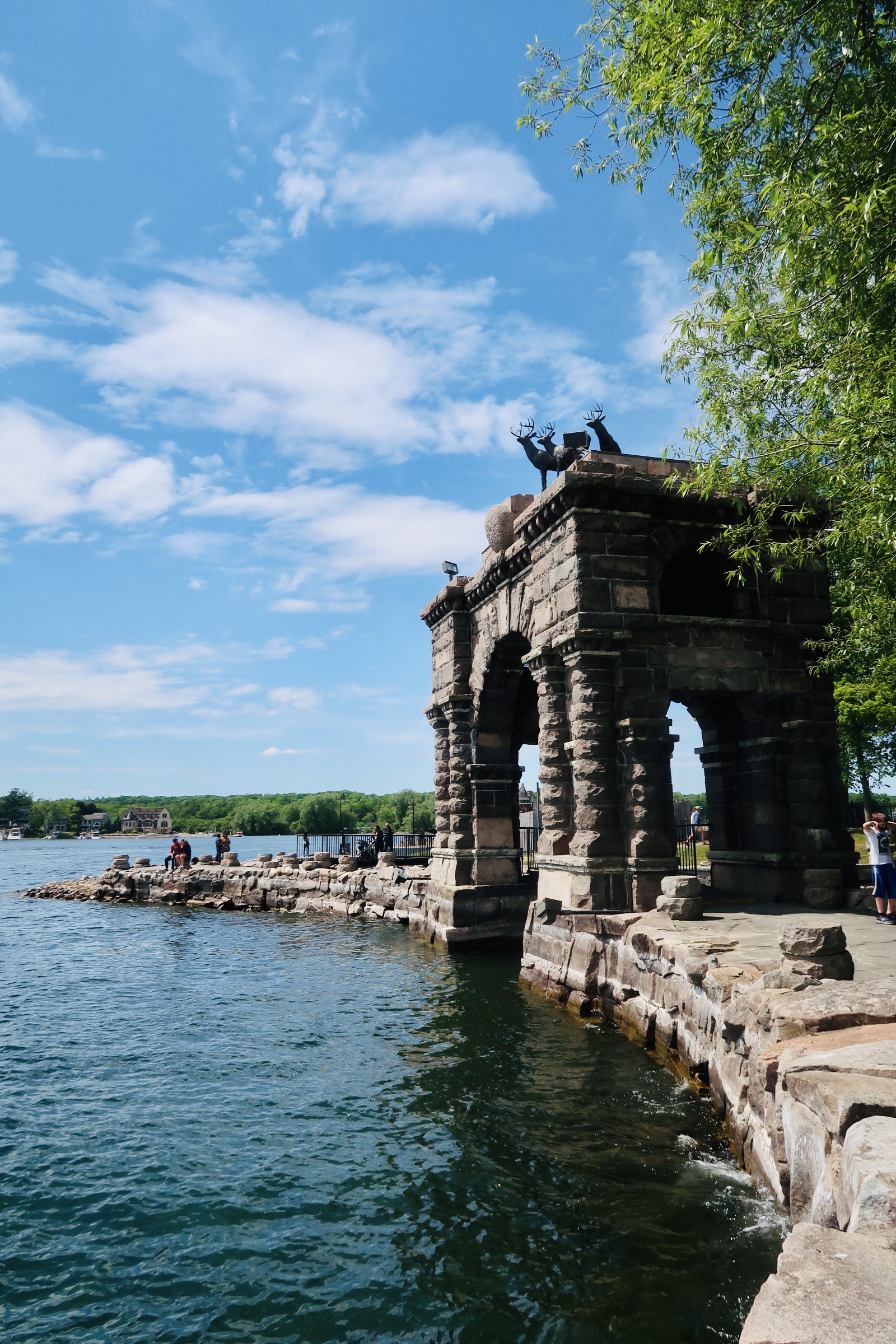
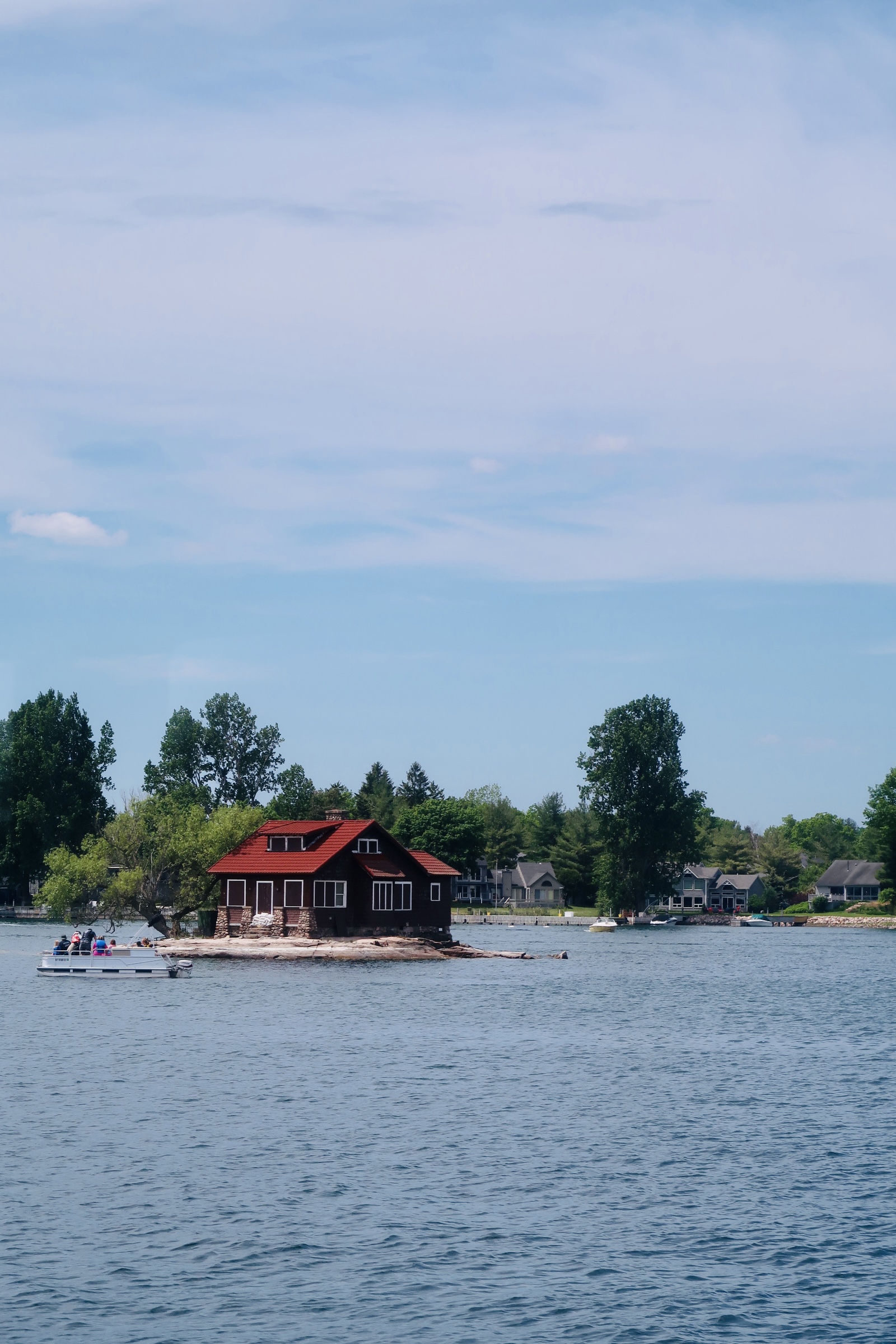
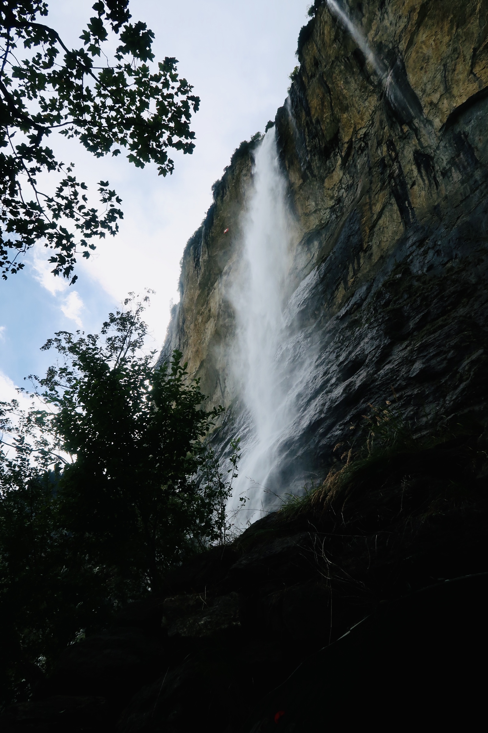
We biked the perimeter, stopping a couple times to read the signs that tell the history of the island, or to climb up to Arch Rock, or dip down to the water and enjoy the view and peaceful moments. It really just felt so peaceful and incredible, even on Main Street or in the picnic area, which is packed with people. Once we finished our perimeter we stopped for a quick bite, then took our bikes up the mountain and to the interior of the island. Stopping to see the exterior of the Grand Hotel, the Carriage House, and then up and onward to the highest point on the island. It was a total of 13.6 miles by bike and just one of the best days. We were so happy and tired and overjoyed by the end of it that I just knew it was a special place. The pictures don’t even do it justice, you just need to go. I promise it is worth it.

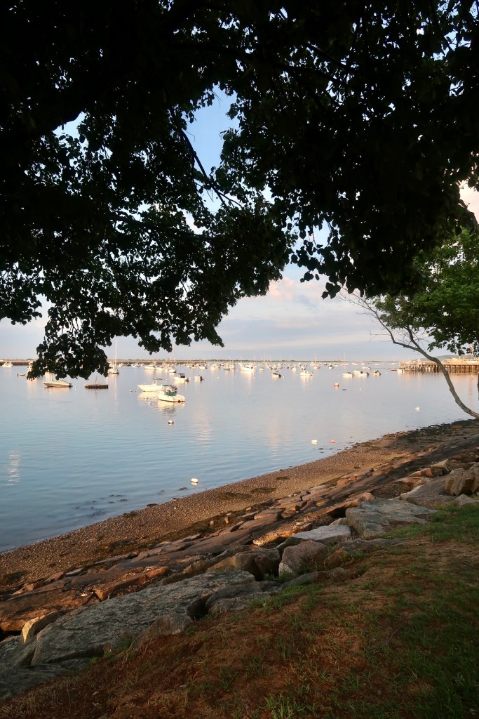
So, day 2 in the Upper Peninsula region we started off by walking through St. Ignace. I’ve touched on the history of the city originally, but it is very much steeped in the French Catholic Missionaries coming to try and convert the Native Americans who lived here at the time. We visited the Museum of the Ojibwa Culture, which highlighted the history of the people and the region, as well as the problem with the missionaries AND touched on the history of residential schools- which were such a big part of the region and the cultures history. We went from there down along the water just taking in the beauty of walking along the water. 

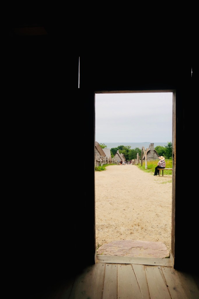
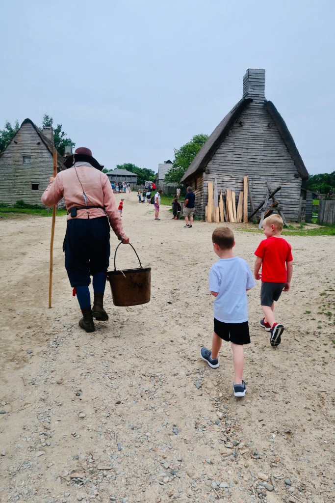
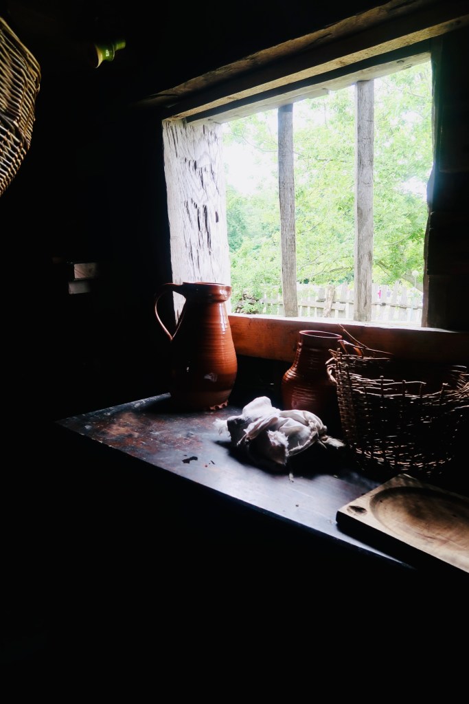
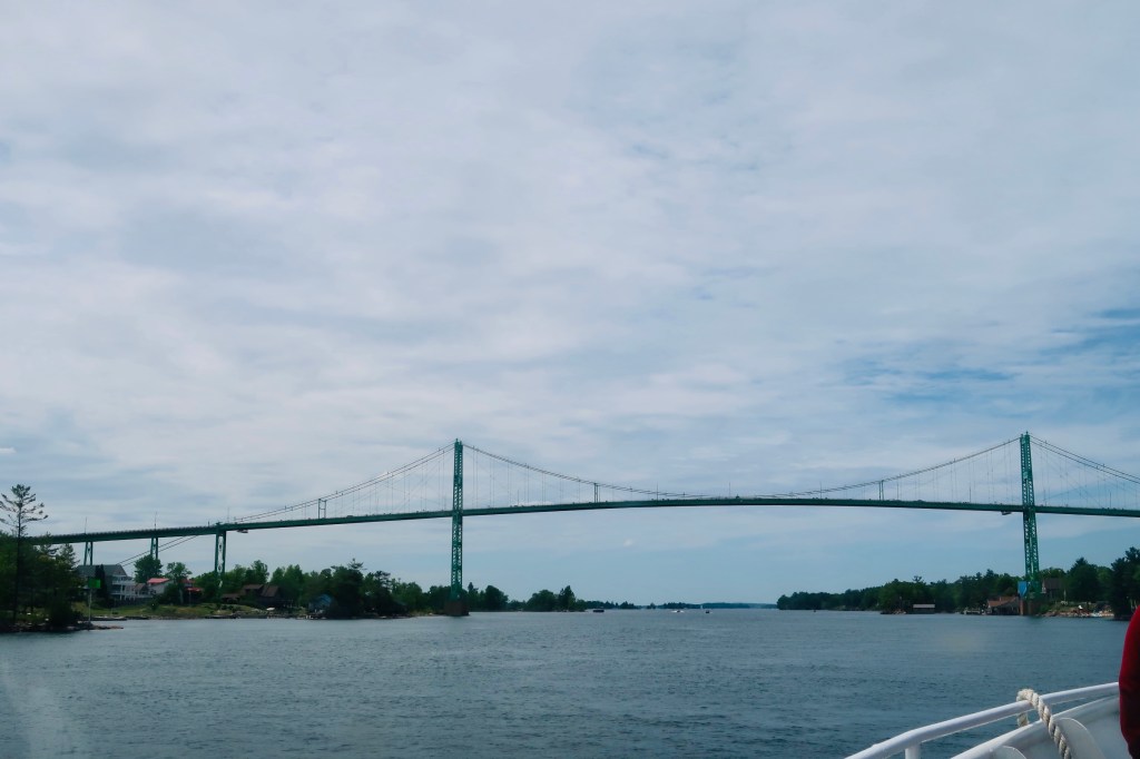
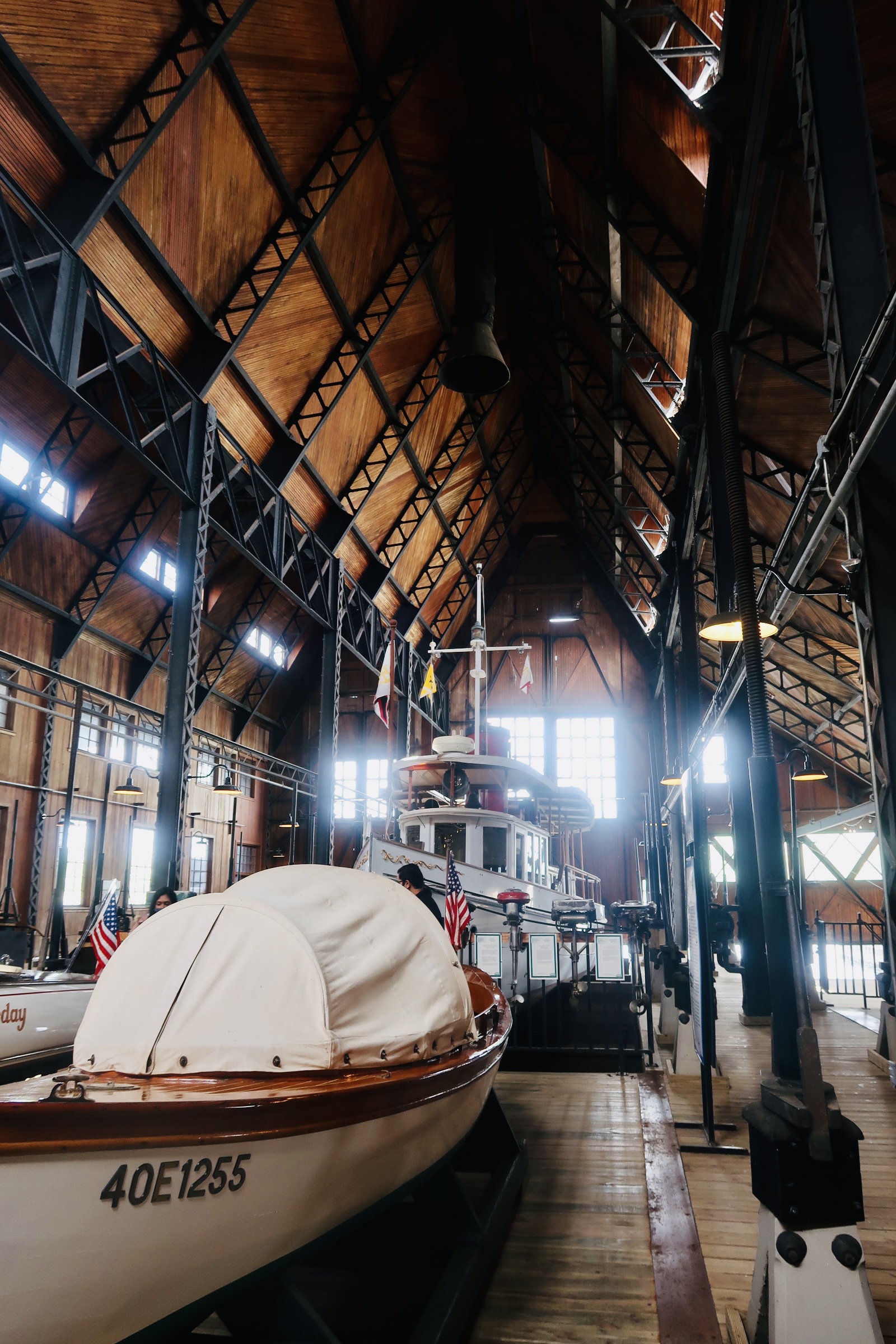
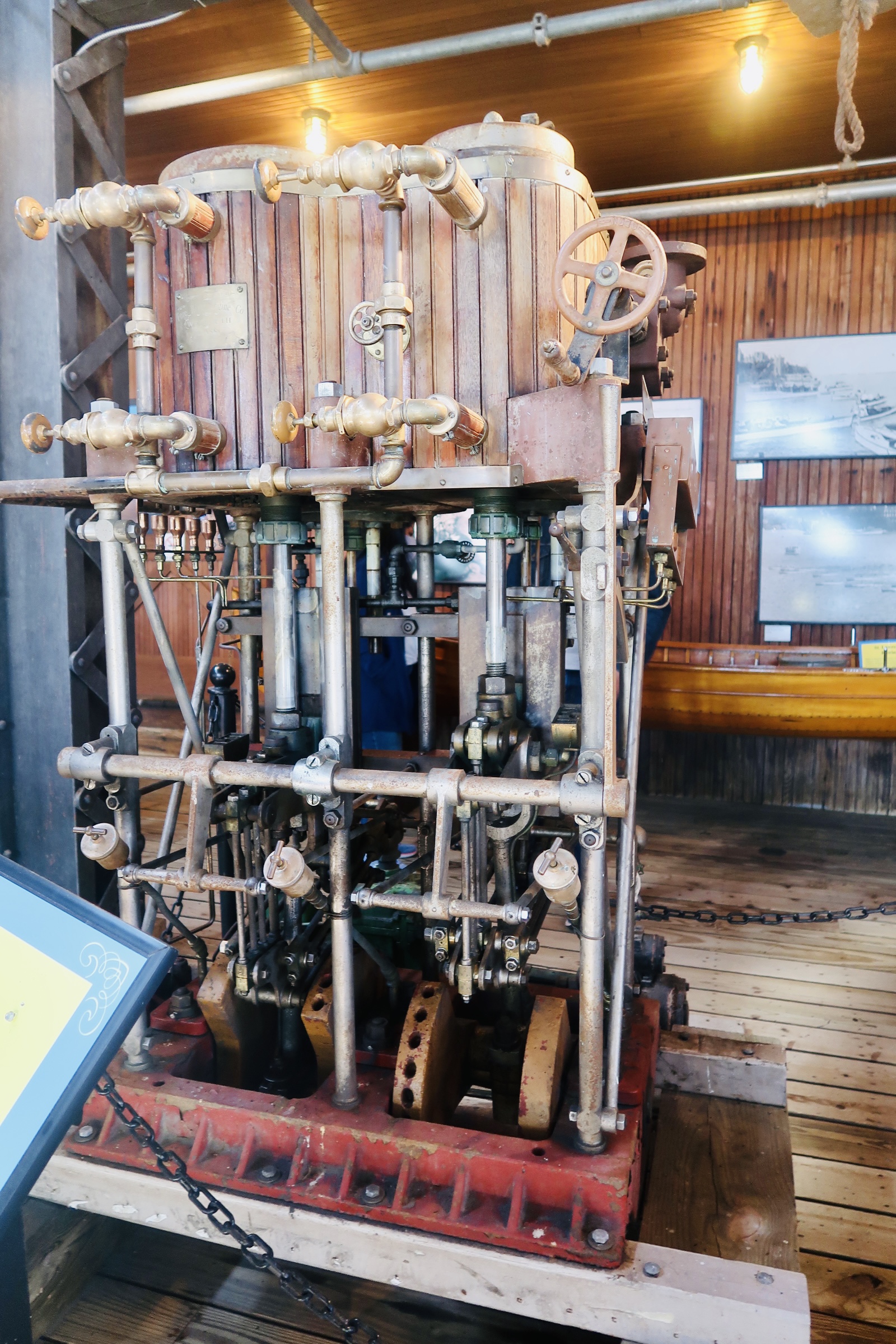
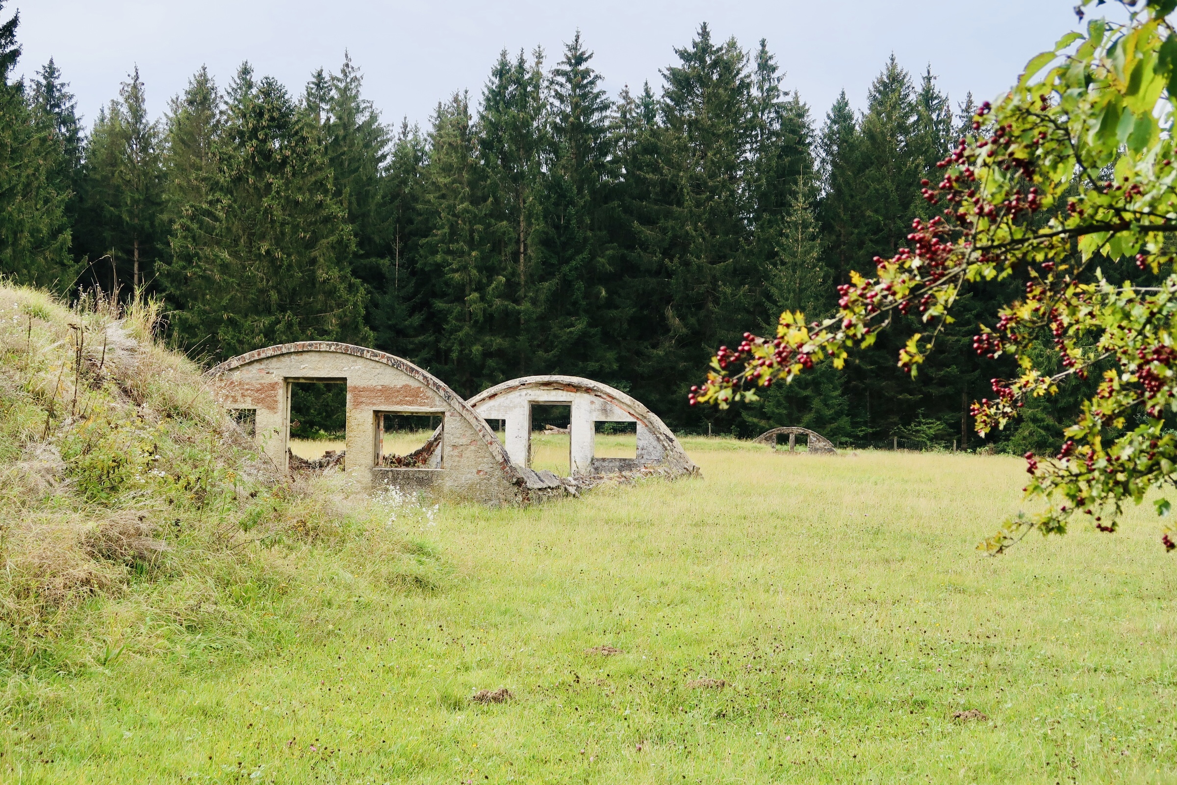
Once we finished up, we hopped in the car and headed across the bridge to the northern tip of the “Lower Peninsula”, Mackinaw City. Fun fact, Mackinaw City serves as the terminus for the following: Dixie Highway, Mackinaw Trail, East Michigan Pike AND West Michigan Pike. Again, I’ve touched on some of the history, so let’s talk about the main attraction we visited, Fort Michilimackinac. After everything in the region (in terms of European colonization) disappeared in 1705, the French decided to reestablish a presence in 1713. They decided a fort was the right way to go and in 1715 Fort Michilimackinac was opened. They had a good fur trade, worked well with the tribes in the region, HOWEVER in 1761, after a loss in the French and Indian War, the British took control of the fort. The British kept the fort in place, but they stopped visiting and distributing gifts to the local tribes as the French had done. This led to the local tribes becoming resentful and angry at the British. Tensions rose until a full-on battle was waged called Pontiac’s War. Fort Michilimackinac had a small part to play in this war as there was a battle in June of 1763 in which a group of Ojibwe staged a game of baaga’adowe as a way to get into the fort, kill troops and take control. They succeeded and held the fort for almost a year before the British regained control (and kept it after starting to distribute gifts to the tribes once again). After the British decided to move the Fort to Mackinac Island, they moved several of the buildings that they wanted and then burned the rest of the fort to the ground. 

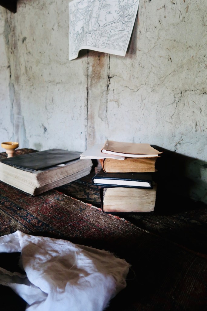
These days most of the buildings on the fort are reconstructions, though through them you can also see portions of the buildings as they stood. The entire fort is an excavation and archeological site- considered one of the most extensively excavated sites in the U.S. It was pretty incredible to walk through the fort and learn the history- we could pinpoint where skirmishes and battles occurred and what led to them.  The fort also did the really cool thing and highlighted a very important person…Ezekiel Solomon was one of the most active fur traders in the regions, but he was also the first Jewish Settler in Michigan. Originally from Berlin and having served in the British Army, he arrived at Fort Michilimackinac in 1761. He was in the fort during the battle with the Ojibwe in 1763, only narrowly missing execution. He often traveled to Montreal as part of the fur trade and became a member of Canada’s first Jewish Congregation before dying in 1808. Such a neat little historical fact and was really fun to not only learn about his life but see a recreation of his home!

And that really wrapped up our time in the Upper Peninsula! This was easily probably my favorite stop of our entire vacation (with Niagara a close second) as it was just so gorgeous. I highly, highly recommend it (if you couldn’t tell by now). It’s one of the most popular, prettiest areas for a reason.

A Cuppa Cosy Summer Holiday – Detroit Michigan

Our next overnight stop on our Summer Holiday was Detroit Michigan, but before we crossed the border back to the States, we hit up Point Pelee, the southernmost tip of mainland Canada. A small National Park founded in 1918, this little area of the country has been occupied in some way since 700-900AD (that’s been documented). Initially a hunting area, the Europeans found it in 1670 and it’s been in dispute for a long while until it became a national park. You are able to camp and picnic in the park, even enjoy the waves on the beach front, but we headed further up to the small museum and bus ride out to the tip and then a walk on the marsh boardwalk. This spot is a boon for birdwatchers, and we saw several while we walked. It was a nice little stop and stretch your feet while being somewhere really cool. 

From there we did head straight through to Detroit. We stayed in the Financial District, close to the water and not far from the spots we really wanted to see- mostly on the auto factory side of things. We had one full day in the city, so we started off early the next morning by stopping in the GM headquarters (scoping out all the new and old vehicles on display as well as quite a few displays about what GM does beyond cars- it’s fascinating), then a short walk along the water- seeing both the statues and Canada across the way, before stopping in at the DNR Outdoor Adventure Center. 

Owned and operated by the Department of Natural Resources the Outdoor Adventure Center provides a variety of hands-on exhibits and activities meant to highlight the offerings of the region. Originally committed in the 1990’s, the museum and surrounding park area had quite the struggle to open up between funding issues and property ownership difficulties. However, in 2015 they were able to open up and logged 100,000 visitors in their first year. There is a little history, and a lot of nature information. The boys were able to “snowmobile”, ride an “atv”, practice “hunting”, as well as sit in an airplane, eagles’ nest, and learn about the environment of Michigan (which is a lot more than just Detroit). It was just as fun for us adults as it was for the kids. 

From there we headed back down the water and over to the tram for a ride to the Ford Piquette Avenue Plant. Built in 1904 this was the second building of Ford’s, however the first purpose-built factory. BUT in order to understand the importance of Ford and his mind and motor company, let’s take a minute to quickly talk about Henry Ford. 

Henry Ford was really a pioneer of his time. He was, what I like to refer to, as a tinkerer with a brain that didn’t stop. In 1892 he built his first motor car (he was 29- so if you’re younger than that and still haven’t figured anything out or are just starting to figure things out at 29- you’re in good company!) after becoming an engineer at Edison Illuminating Company of Detroit. Yes, that Edison. In 1893 he became Chief Engineer and in 1899, cheered on by Edison and several others, he founded the Detroit Automobile Company. In 1901 it was dissolved. However, in late 1901 Henry Ford designed, built and raced an auto that got some attention and he, tried again, founded the Henry Ford Company towards the end of 1901. However, once again, it was not to last as once Henry Leland was brought in as a consultant, Ford left, and Leland then renamed it to Cadillac. 

Finally, in 1903 Ford Motor Company was founded, with the Dodge Brothers as investors (!) and then in 1908 the ever-popular Model T was debuted. It would sell that year for $825 with a price that would continue to drop year after year. Something that Henry Ford is known well for is forward thinking and in 1913 he introduced the concept of the moving assembly belt to his factories (though this could not be only attributed to Henry Ford- several employees helped design and produce this concept). Some interesting facts about Henry Ford to end this little side tangent…He was an early backer of the Indianapolis 500, he was a notorious anti-Semite (both Hitler and Himmler were big fans of Ford and some of his writings were combined and published in Nazi Germany- AND Ford is apparently mentioned TWICE in Mein Keimpf, but he didn’t financially donate to the party – I don’t know why that was such a distinction that needed to be made…), and while he introduced the $5 dollar wage, and 40/48 hr. work week, he HATED labor unions and fought fiercely against his workers unionizing. 

So, the Ford Piquette Avenue Plant. Built in 1904, this was the second location owned by the Ford Motor Company and produced the Models B, C, F, K, N, R, S and finally the Model T during its 5 years. Initially cars were manufactured with hand tools that would be carried to the vehicle and a single location. This plant is where the idea of a moving assembly line was created. Just before the Model T debut in 1908, employees experimented with the idea that the chassis of the car moved along to the workers, rather than the workers moving to the chassis. They continued experimenting by using a rolling option, instead of the previous rope maneuvering, before coming up with the initial moving assembly belt (a precursor to the one Henry Ford later put in place at the Rouge Facility). Now, once the Model T was completed and out in the world sales quickly skyrocketed. Demand became so much that the Piquette Plant closed for two months to help catch up and the plant itself quickly became too small. In 1909 Ford Motor Co started packing up to move over to the Highland Park Ford Plant to continue. The plant building itself went through a couple different owners and businesses before being sold in 2000 to the Model T Automotive Heritage Complex (after hearing that it was going to be torn down) and re purposed the building into a museum full of over 40 early automobiles. The plant was added to the National Register of Historic Places in 2002 and a National Historic Landmark in 2006. 

Finally, a few fun facts about the cars…most Model T’s (post assembly line introduction) were black due to the fact that it was the fastest drying of all the colors, when the production of the Model T concluded (in 1927), Ford had produced 15, 007, 034 cars. 

That about summed up our day in Detroit. Heading back towards the hotel, we stopped over at the Fox Theatre and Comerica Park just to take a little look and then stopped for some food. Our second day, on the way out of the city, we stopped over in Dearborn to see The Henry Ford. 

The Henry Ford is the massive complex that houses the Henry Ford Museum of American Innovation, Greenfield Village, and works in partnership with the Ford Rouge Factory (The Henry Ford is also known as the Edison Institute). It is the largest indoor/outdoor museum in the United States and was added to the National Register of Historic Places in 1969, with the National Historic Landmark label attached in 1981. Where to begin?

We started our day with the Ford Rouge Factory Tour. The Ford River Rouge Complex is well known in the auto industry. Construction beginning in 1917 (opened for production in 1927, completed in 1928) it is the largest integrated factory in the World. The concept was to have everything that was needed to manufacture vehicles right at your fingertips. With the docks, the interior railroad, electric plant, and steel mill, there was no need to wait on much to be delivered in order to complete a car. The complex itself is made up of 93 buildings with 16 million square feet of factory floor space and, while the first products produced were the WWI Eagle Boats, it currently produces all of the Ford F-150 and soon to be Ford F-150 Lightning trucks. The factory tour is really interesting, showing the history of Henry Ford and the current projects, as well as a look at the factory tour (this was not in action when we toured, but you can tour when it is in action). 

From there we headed into Greenfield Village. Greenfield Village is known as an Outdoor Living History Museum- the first in the nation and a model that many other “living history museums” follow. The village is made up of various homes and buildings that were upended from their original locations and moved to the property with the end goal of showing the history of living and working in America since its’ founding. The village is a total of 240 acres, with 90 being used by the village itself. Some of the notable homes are those of the Wright Brothers, Edison and Ford, as well as the courthouse where Lincoln practiced law and a covered bridge from Pennsylvania. There is also the Farris Mill- one of the oldest in America. As part of the admission, you can pay to ride in an authentic Model T (some of which are replicas, some of which are actual authentic – we were lucky to get an authentic Model T), as well as on the Weiser Railroad. 

Finally, we headed into the Henry Ford Museum of American Innovation. Henry Ford was a bit obsessed with collecting and preserving historically interesting items that portrayed what the Industrial Revolution was like, both from an everyday life perspective (think items in the home, kitchen, toys, etc.) and from an industrial machine perspective. The museum is full of a variety of artifacts that range from massive steam and coal locomotives to presidential motorcade vehicles, to doll houses and tractors. There is also the Rosa Parks bus, the Oscar Meyer Weiner Mobile, a variety of engines, and restaurant signage. 

The museum itself was started as his personal collection on a 12-acre site. The building was designed with the Philadelphia Historical Park in mind (namely the Old City Hall, Independence Hall, & Congress Hall). Initially opened in 1929 as the Edison Institute, a private education site, it was later opened to the public in 1933. I will say that between all three (the village, the factory and the museum) we spent almost all day here and still didn’t see everything there was to see. We could have spent much longer if we hadn’t really needed to hit the road to make it to our next stop before bed time.

And with that we headed to my favorite spot on the entire trip…any guesses as to where that was? I’ll share it soon! 

A Cuppa Cosy Summer Holiday 2022- Niagara Falls

It is time to start sharing all the details and history of this year big Summer Holiday. We had quite the adventures, seeing a full loop of the upper northeastern portion of the U.S. and the some of the lower portions of Ontario, CA. I already talked previously about the requirements to enter Canada (I believe I did in my Montreal post), but I’ll touch on them again. These may or may not be up to date when you are reading this post (as they still change day to day), so I would recommend checking the Canada travel site HERE for the most up to date information. To enter Canada as an adult you must be fully vaccinated and fill out the ArriveCAN app on the phone (you can do this via we browser and print the certificate as well if that is easier for you I believe). Kids aged 5 & Up are required to be vaccinated unless they are traveling with fully vaccinated adults. For the vast majority of Ontario, we were not required to wear masks. 

A couple things to note before we get into these posts…in some places I’ll be sharing our hotel and food options, but in others I won’t. To be honest, I treat most hotels as a place to lay our head for the night and what I mean by that is, I don’t always have to be in the heart of downtown, best of the best, right in the action accommodation. Sometimes the best for us is valet parking, close to public transport, or best bed configuration. The same goes with food, though we are a bit pickier about that. However, with food I find that this is a personal varied choice. If a restaurant really stood out for me, I’ll share it, but otherwise I don’t have much in the way for either of those recommendations. 

Ok, so now on to the actual vacation (I’ll post the rules and restrictions once again when we enter back into Canada later on in the trip…). A brief overview of our route of sorts: Niagara Falls, Canada  Detroit, Michigan Mackinac/Upper Peninsula Region, Michigan Sudbury, Ontario  Toronto, Ontario Kingston, Ontario  Home. We took a total of 14 nights/15 days to hit everything, usually spending a minimum of 2 nights in each place, except Kingston which is close enough to our home (aka we can see it whenever) that we didn’t need to do more than a single night. Today kicks everything off with a post on Niagara Falls.

We started our time in Niagara on the American side at Old Fort Niagara. This fort is unique in several different ways; the oldest structure in North America between the Appalachian and Mississippi, was manned by three different countries, and expertly shows the way in which military life and conflict has changed over time. The region was originally occupied by the Seneca in the 17th century as a seasonal hunting and fishing spot. When the French took charge in 1679, it was a key access point for the Great Lakes. The fort passed from the French, who built the oldest building- the “French Castle”- in 1726, to the British in 1759. The British held it from 1759-1796, and again from 1813-1815. The Americans finally got a piece of the Fort (aside from that little loss 1813-1815) in 1796, and then permanently in 1815. While the War of 1812 was the last conflict at the Fort, it has been used in some shape or another through major conflicts in our history. In World War One it was used as an Officer Training Camp, In World War Two it was used Induction Center for troops and a POW Camp. In the Cold War it housed Anti-Aircraft troops. In 1929 & 1934 restoration projects went underway to fix the French Castle and other encampments and buildings within the fort. 

The fort itself is pretty cool if only to see the ways the natural resources and land were used to create an effective barrier. The French Castle also is a really great way of showing how they secured items and lived in an age that we can’t even fathom (wooden nails for example). They’ve also got the originally US colony flag that flew over the fort. If you are into war history, battle or forts, this is a really great stop. 

From the Old Fort we headed over the Niagara State Park and Goat Island. I’m not going to get in to too much of the history of the Falls as I feel like most of us know what Niagara Falls is (I feel like I say this and then go on and on and on), but I’ll give a couple fun little nuggets that I learned and found interesting. First off, Niagara Falls is over 12, 00 years old, but is considered “young”. The Falls are comprised of three separate falls: Bridal Veil, American, and Horseshoe falls. Together they produce 2.4 million kilowatts of electricity for the U.S. and Canada. 90% of the Great Lakes (that would be Superior, Michigan, Erie and Huron) drain into Niagara River, and then on to Niagara Falls, before hitting Lake Ontario. Two more facts and then I promise I’ll stop…maybe. Niagara Falls was the first state park in the U.S., designed by Frederick Law Olmstead (the same who designed Central Park). The water has only stopped once, in 1969 at the American Rapids so that scientists and Geologists could come in and study the effects of erosion. During the Winter Freeze and Spring Thaw a little bit more of the rock face is eroded away. 

Now, we started our trip to the Falls out on the American side, which is cool in its own way. We went to the overlook of the Bridal Veil and American Falls, where you can see above the falls and look down. We also visited the “Cave of the Winds”, which is located on Goat Island. This attraction originates back to the 1800’s when there was a cave of sorts just under Bridal Falls. Tours to this “cave” began in the 1840’s (though people visited prior to that) before rock fall forced it to close in the 1920’s. It reopened for a time in 1924 where visitors could visit the “front” of the falls and cave. However due to more rock falls and erosion, engineers decided that the cave was no longer a safe destination and dynamited a portion of the rock under the fall. The visiting area was then replaced by what we see today- a grouping of stairs and standing decks at the base/slightly in front of the falls.

This was easily the must do thing on the American Side. Not only from the observation deck you not only get a really neat view of the falls, and, on a sunny day, the rainbow, but you can also feel the full blast of the falls with hurricane force winds and water spray as it rushes down. 

From there we headed across the border and to our hotel for the evening to check in. We stayed at Old Stone Inn Boutique hotel and found that to actually be a really good option. It’s just outside the hustle and bustle of Clifton Hill and Niagara proper, but not far enough that you can’t walk. After checking in we headed back down the Falls, this time on the Canadian Side for the Illumination of the Falls and the Fireworks show. The Illumination is a year-round show, started in 1860 and utilized for a long time for royal and foreign dignitary visits before becoming a permanent attraction in the 1920’s. The fireworks are a summertime special and are every night in the Summer at 10PM. Both a worth seeing and we loved being able to experience it. I would, obviously, suggest getting there early, but if you show up about 15 minutes before 10, you’ll still get a good viewpoint to watch them. They lift off from the same area as the Voyage into the Falls on the Canada side, so closer to Horseshoe falls would not be a bad spot to pick. Likewise, a spot by Queen Elizabeth Gardens or in between the three falls is good too. 

The next day we were up and off for an early morning Voyage to the Falls. A little clarification before I get into the history, Maid of the Mist (of the U.S.) used to be the only operator on the boat tours to get up close to the falls. They initially launched in 1846 as a ferry between the U.S. and Canada but was swiftly closed down in the 1850’s when the suspension bridge was completed. The company then launched with tours in 1854, but was, once again, swiftly closed when the American Civil War started. It re opened in 1885, this time going closer to Horseshoe Falls than previous. The U.S. added boats in 1892, but those burned on the Canadian side in an accident in 1955. In 1960 during a voyage, the Maid of the Mist rescued and saved a young boy who later became the first to survive a jump over Horseshoe Falls only wearing a life jacket. Finally, in 2013 Maid of the Mist split in to two separate entities, Maid of the Mist on the U.S. side, Hornblower Niagara Cruises (later Niagara City Cruises) on the Canadian Side. These days the boats are electric powered with zero emissions- which is great! 

In my honest opinion, whether you choose to do Maid of the Mist or Niagara City Cruises does not matter. They both map roughly the same route and one does not do less than the other (and I can tell you that factually as I watched them sail day in and day out from above- it is the same). It’s really going to be whichever you choose. But you SHOULD do it. It’s truly just incredible and awe inspiring to be able to stand there…in this belly of the beast of sorts and just…revel in mother nature. Truly just incredible. 

In all honesty though, if I could tell you one thing about visiting Niagara Falls, it is to view it from the Canadian side. You are able to actually view the falls from the “front”, rather than above or beside. It is truly a stunning view and one I am so glad we got to see. Once we finished touring the falls from boat, from below, we decided to wander through the gardens and slowly over to where we could go under the falls. 

Journey Behind the Falls started as this…competition between two businessmen. Located at Horseshoe Falls, in the 19th century, the only way to get down to the bottom of these falls was to take a steep hike down, over a rocky path filled with boulders and questionable rope ladders. It was dangerous and other spots that were accessible were covered up by “entrepreneurs” trying to make a quick buck and charge to look through a small peep hole. In 1818, the first set of stairs down closer to the bottom were built, followed by a spiral staircase to go lower. This was great, however it kicked off a feud between two businessmen that led to staircases being purposely broken and people being injured (unintentionally). This lasted until 1855 when Niagara Falls Park Commission was formed and took control. Shortly after the first elevator was installed and then in 1889 the first tunnel was opened to give lucky tourists a chance to go under these legendary falls. The tunnel as they exist now were created in 1944 and the observation deck was added in 1951. 

While I found this to be really cool and gave us a chance to see below all three waterfalls, I don’t know if the tunnels are absolutely necessary. This could have just been an off moment when we visited, or maybe just shining a light on the society we’ve turned in to, BUT the lines to see the portal under the waterfall were awful. If I had to do it again, I would probably have just gone to one portal and then out on the observation deck. 

Our final day in Niagara we spent the day on Clifton Hill. Originally Clifton Hill was a sprawling mansion property lived in by both the “owner” of the city and then a U.S. Senator. However, as tourism grew, when Sir Harry Oakes purchased the land, he had business in mind. Before slowing turning Clifton Hill into the fun tourist spot it is now, he created a small quiet garden oasis in the parks, gardens, and outdoor theatre at the bottom of the hill. However, the Hill itself is now basically a carnival park. With Put-Put Golf, a racing speedway (of the go kart variety), arcades, bowling, and haunted houses, you can spend a full day just playing all the games. It was a good way for us to “treat” the boys and ourselves- we did a good amount of the games by purchasing a “FUN” pass- which gave us the Ferris wheel, put-put, and several “roller coaster” 3-D games (including a zombie apocalypse, ghost hunt, and outer space extravaganza). 

All in all, this was the perfect stop to kick start our trip! While Niagara Falls as a whole is very much do able in two whole days, having that half day to explore the American side before going into Canada was fun. If you didn’t want to do anything beyond the actual falls stuff (no fort, no Clifton hill, or if your kids were a bit older and able to withstand later nights better) I think you could easily just do two nights. For us though we’ve learned that sometimes taking the extra time, being able to travel a little bit slower is worth it. 

See you next time…in Detroit!

A Morning in Salem

It’s officially October, officially the Spooky Month, and officially time for me to talk about our stop during our Summer Holiday (HERE, HERE, HERE, HERE) that I haven’t yet. I’ve been waiting, because to me, Salem is the heart of October, and while we went during the middle of Summer, I held on to that spooky feeling the entire time. We only stopped for a few hours, for several reasons, and didn’t do much, but it was a really exciting stop. 

With all of that, it’s definitely time for me to level with you…I went to Salem mostly for Hocus Pocus. I wanted to see the history, pay homage to those who were killed during the Witch Trials and learn their stories, but I also very much wanted to stop at certain points for filming purposes to see them for myself. There was A LOT more that we could have done, but after leaving Boston, the boys were tired, it was sunny and hot, and so we tried to limit our stops. 

So, a little recap on Salem history…

Salem was founded in 1626 by a group of immigrants from Cape Ann, with the Massachusetts Bay Company arriving two years later in 1628 to settle it for the Puritans. Over the following decades the town grows, militia is established (Salem would later be recognized as the birthplace of the National Guard), trade is established, a cemetery is created (“Old Burying Ground” or Charter Street Cemetery), a custom house is built to deal with taxes, and so on. In 1668 the House of Seven Gables is built, known later as a home of Nathaniel Hawthorne, and in 1675 the Witch House is completed, which played a large role in the Salem Witch Trials as one of the presiding judges lived there and some cases were heard in the home.  Finally, in 1692 the Salem Witch Trials, what would bring this little town to the history books, began. I think we all have a fairly good idea of what the Salem Witch Trials were, but you can read through HERE to get a good look into that history. The trials concluded (after a whopping 3 months and an accusation levered at the governor’s wife) with at least 20 dead by ruling and many others dying in prison. 

After the trials, life in Salem quieted down for a time until 1775 when Salem conducted the first armed resistance of the Revolution. The British were attempting to collect ammunition that had been stored in the town, but the militia of Salem successfully blocked them. The town of Salem continues to grow and expand and in 1799 a group of Sea Captains worked together to found the Peabody Essex Museum, the oldest continuously operating museum in the country. It features culture from the New England area, as well as around the world. 

Once again, a period of time passes; Nathaniel Hawthorne publishes a Salem local book (Fanshawe in 1828 and in 1836 Salem is incorporated as an actual City.  Then, thanks to Nathaniel Hawthorne, Salem comes back in the spotlight with the publishing of The Scarlet Letter in 1850. The residents were not a fan as they felt it mis portrayed the residents. However, Hawthorne followed up with The House of the Seven Gables, which turned the house into one of the most famous historic houses in the country. In 1866 Salem held the first public demonstration of a long-distance phone call. 

After a massive and devastating fire in 1914, and a National Historic Site designation in 1938, Salem becomes part of pop culture when the seventh season of the show Bewitched is filmed in town. This reignites interest in the city and the city starts to lean a bit more into its…darker past. In 1982 it hosted a one-day Haunted Happenings Festival, which still continues to this day (every October for the entire month now) and offers a variety of spooky and historical events to attend. You can see the site HERE if you’re interested! 

In 1992 they added the Witch Trials Memorial, which is simple, but contains stone benches around the perimeter with the names of every accused witch along with the execution date.  Finally, in 1993 Hocus Pocus is released into theatres and catapults Salem not only from the history books, but into a constant pop culture sphere (in my opinion). Fun fact, the very very opening scenes (think like opening credits) were actually filmed overhead the Plymouth Patuxet that we visited in Plymouth (you can follow the first link in my vacation above or HERE). 

So, what did we actually manage to see on our quick morning? Well, first I could not help myself but see the house from Hocus Pocus. It’s privately owned and while they don’t mind folks taking photos of the front, be courteous. Don’t leave your trash, don’t block traffic, don’t blast their personal information (such as cars, license plates, etc.) into the online world. We literally pulled over long enough for me to take a couple photos and then we left- a total of maybe 5 minutes. Then, we parked at the downtown mall, paid for two hours parking, and trekked through main street. 

We stopped to pay our respect to the accused Witches at the Memorial, we wandered over to Town Hall, to the Witch House, and stopped at the Ropes Mansion. The main street is absolutely delightful and the perfect spot to buy all your souvenirs, take in the sights, grab a bite to eat and just enjoy the small-town vibes. It was all in all, a delightful stop and I would definitely recommend making a least half a day to a full day to learn the history and take a step into both real life history and a world of pop culture.

A Weekend in the Finger Lakes

Our final trip of the Summer was over Labor Day weekend and involved over 12 miles of hiking! It was a last-minute trip of sorts as we wanted to do something but didn’t know if schedules would work out for us to go anywhere. When it came out that we were going to be able to make it work, we decided to opt for a weekend in nature. We are a big “outdoors” active family, we love walking and hiking as a key part of our travel. I personally am a big water person (think lakes, streams, waterfalls, NOT beach). So, we decided to opt for a weekend in the Finger Lakes Region of New York. 

The Finger Lakes is a region in New York featuring ~11 lakes that run North to South. The Finger Lakes were actually formed during the last ice age when glaciers in the area receded to form these unique gorgeous lakes that do look like fingers from above. Each lake even has its own “claim to fame”, with Skaaneateles Lake being considered one of the cleanest lakes in the United States, Keuka Lake (the third largest) being a “crooked lake” like Lake Cuomo as well as for providing an excellent microclimate for wine. Cayuga is the longest lake in the grouping, running just under 40 miles and 435 ft deep. Seneca Lake is the largest by volume, with 618 ft deep. Finally, in fun facts, Canadice Lake – the smallest of all the lakes- is the most “untouched” of all the lakes making it the perfect peaceful spot for hikers and wildlife. 

Though the Finger Lakes have been existence for quite a long time, they weren’t actually referred to as “The Finger Lakes” until the 1800’s. The region was home to several Iroquois Tribes, which are referenced and respected throughout the areas you visit. The Tribes were actually able to fend of colonization for quite a long time, some of the last in their area to be colonized after putting up a large fight. 

Ultimately The Finger Lakes region is known for Waterfalls & Wine (or Beer), making it a pretty perfect vacation destination. This region is actually the main wine region in New York. In some ways it reminded me of Lauterbrunnen Switzerland (although, much to my disappointment it is very much not Switzerland- haha), in that you can be driving or walking down a road, look to your side and there is a waterfall. It is also the home to Watkins Glen International Raceway, which is home to several races of varying caliber drivers. 

We decided to explore the more Southern Region of the Finger Lakes, Seneca Lake and Cayuga Lake. Our initial plan was to RV or camp in the area, but a) camping wasn’t going to be an option and b) RV sites (and RV rentals) book up months and months in advance. So, instead we booked a hotel in Horsehead (which was all that was available!) to stay in. I will say, in some ways this would have been the only thing I would have changed about our trip. We spent 75% of our time out in the woods, in nature, and to leave that to come back to a hotel was a bit jarring. Otherwise, it was the perfect weekend. 

Our first stop was Buttermilk Falls State Park.

This is a park featuring a foaming cascade of waterfalls coming from an offshoot creek heading towards Cayuga Lake. There is a large amount of hiking trails throughout the park as well as camping, RV, Cabin, and Cottage sites to stay in the park. We walked the Gorge and Rim Trail, which allows you to see the different water spots. There are a couple of trickier spots to navigate, but overall, I would say these two trails are fairly easy for any level of hiker. I did not actually where my hiking boots for this trail or the next if that tells you anything. As for the falls themselves, these were pretty incredible to see. They are definitely a cascade effect, so you’ll be able to see several different smaller falls that lead down to the bigger Buttermilk Falls at the “bottom”. From Buttermilk Falls State Park we went over to the sister park of Robert H Treman State Park.

Similar to Buttermilk this State Park is home to not only waterfalls, but also campsites, hiking spots, AND (unlike Buttermilk) you are able to swim in the stream fed pool at the base of a waterfall. There are two waterfall spots; the one I previously mentioned that you can swim in and then the Lucifer Falls which is a 115-foot waterfall. Now, normally you would be able to hike through Enfield Glen gorge and get up close and personal with Lucifer Falls, however when we went there was a section that was closed, so we weren’t able to hike it down. We still managed to hike the trail opposite and see the falls in all of their glory, which were incredible. The trail was a bit more up and down than Buttermilk, but otherwise still pretty straightforward. After that we decided to call it a day, head to the hotel and let the kids do a bit of swimming in the pool. 

The next morning we were up bright and early to head to what became the real highlight of the trip: Watkins Glen State Park. I’ll say it here and now, Watkins Glen State Park was my favorite of the whole weekend hands down. The Park and falls were beautiful and expansive, the gorge trail was easy to navigate and if you walk the gorge in, the rim out, you get the perfect mix of both water and woods. 

The gorge was formed over time, starting during the same glacial event that formed the Finger Lakes.  As the water of Glen Creek cascades through the glen, cutting away at the rock. This is an ever-changing gorge, and you can feel that what you are walking through will continue to shift and change and move over time. The gorge opened for tourists in the 1860’s as a privately owned resort destination. In the very early 1900’s, New York State purchased the gorge in an effort to protect the land, the wildlife, and the people who would trek through. The goal was to create a safe and welcoming environment for everyone to enjoy. The stone trails that make walking the gorge so easy were crafted in the 1930’s through a program to help put Americans back to work post Great Depression. 

Like many of the other State Parks we’ve visited, there are camping options in the park, both primitive and basic cabins. The hiking trails were fairly easy (the official pamphlet calls them “moderate to challenging”), but I would definitely wear some sort of hiking shoe boot as the trails are wet. Another thing to note is that the Gorge trail does close during winter so you’ll want to keep that in mind as you plan a trip, and I would highly highly recommend walking the gorge trail. It’s incredible. 

We spent a good 2-3 hours in the park before wandering through the main street of town and over to Seneca Lake. We had a little snack and walk to the end of the pier at the lake before heading out. We stopped over to Shequaga Falls, which were easily the most incredible “side of the road” waterfalls as well as Hector Falls. From there we decided to do end our weekend on a high note of things for the boys and went to look at the international speedway and play a round of mini golf. 

Our final stop on our weekend was Taughannock Falls State Park. Taughannock Falls is a 215-foot waterfall right near Cayuga Lake. Like many of the other parks we’ve been to, it provides hiking, campsites, and cabins, along with a boat launch and marina for Cayuga Lake. We walked the Gorge Trail, and it was probably the easiest walk we did the entire weekend, the most accessible for anyone. I’ll be honest, the great thing about these falls is the accessibility, you can easily see them from above or below and while they are really nice, but they weren’t a highlight. 

And that really rounds up our weekend in the Finger Lakes! It was easily one of my top long weekend trips (rivaled by…of course Switzerland) and I think that it was the perfect way to close out the summer. As I previously stated, I do wish that we had camped/RV’d or stayed a little more remote in a cabin, but it was still a phone trip and the boys got to have a little hotel pool time. 

A Weekend Upstate

One of our final Summer Hurrahs was a weekend in the greater Albany region. We spent a total of 3 nights in Schenectady, exploring Saratoga Springs, Schenectady, and Albany. It was a relaxed weekend trip that covered quite a few cute spots. Our first evening was spent getting settled into our Airbnb and heading over to a nearby park for some live music. We didn’t really “start” our exploring until the next morning. 

Fueled with some delicious bagels, we headed out for a day in Saratoga Springs. Saratoga Springs is really known for two things, horse racing and spring spas. The city’s slogan is actually “Health, History, Horses”. We started with the latter and ended with the former. So, Spring Spa’s. This dates back to the Native Americans believing that the springs (High Rock Spring) held medicinal properties- this is nothing new, there has long standing been a belief that mineral springs are good for you/your soul/your body/etc. This was then expanded when a British soldier was brought by the Native Americans to the spring to treat wounds from the French and Indian War. 

But back up for a moment… The land was originally “settled” by the British who built the Fort Saratoga in 1691, which was actually now Schuylerville. This is most noted in the location of The Battle of Saratoga, which actually took place in what is now Stillwater and the surrender at Saratoga took place in Schuylerville. Saratoga Springs was settled in 1819, incorporated in 1826, and then became a city in 1915. There are two turning points for tourism in the history, one of which was the arrival of the railroad, which made it much more possible for anyone to visit and be cured by the legendary springs. The second was the doctor Simon Baruch advocating for the “European Spa” (aka springs and bathhouses) coming to America. At one point in time, Saratoga Springs was the home of the largest hotel in the world.

Saratoga Spring State Park was developed in 1962 when the state of New York to control to preserve the springs. The property was then labeled a state park and gained National Historic Landmark status about 25 years later. There is a wide variety of activities to do within the park, between walking trails and taking in the springs, to snowshoe and cross-country skiing in the winter, to golf courses and pools to enjoy. We enjoyed walking along the creek and seeing a couple of the springs, as well as the wells that would have been used in its heyday. 

After we were entirely relaxed from the Springs, we headed over to the excitement of the Racetrack. The Saratoga Racecourse is the fourth oldest racecourse in the US, though many think it is the oldest. The track dates back to 1863 and has been in use almost every year since (notable exceptions would be during an anti-gambling legislation, as well as during World War II). The track itself has three tracks within the complex, a dirt track, a turf track, and a second inner turf track, which offers steeplechase races. We watched I think 4 or 5 races and enjoyed the excitement of the tracks and were swept away in the anticipation of the race. The boys enjoyed it and then were able to go in the kids’ zone to play some games in between. It was a fun way to spend a couple hours and an experience to have (this was my second time going to the races). 

We spent much of the rest of the day wandering the downtown shopping district, popping into bookstores, clothing stores, and tea shops and enjoying the afternoon in the quaint little town. It was a lovely way to spend a day in Saratoga Springs and the city itself is a really nice spot to stop for a weekend of fun and relaxation. 

Our second day of the weekend we headed into Albany. Albany is the state capital of New York (as of 1797) and a relatively modern city in the area (whereas quite a bit still has some original architecture, I saw a much more modern look to Albany). Originally founded by Dutch colonists in 1614 (though inhabited by the Mohican tribe at the time), the city of Albany was officially chartered in 1686 (under the English). The Albany region has its’ own long and storied history involving the Native Americans, the fur trade, and the shipping trade. It is one of the oldest of the original 13 Colonies and the longest continuously chartered city.  We headed into the city with no real plan, just a list of sites we’d like to see. This actually came out to be quite handy as we quickly learned that there is very little open in the city on Monday’s and Tuesdays. Every museum and attraction, save for the State Museum is actually closed those two days of the week. A bit of a bummer, we ended up driving past two of the attractions we wanted to see (The Schuyler House and The USS Slater (DE-766)) so we could still see them, even if we couldn’t tour them. The one place we were actually able to visit was the New York State Museum. Located within the Empire State Plaza (which also houses the State Library and Archives) and across from the Capital, this imposing building and museum details the history of the state of New York. It is the oldest and largest state museum in the US. As we walked through, we learned about the mining activities, the native American presence in the state, the history of New York City and its diverse makeup and neighborhoods. There is also a section devoted to September 11, which was incredibly meaningful and special to see. 

From the state museum we walked over to the Capital (though due to security you are not able to tour it at this time), and up through some of the neighborhood streets, admiring the old architecture (all of which is plaque dated and so awesome). We spent most of the rest of the day stopping in at different antique stores and bookstores as we wandered from little town to little town. 

The final thing we did on this little weekend away was see one of the Erie Canal Locks. The Erie Canal was built to provide a route from the Atlantic to the Great Lakes (Hudson River to Lake Erie was the original stretch). Originally proposed in the 1780’s, it was considered again in 1807, this time gaining approval and funding. Construction started in 1817 and finished in 1825 with a total of 34 locks. At the time water was the most cost-effective way to ship goods (as there were no railways) and this was a way to transport goods at less cost and faster transport. By and large this is considered the most successful human built waterway and one of the most important works of civil engineering in the United States. We saw Lock 7, also known as Vischer Ferry, though we also drove past Lock 8 (and have since seen the Oswego Canal). I will say, the sheer engineering of these locks is impressive, and it was very cool to stand right at the edge and see it first-hand. 

And that was our weekend in Upstate New York.

A Cuppa Cosy Summer Holiday 2021 – Boston, MA Pt.2

It is time for the second part of our few days in Boston (you can read the first part HERE). As much as I had thought that I wouldn’t write too much about the history, I found myself getting swept away in it all. So, here we are, a second post. Todays post is going to be all about The Freedom Trail located within Boston. We split the Freedom Trail into two days, doing half each day, but it is completely feasible to do it in one day if you’d like. I always appreciate when a city puts something like this together (and trust them when they do) as they usually have the best directions to hit everything you want to see- Luxembourg City did this very well too.

The Freedom Trail is a highlight of a trip to Boston as it is a 2.5 mile red line that wanders through the city, taking you to all the important spots in Boston history. Dating back to 1950, it allows you to view museums, meeting houses, churches, and other buildings that hold a special significance to the city. Anything from churches and cemeteries (with Samuel Adams, Paul Revere, and others gravesites) to a plaque on the side of a building signifying the first book store, The Freedom Trail will give you a little bit of everything. The tour (or at least the direction we went with) starts you off in Boston Commons. 

Boston Common is America’s oldest public park, dating back to 1634. The Puritans purchased the grounds from William Blackstone, it was originally used as a common grazing land for local livestock. It also became a spot for public punishments (featuring everything from stocks and pillory for theft to the hanging of witches and others). During the Revolution it served as a training and camp ground for the British. Today it serves as a public park (the smaller park across the street is where you can find the famous ducks) and a place for rallies and marches, as well as live music and festivals. Towards the end of the park there is a monument to Robert Gould Shaw and the 54th Regiment. This memorial honors and commemorates the first all-Black volunteer regiment during the Civil War. Most of them died during an assault in South Carolina, but they are forever memorialized here.** You also get a glimpse of the Massachusetts State House as you exit the Common. This has been the home of the state government since it was opened in 1798. 

The next stop on The Freedom Trail that we made was to the Park Street Church and Granary Burying Ground. The church dates to the early 1800’s, but the burying ground is the real attraction at this stop. This cemetery is the final resting place for some of the key players of the founding and fighting for the colonies of America. This is the final resting place for around 5,000 of Boston’s own, though there are only markers and knowledge of 2,300. Notably buried here are Benjamin Franklin, Paul Revere, John Hancock, Samuel Adams, and a memorial for those massacred at the Boston Massacre. On these headstones you won’t find religious markers, rather these motifs of skulls with wings (to symbolize flying to heaven). Keep an eye out for grave markers- similar to those in Plymouth, there are metal markers signifying when the person participated in a momentous occasion, such as the Boston Tea Party. You are also able to go to another church and burying ground- the oldest in the city. We didn’t end up going in the church, but we did have a peak at the cemetery. Similar to Granary, this boasts several “big names”, the first woman off the Mayflower, Mary Chilton, William Dawes Jr, messenger sent to warn that the British were coming, as well as many others. 

The next few stops on the trail are “bunched” together in that you have the first public school of America (which boasts educating 5 of the signers of the Declaration of Independence), a statue of Benjamin Franklin (who actually dropped out of the school just mentioned), and the Old Corner Bookstore, which is the oldest commercial building in the city (it’s now a Chipotle). 

From there we headed over to the Old South Meeting House (this deviates slightly from the trail, but as I said, we split this in half so there was some deviations here and there). The Old South Meeting House is “the room where it happened”. It was the center piece to debate, to sermons, to public meetings. The largest building in colonial Boston, this was originally built as a Puritan meeting house. The congregation boasted members such as Samuel Adams, William Otis, William Dawes, Benjamin Franklin, and Phillis Wheatley, the first women and enslaved women to publish a book. The building also served as THE site, where the Boston Tea Party was decided, with 5,000 men in attendance debating the tax and what to do about it.  It now is recognized as the first in what are now regular history conservation projects. But the road was not easy, the building was actually sold in the 1870’s and it took a group of 20 women to save the building from being demolished (which also makes it the first building to be saved due to historical significance- lots of history in just one building). It has been a museum since 1877 thanks to their efforts. 

We made a last stop on our first day of the Freedom Trail over to the site of the Boston Massacre and the Old State House. The Old State House is the oldest surviving public building in the city, dating back to 1713. It now serves as a multi functional museum, documenting not only life in Boston, but the revolution, the Boston Massacre, and has a hands on second floor exhibit for kids to see what certain aspects of life were like. The boys especially loved this as they got to play “King” and “Governor” and dictate things. Right in front of the Old State House is a marker for the location of the Boston Massacre. Taking place on March 5, 1770 the Boston Massacre was a fight between the Redcoats and the people of Boston that ended with the death of 5 people. The tension between the two groups of people had finally boiled over and this tragedy became a turning point leading to the fight for independence. 

The next stops on the Freedom Trail are to Faneuil Hall/Quincy Market. I talked about Quincy Market in my previous Boston Post (HERE) and we didn’t actually get to properly go into Faneuil Hall during our time in Boston. Faneuil Hall served as a meeting place for public speech and commerce. You were able to protest, loudly, you could conduct various forms of business, you could swear an oath of allegiance. Basically it was a center of politics, conveniently located right next to the markets and commerce place. 

And that was the end of our first half of the Freedom Trail. I am noting this BECAUSE I feel like, if you want to split it into two days, that is a good place to split it. Most of the above attractions are within the same are of Boston, with convenient and easy walking distances. Then, the below would be the other half of The Freedom Trail. Again, you can do it in one day if you like (and public transport is actually decent if you need it), but this would also be a good stopping point for the day. 

**I also want to note, that there is an African American portion of The Freedom Trail. This trail takes you through the sections that the freed African Americans would have lived, their meeting house, the various monuments (including Phillis Wheatley) and other spots. You can find the trail right off of the Robert Gould Shaw Memorial at the end of the Boston Common. 

The second half of the Freedom Trail gets a little bit more into the battles of the city. Starting at Paul Revere’s home, you are able to get a good glimpse into how folks of his stature, in his time, would have lived. Built sometime near 1680, his home is the oldest remaining structure in downtown Boston. It is also the only “home” listed as part of the Freedom Trail. You are able to walk through the home, see the kitchen, the sleeping areas, AND see quite a few of the artifacts from his life. You can also see the famous Revere Bell (as we always seem to forget the Paul Revere actually was a craftsman by trade). THis is a quick but easy stop to make and a great way to start off a second day of the trail. 

From the house, you then head over to your third and final church The North Church. This church plays an important role (maybe even more important than the other two) as it was THE church that the light was put up in to signal the midnight ride. Dating back to 1723, inside the church you are actually able to see one of the lanterns that was placed in the window for the ride. You are also able to see the bust of George Washington that Lafayette said was the best representation of him. Right around the corner from the church is Copp’s Hill Burying Ground. This was, by and large, the burying site of many of the craftsmen and merchants that lived on the North side of Boston. A couple notable people buried are two of the ministers involved in the Salem Witch Trials, the founder of the Black Freemasonry, as well as the man who hung the lanterns on the night of Pau Revere’s ride, and a builder of the USS Constitution. This particular burying ground was also a marker for the British to aim at during the Battle of Bunker Hill (which we ARE getting to, I promise). 

Speaking of, the next stops that you can make are entirely up to you. You can either go up to Bunker Hill at this point (which is what we did), OR you can go down to the USS Constitution. We chose to go up first, then back down, and at the end we took the Ferry back to the “main” part of Boston. It is entirely up to you how you want to walk this part. 

The Battle of Bunker Hill was the first battle of the Revolutions, and while the British technically won (after three assaults) it did prove that the colonists were not going to go down without a fight. The order of “Don’t fire until you see the whites of their eyes” is believed to have originated in this very battle. The monument was started with the laying of the first stone by Lafayette (excuse me, The Marquis De Lafayette) in 1825. It was completed in 1842. 

The final stop (for us) on the trail was at the USS Constitution (and then the USS Cassin Young DD 793). The USS Constitution is the oldest, still afloat, commissioned warship. It was launched in 1797 as a three-masted heavy frigate, one of six authorized by the Naval Act of 1794. The ship is known for the War of 1812 and the defeat of 5 British Warships and where the nickname of “Old Ironsides” was given. The Constitution was retired in 1881and was designated a museum ship in 1907. It is still a fully commissioned Navy ship and is manned by active duty Navy personnel on special duty assignment. 

The USS Cassin Young is a destroyer from World War II. It was launched in 1943 and is only one of four of the Fletcher Class destroyers still afloat. The ship served in both World War II (where it was damaged in two kamikaze attacks) and the Korean War, being retired in 1960 and serving as a memorial ship ever since. The ship was intended to serve as an escort to the larger ships and defend them from attack. Unlike the USS Constitution, this ship has been permanently loaned to the National Park Service and it maintained and operated by them rather than The Navy. 

And that wrapped up our time in Boston! Boston was a definite highlight for our entire family. The boys loved the history, the boats, the endless exploring and my husband and I loved the pace of the city (and obviously the history). I don’t know that we’d ever be “city people” (most are just too crowded and busy for us), but Boston was such a nice surprise! 

A Cuppa Cosy Summer Holiday 2021 – Plymouth MA

It is time to talk about our annual summer holiday and travels! This year we decided to do a “USA history” tour of sorts, starting in Plymouth Massachusetts, then heading up to Boston, MA, a quick stop in Salem, MA and ending in Portland ME. Honestly, the trip was overall so relaxing and enjoyable. I don’t know if it was the amount of time in each stop, or if it was just the fact that the boys are older, we are more “travel experienced”, and that we haven’t traveled (thus the excitement is greater), whatever it was, this really worked for us. A quick overview of our trip, we did two nights in Plymouth, three in Boston, two in Portland. 

We arrived mid afternoon in Plymouth on our first day, prior to the check in time at our hotel, so we decided to just head over to a first stop. We started at Plimouth Patuxet. 

The Plimouth Patuxet or Plimouth Plantation (the original name) is what’s known as a living museum. Started in 1947 it features two central locations, plus the Mayflower II and the Grist Mill (in separate locations), one a replica of the village of Plymouth from 1627 with first person historical “actors” and the second is a replica of the Wampanoag village as it would have stood in the 17th century along with guides to help visitors understand life for them. It gives visitors an insight into not only what life would look like and be like, but a chance to learn about some of the people who would have lived in the Plymouth Colony.

Most of us know the history of America, the Colonies, etc., so I’m not going to focus too much on it, but I will say that there is a big difference between the colonies of Jamestown (the first) and Plymouth. Jamestown was founded by entrepreneurs who were seeking new land to develop, live and to expand fortunes. Plymouth was founded by a sect of Puritans (later as we all know as Pilgrims) who were fleeing religious persecution. They did not actually sale directly to the “America’s” though, they first went to The Netherlands to avoid the persecution. That didn’t end up working and they ended up making the journey towards the “America’s”. 

The Patuxet was really neat to walk through and I found it to actually be quite respectful to both the Wampanoag, the Patuxet, and the Colonists. The boys really appreciated the first person actors and being able to be involved in this living history (even though they truly couldn’t comprehend the entire grasp of it). 

We spent a couple hours at the Patuxet, then headed over to check in to our hotel. We stayed at the John Carver Inn for two reasons, one being its location right off the main street of town, and the other being the very cool pool that it offered. I will say, that while we loved the pool (which has a makeshift Plymouth rock holding the hot tub, and a slide within the “mayflower”), the hotel rooms were a bit dated. There isn’t anything wrong with that and we enjoyed our stay, just something to note. After checking in, we decided to just go venture out on the town.

Wandering along the main streets of downtown Plymouth offered a variety of breweries, small boutiques, and tourist shops. We ended up stopping at Tavern on the Wharf for dinner that first night, watching the sun light up the water as it started to set. From dinner, we continued to walk along the bay, watching the sun set slowly over the bay. Walking along the bay puts you right at the Plymouth Rock. This is when I would recommend seeing because a) you get to see the sunset on the water, and b) it tends to not be as crowded. 

So, Plymouth Rock. I want to start with the fact that there is no writing from the Pilgrims in regards to Plymouth Rock. It wasn’t recorded until ~1715 when it was used as part of the town boundaries and was simply a “great rock” and there wasn’t even a claim to it being the landing place until 1741 (~120 years later). Second, the rock itself (as it stands today) is quite small. It is not even the full size of the “original Plymouth Rock” due to its being moved around and pieces being taken, bought, and sold. Today it stands at about 1/3 of the size that it actually was. There is also a crack in the rock where it was broken in an attempt to place it in the town square, the two portions were put back together and the date was stamped in the 1770’s. So, it’s cool to see, but also a bit anticlimactic in a way. 

We finished out the evening with a  stop at Burial Hill, which was located right behind the John Carver Inn. Since there was still daylight (this cemetery sits much higher than the bay), we decided to take a little wander through the cemetery and see some of the oldest gravesites in our country (documented- there are much much older sites obviously from the indigenous peoples). Burial Hill was originally the site of the Pilgrims first meeting house and was first used as a burial spot in the 1620’s. There are Pilgrims and Mayflower passengers buried in the cemetery, as well as various revolutionaries and soldiers. Any person that has a history tied to a battle/war, the Mayflower, or the colonists has a medallion placed next to the grave marker (some of these still stand, some have been destroyed over time by the elements). 

The next morning we started out somewhat early, to get some breakfast from Munchies & Milkshakes. Robert had found this spot and read reviews about donuts and baked goodies, so we figured why not give it a try. I can tell you, it did not disappoint. We took our donuts to a bench overlooking the Mayflower II and the bay and had a lovely little picnic. Then it was off to tour the Mayflower II. 

As the same organization owns all three “Pilgrim”/Plymouth related attractions, you are able to purchase one ticket for all three locations, which is what we did. I can’t say that it was a cheaper option or a good bargain deal, but I can say that it was definitely easier when it came time to visit the other locations. We walked right into the Mayflower II and were able to get on the boat almost immediately. 

The Mayflower II is a reproduction of the original Mayflower. It was built in the 1950’s in partnership between an English builder and the Plimouth Patuxet. It was a partnership to honor the alliance between the United States and the United Kingdom during World War 2. Considered a generic reproduction with modern additions (like electric lights and a ladder) it sailed from Plymouth, Devon recreating the historical journey of the Pilgrims, landing at Plymouth Massachusetts after about 2 months. It has journeyed through various ports and cities on the East Coast both for tours and for restorations, but in 2020 it made a permanent return to Plymouth in honor of the 400th anniversary (lucky for us!). 

I do think that this is a very worthwhile attraction to see. Not only does it put the voyage in perspective and the conditions and turmoil that the Pilgrims faced during their voyage, but it also is neat to check out. The “crew” on board is a mixture of modern day guides and first person interpreters and you are able to see just about every area of the ship, including the mooring boat that they would have used to send expeditions from the ship to the mainland to find a settlement space. 

From the Mayflower II we walked the opposite direction (away from Plymouth rock and towards the shipyard area) to walk the riverfront. The town has a rocky area that you are able to walk a bit out into the bay waters and see the town from the water (in a way). Now, you are walking on rocks that have been piled up and around coming out of the water to form a walkway. It’s not a “sidewalk” or anything of that nature, just a man made path. We walked about halfway out and decided to turn back (as it’s just an outcropping to see the view). 

At that point in the day we were reaching the peak of the sun and heat, so we decided to head back to the hotel and spend a bit of time at the pool. This is something we don’t often do, but we had partly booked this hotel for the pool, so we figured we should take advantage of it. It was a lot of fun and allowed some of that sun and heat to pass over us. 

After a brief lull, we headed back out, this time to the Plymouth Grist Mill. This Grist Mill is a working mill recreated on the site (and similar to) the Jenney Grist Mill, which was one of the first operating mills from the Pilgrims in Plymouth (built and operated by John Jenney who came over on the Little James in 1623). The Mill was originally built in 1636 and remained in operation, though passing through different hands as owners passed away or sold, until it burned down in 1840’s. The property stood as it was until the town went through some re devolopment and mill was rebuilt/reproduced in 1969. It is a fully functioning mill processing what, rye, barley, and corn (which is ground on the primary millstones). You are able to watch the mill at work if it is the time of year for it to run, otherwise you are able to tour the mill and the workers will show you how everything operates. A Very kind tour guide turned on the outside portion for the boys to watch. 

I will say, this was another neat stop to make, BUT if you can’t fit it in or you are wondering which of the three attractions you don’t need to visit- this can be cut from your itinerary. It’s a short visit (which worked out really well for us), but I wouldn’t say it provided much “first hand” insight. Cool to see, but not necessary.

The final stop we made in Plymouth was the National Monument to the Forefathers. Originally known as the Pilgrim Monument, this is thought to be the worlds largest solid granite monument standing at 81 feet tall. It is dedicated to and commemorates the Mayflower Pilgrims and their ideals. The idea dates back to 1820, but the cornerstone was not laid until 1859 (after plans started almost 10 years earlier). It opened in 1889 and features a total of 5 figures. The top one is known as “Faith”, with the four buttresses featuring “Morality”, “Law”, “Education”, and “Liberty”. These are then broken down further on each buttress to give more ideals for each overarching concept. The front and rear panels both have quotes engraved, with the side panels containing the names of those on the original Mayflower. 

We wandered from the monument, which is tucked up on a hill back in a neighborhood, back down to the main street and stopped for dinner at the Waterfront Bar & Grill before heading back to the hotel to pack and leave the next morning. 

And that wraps up the first stop in our 2021 Summer Holiday. I will say, I’ve only ever been mildly interested in the Pilgrims tale (more so in a respectful manner of history), so while this was a cool spot and town was pretty, this wasn’t a highlight for me. It also wasn’t for the kids (minus the pool), but that’s because they much preferred the next stop on our destination…

A Day in Alexandria Bay

We recently spent a day exploring a little bit of Alexandria Bay and the Thousand Islands Region. The entire Thousand Island Region is absolutely gorgeous, and we really wanted the chance to explore it a bit more (we recently took a weekend to see Sackett’s Harbor and Wellesley Island which you can read about HERE), so we decided that a boat tour was the best way to go. Not only did this give us a chance to see the waterways, the summer vacation homes that most of us dream of, we also were able to stop at Boldt Castle, a well-known spot in the region. *A note that you can visit Boldt Castle and Singer Castle by personal boat if you have your own- they have docking options. *

Let’s back up a bit and touch a little on Alexandria Bay. Alexandria Bay was originally home to the Iroquois & Algonquin tribes, who would use the area as a Summer Hunting and Fishing spot. During the American Revolution (and shortly after) the land was purchased, then it passed hands after the War of 1812, the continued to be passed around for some time. Eventually the goal was to bring the Islands and Alexandria Bay to become a premier Sumer destination and, after the Civil War and a visit by Ulysses S. Grant, it did. Another period of time that did the region a lot of good was Prohibition when the narrow river ways would allow alcohol to be covertly brought into New York from Canada. To this day you can still find bottles at the bottom of the water from when they were tossed over as law enforcement approached. 

While we were in the area our main focus was the boat tour and Boldt Castle, but we did wander up through James St (and pick up a wine slushie- delicious) and a little bit along the river walk. There is plenty for us to go back and wander through and I can totally see the allure of this area as a summer hotspot. It brings all the charm of a “Bay Town” with just enough history and a variety of things to do. It’s also close to the Canadian Border (when it opens) if you want to pop over. 

Now, on to our main events, Uncle Sams Boat Tour and Boldt Castle.

Uncle Sam’s Boat Tour is one of the companies that operates tours throughout the water ways of the St. Lawrence River. They have several different tour options for you to choose from, each a variety of sites to see and costs. You can also choose to simply take their ferry over to the castle if that’s all you want to see. I personally would recommend taking one of the full tours so you can see the area a bit more in depth. We chose to do the American Narrows Tour (link) which gave us a good variety of the Islands, a stop at Boldt Castle, and was a good amount of time for our children too. Each tour comes with a tour guide on hand that takes you through this history and current information for the area AND a snack/drink bar. At some point I would like to do the tour that takes you out to Singer Castle as well. 

A couple of tour highlights for us were the Skull & Bones Society clubhouse. Story goes that the original owner of the Island was a part of the Skull & Bones Society at Yale and upon graduation (club rule) willed the entire Island to the club. There was also an island that had a partially sunken boat where the captain decided that steering the boat as it was out of the narrows was not worth it, so he simply left it on the side. Another interesting spot that gained some fame? An island that was owned by The Claudia Family that has both a home and an old monastery. Not only the monastery claimed to be haunted, but the island also served as a stop on the Underground Railroad. The TAPS team from Ghost Hunters and Meatloaf came out to film an episode of the show and feature the “haunted island”. One final fun story (or rather not fun for the people involved) was our tour was about a man-made island. Story goes a man wanted to buy an island and summer home for his wife, so he sent her up to the region to search for the one she wanted. She searched and searched and didn’t find one she liked, so he purchased some of the underwater ground and BUILT an island for her. He then built the house on it and presented it to her. But, as you may see where this is going, she didn’t like it, and ultimately decided she didn’t like him. The island and home still stand today, presumably with a happier family in residence. 

The last, well only, stop on the tour is at the famed Boldt Castle. 

George Boldt immigrated from Prussia to America in 1864 at age 13. He started at the bottom as a kitchen worker before climbing up the chain of the hotel industry. At 30 he purchased his own hotel (The Bellevue) and thus continued his rise. Ultimately, he would become the proprietor of the merged Waldorf Astoria (after mediating a feud between William and Jacob Astor). He is also the very man who made the Thousand Island Dressing so famous, having his maître-d include it on the menu of his hotel restaurant. 

In the beginning of 1900, he purchased Heart Island with the sole purpose of building a Rhineland Castle as a symbol of the love he had for his wife, Louise. The plan for the castle was a 6-story building with 120 rooms, along with tunnels a powerhouse, Italian Gardens, a Children’s playhouse, drawbridge and more. It was to be a massive castle. Work had been underway on the home for a few years before Louise suddenly died from pneumonia, at which point George, in his grief, ordered all work to be stopped and never stepped foot on the island for the rest of his life. 

An ultimate symbol of love (if you ask me). 

As the home and island fell into disrepair, it was eventually purchased by the Thousand Islands Bridge Authority to restore and open the home/grounds. You are able to tour both the home (both the completed and incomplete areas) and the grounds and all proceeds from shop and ticket sales go directly back into the restoration. 

Now, let me say this straight away, the home and grounds are IMPRESSIVE. We loved our day there and I’ll share all the things about it, BUT I don’t know if I would classify it as a castle, more so as an estate. Semantics, I know, but that’s just my thoughts. 

So, some of the highlights for us…

The Entry Arch. Modeled off of the Roman Arches and maybe a little inspiration from the Arc De Triumphe, this was supposed to serve as the formal entry point to the island. It is topped with 3 Stag Deer (a theme throughout).

The Power House and Clock Tower. This is the most photographed spot on the property (and probably one of my favorite little nooks) and served as the home to the 2 generators that would have been used to power the home and island. It was designed to appear like a medieval tower rising directly from the water and features a beautiful bridge across the water for access. The clock tower was modeled and formed off of the chime tower at Westminster in London. 

The interior of the home was where I really saw the more modern (or rather of the time) American inspiration. Yes, we feature the massive fireplaces and the brick/stonework that you could find in other European Castles, but the marble flooring, the grand staircase, and the overall look of the interior was much more of its time and place. You can see both the hotel and concern for guests in the home, as well as the fact that he wanted to make it homelike for his family. The library and kitchen were personal favorites of mine, but I also wouldn’t have minded one of the open windowed natural light bedrooms on the second floor (I believe it was intended to be Louise’s). 

Of course, one cannot forget the Mother in Law suite that we learned about while on the boat. Allegedly the little house directly to the side of the main Island, accessible only by boat, was intended for George Boldt’s Mother-in-Law. There was a long funny story that was told to go along with this information, but I don’t know how factual any of it was, so I won’t share it here. It was funny though. 

Finally, we stopped over to the Yacht House across the river from the main house. The Yacht house served as the lodge for the Boldt’s houseboat and various yachts and speed or race boats they owned. There is a free shuttle from Heart Island that takes you over and you can either purchase tickets at Boldt Castle (a combined ticket) OR at the boathouse. The Yacht house currently holds a collection of antique boats on display, as well as a steam engine, and a steam Yacht that is on loan, but would have been similar to what the Boldt’s would have owned. The building itself is listed on the National Register of Historic Places. 

Overall, we had such a beautiful day exploring the Islands, the Castle, and a little bit of Alexandria Bay. I can see this being a spot we come back to again. 

Interlaken-Oberhasli District, Switzerland – A Long Weekend

We recently just spent a long weekend in Switzerland. Ok, I need a moment already, just from typing those words. Never in my wildest dreams did I think I would utter that sentence. Never. 

Ok, shock over. We recently spent a long weekend in Switzerland, and it was glorious. Where do I even begin? My husband’s only requirements for the trip was to be able to see/be at the top of the Alps, so we picked a spot right near Interlaken, in the heart of the mountains and lakes. With COVID-19 restrictions we were restricted from traveling to some of the major cities, and we wanted to be a bit…off the way. When a local friend posted about a hotel she stayed at right on Lake Brienz, I knew that was where we needed to be. 

One little, teensy, note to make about Switzerland before we get into the meat of this post. If you know anything or have heard anything about Switzerland it is that it is an expensive place to visit. This is not an exaggeration. You will need to plan accordingly for this visit and budget if you need. There are certainly ways to make it a “cheaper” trip, but it will never be inexpensive. For us, I knew that this was going to up towards the more expensive trips we took on our time here and I was 100% ok with that. It was more important to me that we did what we wanted to do and enjoyed our time without worrying about the cost necessarily. With that being said, there were a couple of things that we DID NOT do, which I will get into later. 

Before we got to Switzerland though, we made a stop at KZ-Lager Kaufering VII. This is a European Holocaust Memorial in Landsberg Germany and is the largest remote area (sub camp) of Dachau Concentration Camp. There was a total of 11 of these sub camps of Dachau and this one has the actual remains of the tube style barracks. In total these camps saw 30,000 prisoners, with at least 14,500 prisoners dying over the time the camp was open. Exact numbers are not known as the records do not match up (one study found upwards of 44,000+). The camps were intended to put prisoners to work on an armament project, without any consideration by the guards for the health and safety of the prisoners. During the war crimes investigation, it was discovered that these sub camps were the worst in Bavaria and the prisoners came to refer to them as “cold crematorias”.     

We were not able to walk inside the camp and see the buildings and cemetery up close, but you could still get a feel from outside the fence. This is the second concentration camp we’ve been to (Dachau Concentration Camp being the first and hopefully a visit to Auschwitz soon) and I will never be able to fully verbalize the experience. So, once again, I will let pictures say what I cannot. 

After that, we headed off on our Switzerland Adventure. We stayed at the Hotel Seiler au Lac. Not only is the hotel itself incredible (you can request a lake front room, all of which have balconies looking right out to the water- swoon), but the staff were incredibly helpful and went above and beyond our needs. We opted to have breakfast at the hotel (included), which was handled excellently with COVID restrictions. We did also opt to have dinner at the hotel restaurants (one night at each- two restaurants attached to the hotel), and both meals were delicious. This particular hotel is located in Bonigen, Switzerland, a quick distance away from Interlaken (you can walk or take a bus- passes were offered by the hotel), and only a 20-30 minute drive to either Lauterbrunnen or Grindelwald (Berne is about 45 minutes away if you want to go there as well). 

Our first evening was mostly spent wandering around Lake Brienz before settling into our hotel and grabbing dinner at the Pizzeria attached to the hotel. 

We set off late the next morning to head into Interlaken. 

Here is where I am going to clarify some of our choices in activities. There are a couple of things that I base “what we do” on, the biggest factor being the weather. It was a wet and rainy morning in our area of Switzerland, so we knew going to Jungfraujoch (the top of Europe- aka the highest point of Europe) was going to be hit or miss. The second factor, less so than weather, is cost. This is really only specific to Switzerland as things are, generally, more expensive in the country. We made the decision to pass on heading up to Jungfraujoch as the potential for bad weather combined with the cost was not worth it for us. Instead we chose to top some of the smaller peaks, and this was just as incredible as anywhere else we could have stopped. 

So, back to our day. Chances are, if you’ve tried to take a train or summit one (read: many) of the Swiss Alp peaks, then you’ve gone through Interlaken. Not only is Interlaken the central city between Lake Brienz and Lake Thun, but it is also a main transport gateway to the Alps in the region. You’ve got the two lakes, then the River Aare which flows between them (and therefore between the city). There has been a city in this location since the 12th century, but it was originally known as Aarmuhle (changed to Interlaken in 1891). It started out as the home of a convent and monastery, but as it continued to grow, it became a large city. It started to become known as a resort town in the early 19th century, with a railway opening in the 1870’s (and more following in the next 20-30 years). 

We spent most of the rainy morning walking throughout the town seeing all the beauty that is offered in the valley. I think one of the best things to do sometimes is to just walk around the streets. We didn’t have any “set ideas” of spots to see until the weather cleared, so we just walked. We stopped in for a light lunch and during that, the weather started to clear out. Faced with breathtaking blue skies, snowcapped peaks, and a new look at Interlaken, we decided to head up to Harder Kulm. 

Harder Kulm is the top of Interlaken. Rising 1,322 meters above Sea Level you are able to get an incredible view of Interlaken, the peaks around the city (opposite), as well as the two lakes, Brienz and Thun. There is a viewing platform that you can stand on for a truly breathtaking experience. You don’t even have to worry about hiking up if you don’t want to (though you certainly can), there is a funicular that takes you to the top in just under 10 minutes. You are also able to go up top in the evening, and I believe there is a hotel located right above the restaurant if you would like to stay. 

We finished out the day at an indoor playground for the kids. Most of our travel is not necessarily based on our kids in terms of places we visit (maybe I’ll talk about different traveling styles in a blog post?), but we saw that there was a neat kids play park and we had a bit of time to kill between finishing up in the center of Interlaken and heading to dinner. So, we let the kids go a little wild and run off all the pent-up energy for a little while. They really enjoyed it and it was nice to be able to do something just for them on our trip. 

Our second day we decided to go over to Lauterbrunnen. It was a tough call as to whether we wanted to go to Grindelwald of Lauterbrunnen, you can’t really go wrong with either option, but I wanted to be able to see the waterfalls that Lauterbrunnen is known for. Honestly, I don’t think you could really go wrong with anywhere in this particular region, so explore it all if you can!

Lauterbrunnen as an area is first mentioned in the 13th century, with the name Lauterbrunnen being mentioned in the beginning of the 14th century. It has an early history of battles and rebellion between the villages and the Interlaken Monastery, ending in the 16th century. The villages that make up Lauterbrunnen were actually very poor. The area started out as a mining area, but all of the profits went to the noble families, and the working-class people remained below the poverty line. It got so bad at one point, that most villagers moved away, joining regiments and emigrating to the United States of America (settling in the Carolinas). At the end of the 18th century, Lauterbrunnen started to gain more traction when mount climbers would start expeditions in the town, and once the road was built from Interlaken to Lauterbrunnen, tourism exploded. Lauterbrunnen has inspired many a writer and film maker (with Goethe and Tolkien both referencing it in their own works, and the 1969 On Her Majesties Secret Service being filmed in the city). 

Lauterbrunnen is really known for its waterfalls and mountain peaks. It is one of the largest nature conservation areas in Switzerland and easily one of the prettiest spots we’ve ever visited. The valley is home to 72 waterfalls, the largest being Staubbach Falls which are one of the highest free-falling waterfalls. Another set that you can visit up close are Trummelbach Falls, which are a natural waterfall phenomena situation behind the rock face. 

We started the morning off hiking through the valley to get to Trummelbach Falls. You are able to park right at the waterfalls if you’d like. HOWEVER, I would highly recommend parking in one of the bigger “in town” parking lots and then walking through the valley to the falls. It was an incredible semi sunrise hike (it definitely wasn’t sunrise, but the light still hadn’t reached in to the valley when we started walking) and you see so many more of the waterfalls this way, as well as get the chance to see some of the local cattle life and ranchers (we got to see a minutes old baby cow on our way back from the falls as well as buy local cheese from a little self-service booth). It’s all flat ground and we really loved being able to soak in all of the natural beauty. 

So, we started at our furthest out point, Trummelbach Falls.

Trummelbach Falls are the largest subterranean water falls in Europe and can carry up to 20,000 tons of meltwater from the glaciers of Jungfrau. They are incredibly loud (thundering loud), cause the mountain to almost tremble at the power, and are the most incredible thing mother nature does. If you’ve read my Garmisch-Partenkirchen post, you’ll recognize a pattern of water going through rocks makes me just swoon and feel overwhelmed with amazement, and Trummelbach Falls was no different. We were lucky with our timing as we were able to see all 10 chutes of the falls (at a total height of 200 meters), whereas during certain times of year you are only able to see the top chutes. They do not recommend this activity for younger children (in fact they don’t typically allow children under the age of 4 in) and I would be careful walking through the paths- it can get very slippery. 

From there, we walked back towards town with a stop at Staubbach Falls.

Staubbach Falls has a height of almost 300 meters (297 to be exact) and , in addition to being the highest in Europe, are the most famous of the waterfalls in Lauterbrunnen. The waterfall inspired Goethe’s poem, Song of the Spirits over the Waters and disperses water as if it were dust. You are able to climb a portion of the rockface to be “under” the waterfall; HOWEVER, I would not recommend this for young kids. I was the only one who went up the rockface and, once I reached the end, was glad my boys did not head up. It is a really cool experience though, and if you can, I would recommend it for adults.

The entire valley is one for the nature lovers and reminded us just how incredible the world around us really is. So much beauty and a place I’m glad we spent a whole day in. 

From the falls, we decided to head up the mountain towards Murren. From the base of Lauterbrunnen you are able to take a gondola up the mountain to Schilthorn, then either hike or board a train towards Murren. We chose the train (much to the boy’s excitement) and were treated to a narrow-gauge railway and breathtaking views.

Murren is a traditional mountain village at 1,638 meters above sea level. From Murren you are able to see Eiger, Monch, and Jungfrau mountains around you. I think this is a great alternative, if you just want to get up in the mountains, but don’t necessarily want to do the Jungfraujoch. There is an element of “off the beaten path” and an actual look at what life is like up in the alps, even though during the summer this is one of the more popular alps spots.  

We finished out our day in Lauterbrunnen with a hot chocolate made in a local coffee shop before heading back to our hotel and our dinner reservation. 

And that wraps up our long weekend in Switzerland! Easily one of the most incredible places we’ve visited, and it definitely makes my top 4 places we’ve traveled. I’ve used a lot of words in this post (2319 at this point to be exact), but none really can come close to what this region was like.