A Morning in Salem

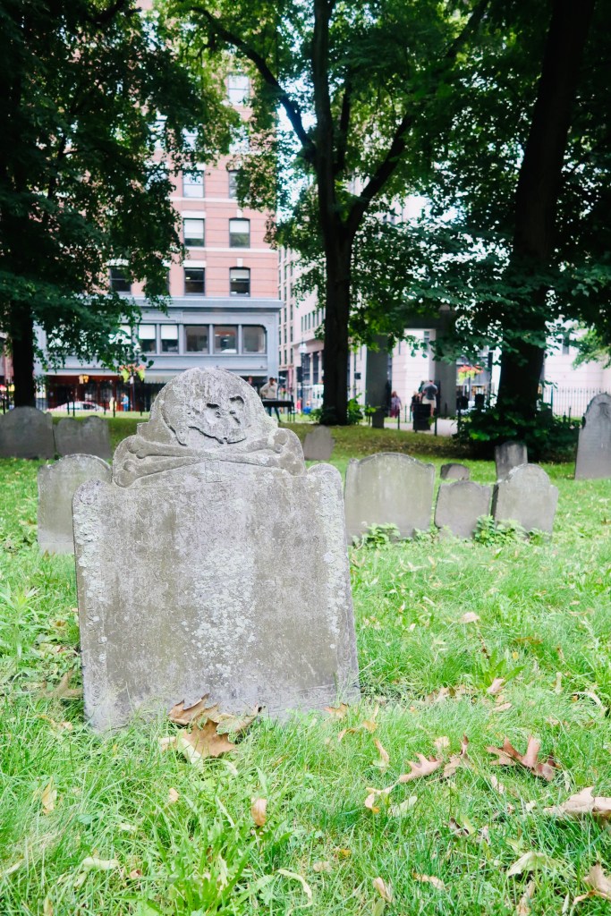
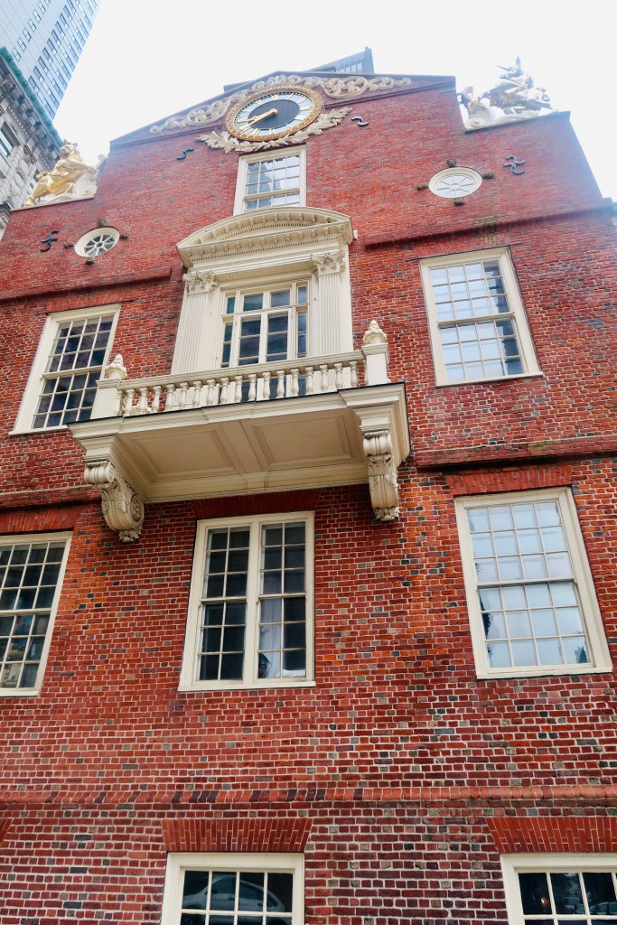
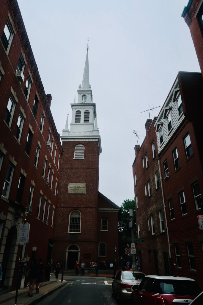
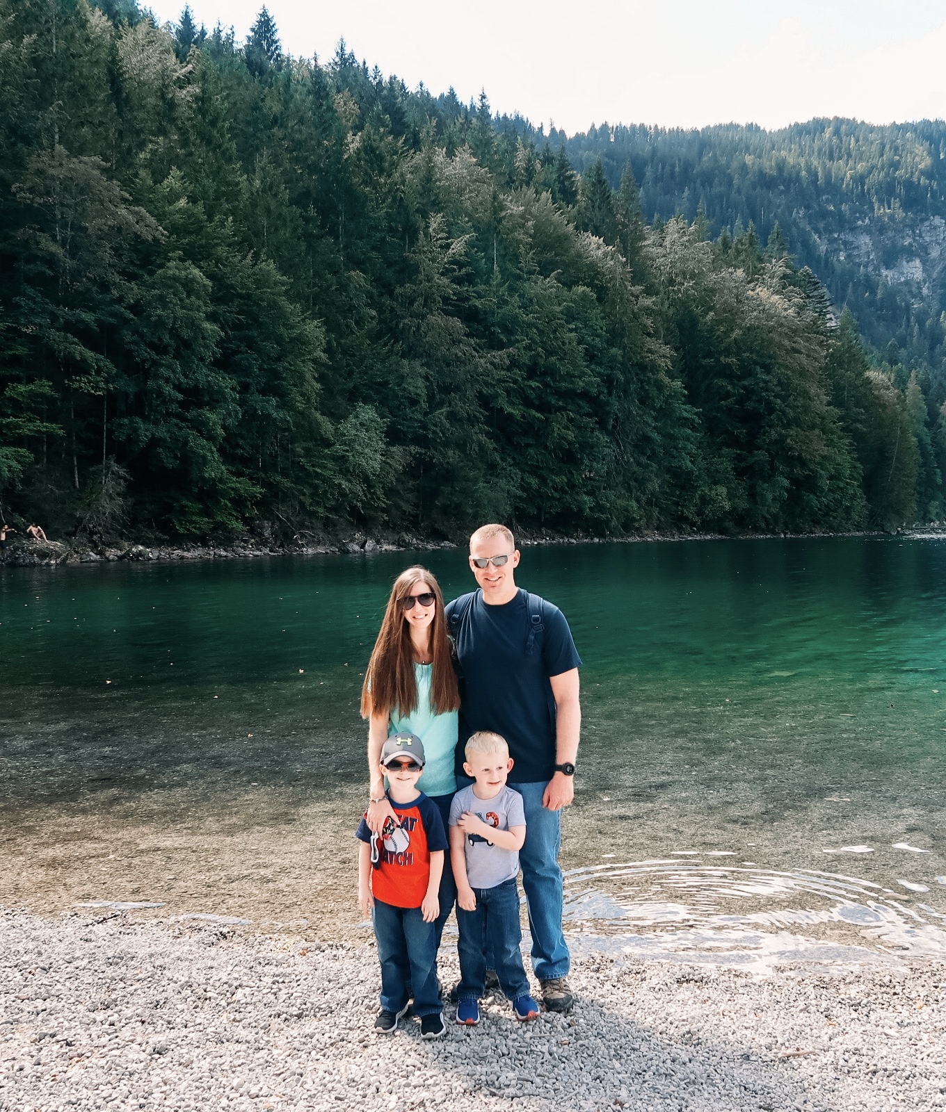
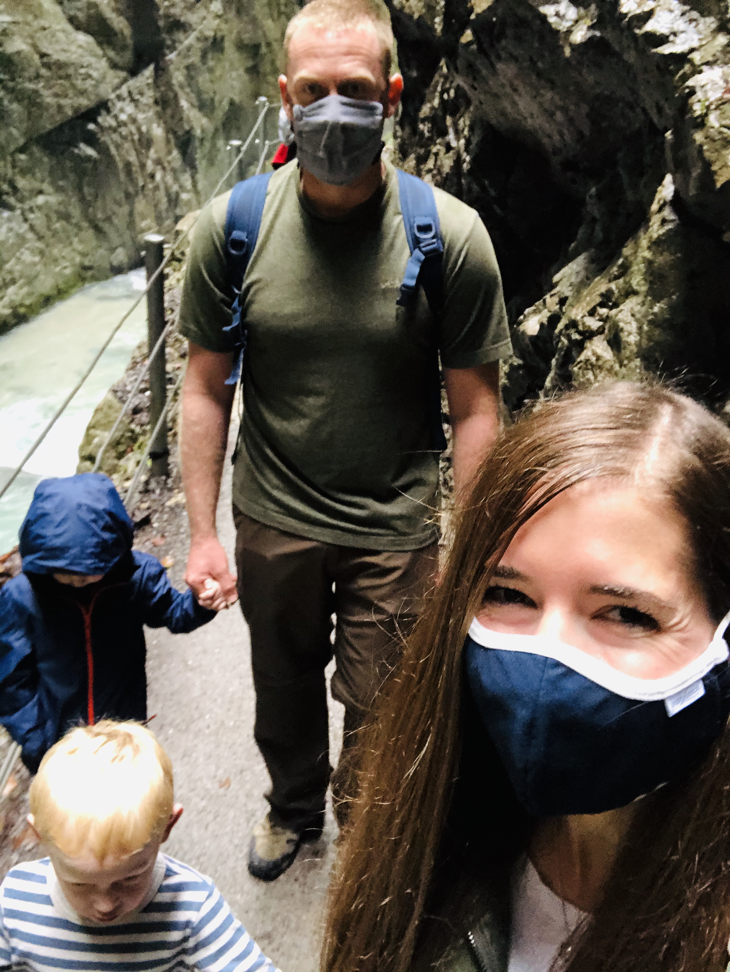
It’s officially October, officially the Spooky Month, and officially time for me to talk about our stop during our Summer Holiday (HERE, HERE, HERE, HERE) that I haven’t yet. I’ve been waiting, because to me, Salem is the heart of October, and while we went during the middle of Summer, I held on to that spooky feeling the entire time. We only stopped for a few hours, for several reasons, and didn’t do much, but it was a really exciting stop. 

With all of that, it’s definitely time for me to level with you…I went to Salem mostly for Hocus Pocus. I wanted to see the history, pay homage to those who were killed during the Witch Trials and learn their stories, but I also very much wanted to stop at certain points for filming purposes to see them for myself. There was A LOT more that we could have done, but after leaving Boston, the boys were tired, it was sunny and hot, and so we tried to limit our stops. 

So, a little recap on Salem history…

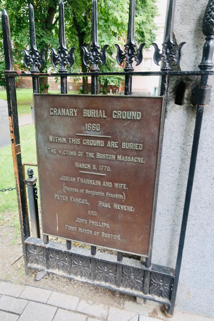
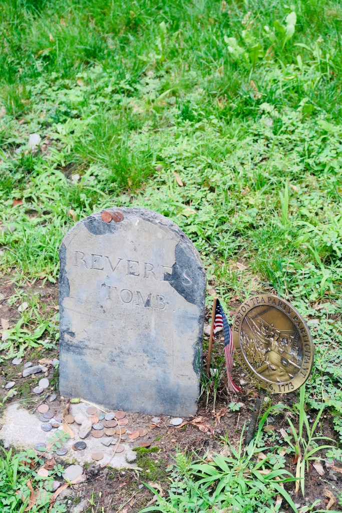
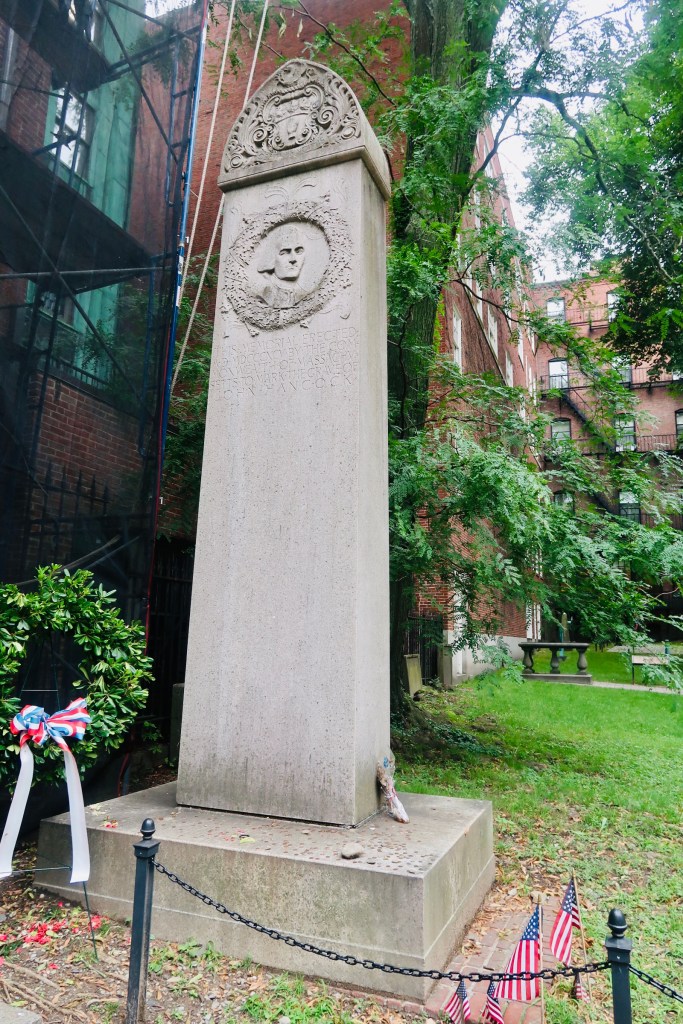
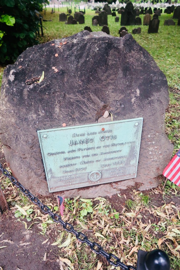
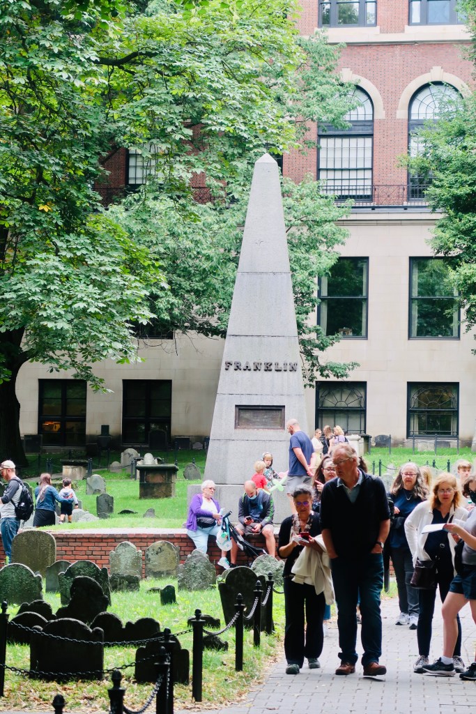
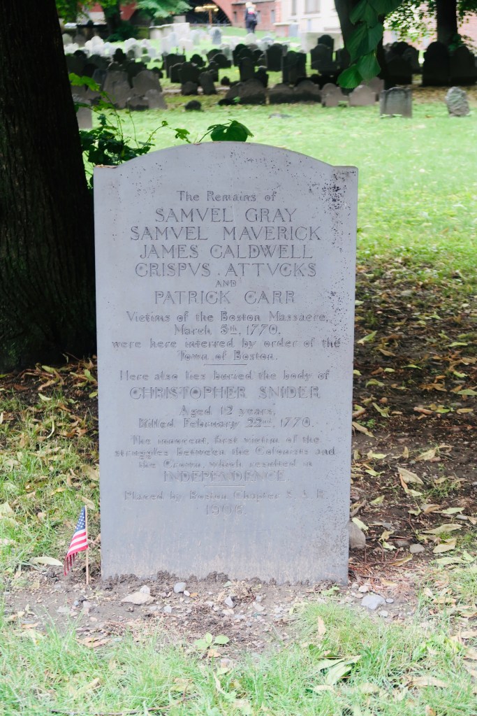
Salem was founded in 1626 by a group of immigrants from Cape Ann, with the Massachusetts Bay Company arriving two years later in 1628 to settle it for the Puritans. Over the following decades the town grows, militia is established (Salem would later be recognized as the birthplace of the National Guard), trade is established, a cemetery is created (“Old Burying Ground” or Charter Street Cemetery), a custom house is built to deal with taxes, and so on. In 1668 the House of Seven Gables is built, known later as a home of Nathaniel Hawthorne, and in 1675 the Witch House is completed, which played a large role in the Salem Witch Trials as one of the presiding judges lived there and some cases were heard in the home.  Finally, in 1692 the Salem Witch Trials, what would bring this little town to the history books, began. I think we all have a fairly good idea of what the Salem Witch Trials were, but you can read through HERE to get a good look into that history. The trials concluded (after a whopping 3 months and an accusation levered at the governor’s wife) with at least 20 dead by ruling and many others dying in prison. 

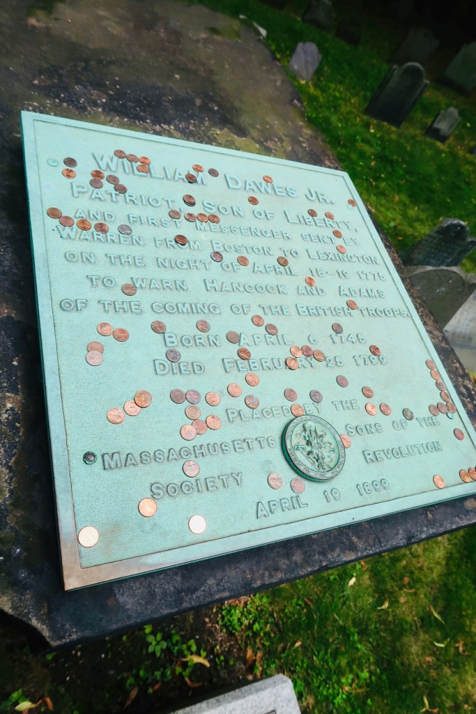
After the trials, life in Salem quieted down for a time until 1775 when Salem conducted the first armed resistance of the Revolution. The British were attempting to collect ammunition that had been stored in the town, but the militia of Salem successfully blocked them. The town of Salem continues to grow and expand and in 1799 a group of Sea Captains worked together to found the Peabody Essex Museum, the oldest continuously operating museum in the country. It features culture from the New England area, as well as around the world. 

Once again, a period of time passes; Nathaniel Hawthorne publishes a Salem local book (Fanshawe in 1828 and in 1836 Salem is incorporated as an actual City.  Then, thanks to Nathaniel Hawthorne, Salem comes back in the spotlight with the publishing of The Scarlet Letter in 1850. The residents were not a fan as they felt it mis portrayed the residents. However, Hawthorne followed up with The House of the Seven Gables, which turned the house into one of the most famous historic houses in the country. In 1866 Salem held the first public demonstration of a long-distance phone call. 

After a massive and devastating fire in 1914, and a National Historic Site designation in 1938, Salem becomes part of pop culture when the seventh season of the show Bewitched is filmed in town. This reignites interest in the city and the city starts to lean a bit more into its…darker past. In 1982 it hosted a one-day Haunted Happenings Festival, which still continues to this day (every October for the entire month now) and offers a variety of spooky and historical events to attend. You can see the site HERE if you’re interested! 

In 1992 they added the Witch Trials Memorial, which is simple, but contains stone benches around the perimeter with the names of every accused witch along with the execution date.  Finally, in 1993 Hocus Pocus is released into theatres and catapults Salem not only from the history books, but into a constant pop culture sphere (in my opinion). Fun fact, the very very opening scenes (think like opening credits) were actually filmed overhead the Plymouth Patuxet that we visited in Plymouth (you can follow the first link in my vacation above or HERE). 

So, what did we actually manage to see on our quick morning? Well, first I could not help myself but see the house from Hocus Pocus. It’s privately owned and while they don’t mind folks taking photos of the front, be courteous. Don’t leave your trash, don’t block traffic, don’t blast their personal information (such as cars, license plates, etc.) into the online world. We literally pulled over long enough for me to take a couple photos and then we left- a total of maybe 5 minutes. Then, we parked at the downtown mall, paid for two hours parking, and trekked through main street. 

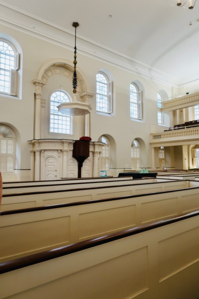
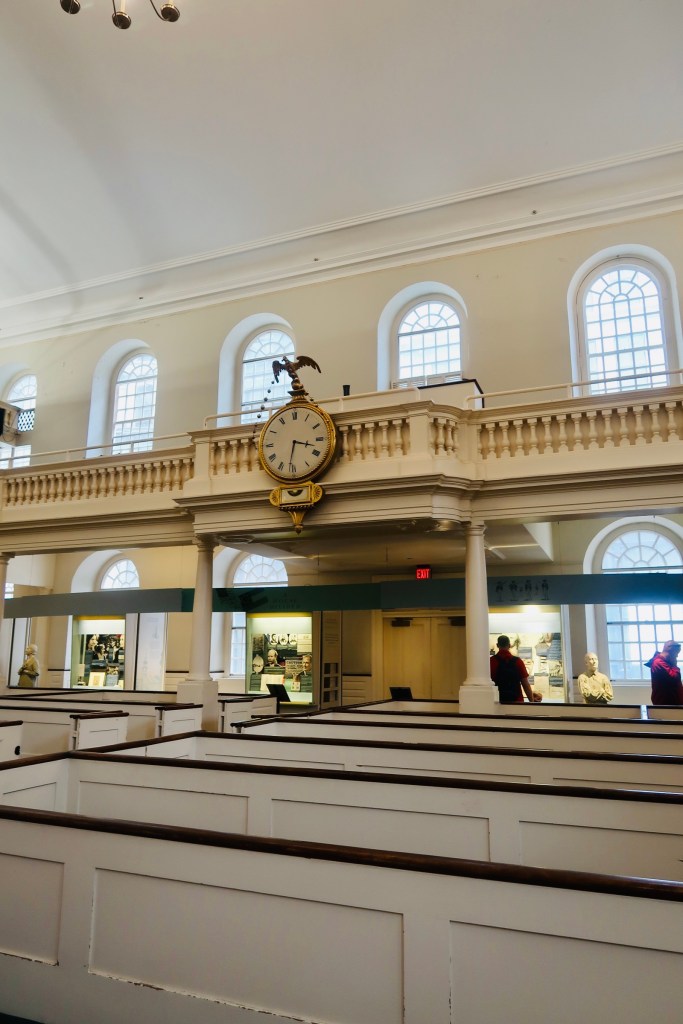
We stopped to pay our respect to the accused Witches at the Memorial, we wandered over to Town Hall, to the Witch House, and stopped at the Ropes Mansion. The main street is absolutely delightful and the perfect spot to buy all your souvenirs, take in the sights, grab a bite to eat and just enjoy the small-town vibes. It was all in all, a delightful stop and I would definitely recommend making a least half a day to a full day to learn the history and take a step into both real life history and a world of pop culture.

A Cuppa Cosy Summer Holiday 2021 – Portland ME

It’s time for our final stop on our Summer Holiday, a couple of nights up in Portland, Maine (you can see our other stops by clicking the following links: PLYMOUTH, BOSTON 1, BOSTON 2). We did make a stop in Salem on our way up from Boston, but I’m gonna save that post for a little bit closer to Halloween time ;). Anyways, I’m a big fan of Maine. This was our second time in the state, with the first being a cabin in the Rangely Lake are and this second one in Portland. I swear, I don’t know many prettier spots than upstate North East and Maine is certainly a dreamy spot no matter where you look. 

I”m going to start this post out by saying, that I think a trip to Portland can have a lot gained by simply going child free. Portland is the home of a lot of breweries and such and we could have done some tastings, hopping around from place to place had we gone without our children, but alas, we still had a fun time. The main shopping district is brimming with people and music and cute, quaint little shops, you are able to do just about anything you’d like on a boat, and you can get some incredibly fresh (and delicious) seafood. 

Portland is the biggest city in Maine (or the most populated at least). It has a good mixture of the older district and modern convenience. The region was originally called Machigonne by the local Native American tribes, however in 1623 the English moved in to settle the land. The first settlement attempt ended in failure and dissapearences of all those that went. In 1632 a fishing and trading village was settled called Casco, then it was “re settled” with the name of Falmouth, before finally being named Portland in 1786.  Historically, Portland has served as a…port city a hub for transportation and shipping. Nowadays it still serves that shipping and transport purpose, BUT it also is home to a thriving community. 

So, two things to note about our time in Portland…1) It was HOT. Like I think probably the hottest temps we had our entire trip. Not only hot, but sunny clear blue skies too. So no relief. 2) This was our last stop, so we were a bit tired, the kids were tired, and Portland is much…further spread apart than the previous stops we had made (and parking is a bit more expensive). Also, we had our kids, and this is very much a hipster town with breweries and nightlife, more so, so there was that to take into account. 

So, we got to Portland kind of mid day to early afternoon, We checked into our hotel and then headed in to town. We mostly spent that first chunk of time just walking through Old Port and the main streets of the “downtown district”. We got some dinner, local seafood, right on the water and then just walked up and down the streets. We also were able to watch the evening fog start to come in, as well as a couple of shipping boats and tug boats navigate the canal space. It was a relaxing nice way to spend the afternoon/evening.

The next morning we were up early (ish) and out the door to go explore some of the sights. We had started with a plan of seeing some trains for the kids, a mansion and lookout for us, and then a couple lighthouses to finish out the day. This quickly changed as we realized the weather and distances between attractions was going to make it a bit difficult for us to see everything we wanted. 

We started off the day at Hifi Donuts for a little donut and coffee moment. From their we headed over to the Maine Narrow Gauge Railroad Co & Museum. When Maine started its rail travel, they not only implemented regular railways, they also implemented what is known as a narrow gauge railroad. The rails on a narrow gauge are only 2 feet apart, as opposed to almost 5 feet apart. In its’ height there were a total of 5 narrow gauge railways that transported both freight and passengers. The benefit of narrow gauge is since it’s narrower than standard rail tracks, you are able to lay tracks in a wider amount of places, connecting rural spots that wouldn’t have been able to utilize a standard railway. 

When visiting, you are able to choose from a variety of seat options, we decided on first class just due to the outdoor seating options. I will say, that we visited this attraction mostly for the children and if they (or perhaps your own) were not as interested in trains, then I would honestly pass this along. The train ride is a total of about 40 minutes long, just taking you along the waterfront. Halfway through the train stops for a break and kids are allowed to go up to the engine and pull the whistle. Our train obsessed boys loved it, BUT if you/you’re kids are not as obsessed or interested in trains, I would give it a miss. 

From there we ended up deciding to skip on the two other sites that we had picked out for within Portland proper. We had intended on going to Victoria Mansion and the Overlook (as well as maybe the Botanical Gardens of the Longfellow House), but the heat and sun were very quickly getting to both kids, as well as us, so we did a quick pivot in our plans and headed straight for some lighthouses. 

Lighthouses are one of those things that I feel like the Maine Coastline is really known for and they are beatiful and well worthy of that. The first lighthouse we visited was the Spring Point Ledge Light. This is what’s known as a caisson-style lighthouse located on the grounds of Fort Preble, right next to the community college. The lighthouse itself sits at the end of a 950 foot breakwater (what the rock outcroppings are called- which I JUST learned). You are able to walk out on the breakwater over to the lighthouse and even tour the interior on certain weekends. Dating back to 1898, this lighthouse is still functioning and has become a landmark in its own right. 

The second lighthouse we went to is probably the most photographed lighthouse in Maine, definitely in Portland (whcih- rightfully so, there are just some spots that lend themselves to that). That would be the Portland Head Light. This is Maine’s oldest lighthouse, built in 1791, it is located right along Fort Williams Park and is still in use today (we heard the bell/horn), as it sits right at the entrance of the shipping channel into the bay. It was incredible, easily one of the highlights of our entire trip, just to stand there and listen to the sounds of the water and the punctuations of the lighthouse horn. 

And that pretty much sums up our time in Portland. In so many ways I wish that we had done more with our time in this gorgeous place, but I also recognize that there is usually one spot on our “multi city” trips that ends up being a bit less than the others and this just happened to be that spot on this trip. We still loved it (and it settled my love of the state of Maine) and I still think it’s a great spot to visit. 

A Cuppa Cosy Summer Holiday 2021 – Boston, MA Pt.2

It is time for the second part of our few days in Boston (you can read the first part HERE). As much as I had thought that I wouldn’t write too much about the history, I found myself getting swept away in it all. So, here we are, a second post. Todays post is going to be all about The Freedom Trail located within Boston. We split the Freedom Trail into two days, doing half each day, but it is completely feasible to do it in one day if you’d like. I always appreciate when a city puts something like this together (and trust them when they do) as they usually have the best directions to hit everything you want to see- Luxembourg City did this very well too.

The Freedom Trail is a highlight of a trip to Boston as it is a 2.5 mile red line that wanders through the city, taking you to all the important spots in Boston history. Dating back to 1950, it allows you to view museums, meeting houses, churches, and other buildings that hold a special significance to the city. Anything from churches and cemeteries (with Samuel Adams, Paul Revere, and others gravesites) to a plaque on the side of a building signifying the first book store, The Freedom Trail will give you a little bit of everything. The tour (or at least the direction we went with) starts you off in Boston Commons. 

Boston Common is America’s oldest public park, dating back to 1634. The Puritans purchased the grounds from William Blackstone, it was originally used as a common grazing land for local livestock. It also became a spot for public punishments (featuring everything from stocks and pillory for theft to the hanging of witches and others). During the Revolution it served as a training and camp ground for the British. Today it serves as a public park (the smaller park across the street is where you can find the famous ducks) and a place for rallies and marches, as well as live music and festivals. Towards the end of the park there is a monument to Robert Gould Shaw and the 54th Regiment. This memorial honors and commemorates the first all-Black volunteer regiment during the Civil War. Most of them died during an assault in South Carolina, but they are forever memorialized here.** You also get a glimpse of the Massachusetts State House as you exit the Common. This has been the home of the state government since it was opened in 1798. 

The next stop on The Freedom Trail that we made was to the Park Street Church and Granary Burying Ground. The church dates to the early 1800’s, but the burying ground is the real attraction at this stop. This cemetery is the final resting place for some of the key players of the founding and fighting for the colonies of America. This is the final resting place for around 5,000 of Boston’s own, though there are only markers and knowledge of 2,300. Notably buried here are Benjamin Franklin, Paul Revere, John Hancock, Samuel Adams, and a memorial for those massacred at the Boston Massacre. On these headstones you won’t find religious markers, rather these motifs of skulls with wings (to symbolize flying to heaven). Keep an eye out for grave markers- similar to those in Plymouth, there are metal markers signifying when the person participated in a momentous occasion, such as the Boston Tea Party. You are also able to go to another church and burying ground- the oldest in the city. We didn’t end up going in the church, but we did have a peak at the cemetery. Similar to Granary, this boasts several “big names”, the first woman off the Mayflower, Mary Chilton, William Dawes Jr, messenger sent to warn that the British were coming, as well as many others. 

The next few stops on the trail are “bunched” together in that you have the first public school of America (which boasts educating 5 of the signers of the Declaration of Independence), a statue of Benjamin Franklin (who actually dropped out of the school just mentioned), and the Old Corner Bookstore, which is the oldest commercial building in the city (it’s now a Chipotle). 

From there we headed over to the Old South Meeting House (this deviates slightly from the trail, but as I said, we split this in half so there was some deviations here and there). The Old South Meeting House is “the room where it happened”. It was the center piece to debate, to sermons, to public meetings. The largest building in colonial Boston, this was originally built as a Puritan meeting house. The congregation boasted members such as Samuel Adams, William Otis, William Dawes, Benjamin Franklin, and Phillis Wheatley, the first women and enslaved women to publish a book. The building also served as THE site, where the Boston Tea Party was decided, with 5,000 men in attendance debating the tax and what to do about it.  It now is recognized as the first in what are now regular history conservation projects. But the road was not easy, the building was actually sold in the 1870’s and it took a group of 20 women to save the building from being demolished (which also makes it the first building to be saved due to historical significance- lots of history in just one building). It has been a museum since 1877 thanks to their efforts. 

We made a last stop on our first day of the Freedom Trail over to the site of the Boston Massacre and the Old State House. The Old State House is the oldest surviving public building in the city, dating back to 1713. It now serves as a multi functional museum, documenting not only life in Boston, but the revolution, the Boston Massacre, and has a hands on second floor exhibit for kids to see what certain aspects of life were like. The boys especially loved this as they got to play “King” and “Governor” and dictate things. Right in front of the Old State House is a marker for the location of the Boston Massacre. Taking place on March 5, 1770 the Boston Massacre was a fight between the Redcoats and the people of Boston that ended with the death of 5 people. The tension between the two groups of people had finally boiled over and this tragedy became a turning point leading to the fight for independence. 

The next stops on the Freedom Trail are to Faneuil Hall/Quincy Market. I talked about Quincy Market in my previous Boston Post (HERE) and we didn’t actually get to properly go into Faneuil Hall during our time in Boston. Faneuil Hall served as a meeting place for public speech and commerce. You were able to protest, loudly, you could conduct various forms of business, you could swear an oath of allegiance. Basically it was a center of politics, conveniently located right next to the markets and commerce place. 

And that was the end of our first half of the Freedom Trail. I am noting this BECAUSE I feel like, if you want to split it into two days, that is a good place to split it. Most of the above attractions are within the same are of Boston, with convenient and easy walking distances. Then, the below would be the other half of The Freedom Trail. Again, you can do it in one day if you like (and public transport is actually decent if you need it), but this would also be a good stopping point for the day. 

**I also want to note, that there is an African American portion of The Freedom Trail. This trail takes you through the sections that the freed African Americans would have lived, their meeting house, the various monuments (including Phillis Wheatley) and other spots. You can find the trail right off of the Robert Gould Shaw Memorial at the end of the Boston Common. 

The second half of the Freedom Trail gets a little bit more into the battles of the city. Starting at Paul Revere’s home, you are able to get a good glimpse into how folks of his stature, in his time, would have lived. Built sometime near 1680, his home is the oldest remaining structure in downtown Boston. It is also the only “home” listed as part of the Freedom Trail. You are able to walk through the home, see the kitchen, the sleeping areas, AND see quite a few of the artifacts from his life. You can also see the famous Revere Bell (as we always seem to forget the Paul Revere actually was a craftsman by trade). THis is a quick but easy stop to make and a great way to start off a second day of the trail. 

From the house, you then head over to your third and final church The North Church. This church plays an important role (maybe even more important than the other two) as it was THE church that the light was put up in to signal the midnight ride. Dating back to 1723, inside the church you are actually able to see one of the lanterns that was placed in the window for the ride. You are also able to see the bust of George Washington that Lafayette said was the best representation of him. Right around the corner from the church is Copp’s Hill Burying Ground. This was, by and large, the burying site of many of the craftsmen and merchants that lived on the North side of Boston. A couple notable people buried are two of the ministers involved in the Salem Witch Trials, the founder of the Black Freemasonry, as well as the man who hung the lanterns on the night of Pau Revere’s ride, and a builder of the USS Constitution. This particular burying ground was also a marker for the British to aim at during the Battle of Bunker Hill (which we ARE getting to, I promise). 

Speaking of, the next stops that you can make are entirely up to you. You can either go up to Bunker Hill at this point (which is what we did), OR you can go down to the USS Constitution. We chose to go up first, then back down, and at the end we took the Ferry back to the “main” part of Boston. It is entirely up to you how you want to walk this part. 

The Battle of Bunker Hill was the first battle of the Revolutions, and while the British technically won (after three assaults) it did prove that the colonists were not going to go down without a fight. The order of “Don’t fire until you see the whites of their eyes” is believed to have originated in this very battle. The monument was started with the laying of the first stone by Lafayette (excuse me, The Marquis De Lafayette) in 1825. It was completed in 1842. 

The final stop (for us) on the trail was at the USS Constitution (and then the USS Cassin Young DD 793). The USS Constitution is the oldest, still afloat, commissioned warship. It was launched in 1797 as a three-masted heavy frigate, one of six authorized by the Naval Act of 1794. The ship is known for the War of 1812 and the defeat of 5 British Warships and where the nickname of “Old Ironsides” was given. The Constitution was retired in 1881and was designated a museum ship in 1907. It is still a fully commissioned Navy ship and is manned by active duty Navy personnel on special duty assignment. 

The USS Cassin Young is a destroyer from World War II. It was launched in 1943 and is only one of four of the Fletcher Class destroyers still afloat. The ship served in both World War II (where it was damaged in two kamikaze attacks) and the Korean War, being retired in 1960 and serving as a memorial ship ever since. The ship was intended to serve as an escort to the larger ships and defend them from attack. Unlike the USS Constitution, this ship has been permanently loaned to the National Park Service and it maintained and operated by them rather than The Navy. 

And that wrapped up our time in Boston! Boston was a definite highlight for our entire family. The boys loved the history, the boats, the endless exploring and my husband and I loved the pace of the city (and obviously the history). I don’t know that we’d ever be “city people” (most are just too crowded and busy for us), but Boston was such a nice surprise! 

Interlaken-Oberhasli District, Switzerland – A Long Weekend

We recently just spent a long weekend in Switzerland. Ok, I need a moment already, just from typing those words. Never in my wildest dreams did I think I would utter that sentence. Never. 

Ok, shock over. We recently spent a long weekend in Switzerland, and it was glorious. Where do I even begin? My husband’s only requirements for the trip was to be able to see/be at the top of the Alps, so we picked a spot right near Interlaken, in the heart of the mountains and lakes. With COVID-19 restrictions we were restricted from traveling to some of the major cities, and we wanted to be a bit…off the way. When a local friend posted about a hotel she stayed at right on Lake Brienz, I knew that was where we needed to be. 

One little, teensy, note to make about Switzerland before we get into the meat of this post. If you know anything or have heard anything about Switzerland it is that it is an expensive place to visit. This is not an exaggeration. You will need to plan accordingly for this visit and budget if you need. There are certainly ways to make it a “cheaper” trip, but it will never be inexpensive. For us, I knew that this was going to up towards the more expensive trips we took on our time here and I was 100% ok with that. It was more important to me that we did what we wanted to do and enjoyed our time without worrying about the cost necessarily. With that being said, there were a couple of things that we DID NOT do, which I will get into later. 

Before we got to Switzerland though, we made a stop at KZ-Lager Kaufering VII. This is a European Holocaust Memorial in Landsberg Germany and is the largest remote area (sub camp) of Dachau Concentration Camp. There was a total of 11 of these sub camps of Dachau and this one has the actual remains of the tube style barracks. In total these camps saw 30,000 prisoners, with at least 14,500 prisoners dying over the time the camp was open. Exact numbers are not known as the records do not match up (one study found upwards of 44,000+). The camps were intended to put prisoners to work on an armament project, without any consideration by the guards for the health and safety of the prisoners. During the war crimes investigation, it was discovered that these sub camps were the worst in Bavaria and the prisoners came to refer to them as “cold crematorias”.     

We were not able to walk inside the camp and see the buildings and cemetery up close, but you could still get a feel from outside the fence. This is the second concentration camp we’ve been to (Dachau Concentration Camp being the first and hopefully a visit to Auschwitz soon) and I will never be able to fully verbalize the experience. So, once again, I will let pictures say what I cannot. 

After that, we headed off on our Switzerland Adventure. We stayed at the Hotel Seiler au Lac. Not only is the hotel itself incredible (you can request a lake front room, all of which have balconies looking right out to the water- swoon), but the staff were incredibly helpful and went above and beyond our needs. We opted to have breakfast at the hotel (included), which was handled excellently with COVID restrictions. We did also opt to have dinner at the hotel restaurants (one night at each- two restaurants attached to the hotel), and both meals were delicious. This particular hotel is located in Bonigen, Switzerland, a quick distance away from Interlaken (you can walk or take a bus- passes were offered by the hotel), and only a 20-30 minute drive to either Lauterbrunnen or Grindelwald (Berne is about 45 minutes away if you want to go there as well). 

Our first evening was mostly spent wandering around Lake Brienz before settling into our hotel and grabbing dinner at the Pizzeria attached to the hotel. 

We set off late the next morning to head into Interlaken. 

Here is where I am going to clarify some of our choices in activities. There are a couple of things that I base “what we do” on, the biggest factor being the weather. It was a wet and rainy morning in our area of Switzerland, so we knew going to Jungfraujoch (the top of Europe- aka the highest point of Europe) was going to be hit or miss. The second factor, less so than weather, is cost. This is really only specific to Switzerland as things are, generally, more expensive in the country. We made the decision to pass on heading up to Jungfraujoch as the potential for bad weather combined with the cost was not worth it for us. Instead we chose to top some of the smaller peaks, and this was just as incredible as anywhere else we could have stopped. 

So, back to our day. Chances are, if you’ve tried to take a train or summit one (read: many) of the Swiss Alp peaks, then you’ve gone through Interlaken. Not only is Interlaken the central city between Lake Brienz and Lake Thun, but it is also a main transport gateway to the Alps in the region. You’ve got the two lakes, then the River Aare which flows between them (and therefore between the city). There has been a city in this location since the 12th century, but it was originally known as Aarmuhle (changed to Interlaken in 1891). It started out as the home of a convent and monastery, but as it continued to grow, it became a large city. It started to become known as a resort town in the early 19th century, with a railway opening in the 1870’s (and more following in the next 20-30 years). 

We spent most of the rainy morning walking throughout the town seeing all the beauty that is offered in the valley. I think one of the best things to do sometimes is to just walk around the streets. We didn’t have any “set ideas” of spots to see until the weather cleared, so we just walked. We stopped in for a light lunch and during that, the weather started to clear out. Faced with breathtaking blue skies, snowcapped peaks, and a new look at Interlaken, we decided to head up to Harder Kulm. 

Harder Kulm is the top of Interlaken. Rising 1,322 meters above Sea Level you are able to get an incredible view of Interlaken, the peaks around the city (opposite), as well as the two lakes, Brienz and Thun. There is a viewing platform that you can stand on for a truly breathtaking experience. You don’t even have to worry about hiking up if you don’t want to (though you certainly can), there is a funicular that takes you to the top in just under 10 minutes. You are also able to go up top in the evening, and I believe there is a hotel located right above the restaurant if you would like to stay. 

We finished out the day at an indoor playground for the kids. Most of our travel is not necessarily based on our kids in terms of places we visit (maybe I’ll talk about different traveling styles in a blog post?), but we saw that there was a neat kids play park and we had a bit of time to kill between finishing up in the center of Interlaken and heading to dinner. So, we let the kids go a little wild and run off all the pent-up energy for a little while. They really enjoyed it and it was nice to be able to do something just for them on our trip. 

Our second day we decided to go over to Lauterbrunnen. It was a tough call as to whether we wanted to go to Grindelwald of Lauterbrunnen, you can’t really go wrong with either option, but I wanted to be able to see the waterfalls that Lauterbrunnen is known for. Honestly, I don’t think you could really go wrong with anywhere in this particular region, so explore it all if you can!

Lauterbrunnen as an area is first mentioned in the 13th century, with the name Lauterbrunnen being mentioned in the beginning of the 14th century. It has an early history of battles and rebellion between the villages and the Interlaken Monastery, ending in the 16th century. The villages that make up Lauterbrunnen were actually very poor. The area started out as a mining area, but all of the profits went to the noble families, and the working-class people remained below the poverty line. It got so bad at one point, that most villagers moved away, joining regiments and emigrating to the United States of America (settling in the Carolinas). At the end of the 18th century, Lauterbrunnen started to gain more traction when mount climbers would start expeditions in the town, and once the road was built from Interlaken to Lauterbrunnen, tourism exploded. Lauterbrunnen has inspired many a writer and film maker (with Goethe and Tolkien both referencing it in their own works, and the 1969 On Her Majesties Secret Service being filmed in the city). 

Lauterbrunnen is really known for its waterfalls and mountain peaks. It is one of the largest nature conservation areas in Switzerland and easily one of the prettiest spots we’ve ever visited. The valley is home to 72 waterfalls, the largest being Staubbach Falls which are one of the highest free-falling waterfalls. Another set that you can visit up close are Trummelbach Falls, which are a natural waterfall phenomena situation behind the rock face. 

We started the morning off hiking through the valley to get to Trummelbach Falls. You are able to park right at the waterfalls if you’d like. HOWEVER, I would highly recommend parking in one of the bigger “in town” parking lots and then walking through the valley to the falls. It was an incredible semi sunrise hike (it definitely wasn’t sunrise, but the light still hadn’t reached in to the valley when we started walking) and you see so many more of the waterfalls this way, as well as get the chance to see some of the local cattle life and ranchers (we got to see a minutes old baby cow on our way back from the falls as well as buy local cheese from a little self-service booth). It’s all flat ground and we really loved being able to soak in all of the natural beauty. 

So, we started at our furthest out point, Trummelbach Falls.

Trummelbach Falls are the largest subterranean water falls in Europe and can carry up to 20,000 tons of meltwater from the glaciers of Jungfrau. They are incredibly loud (thundering loud), cause the mountain to almost tremble at the power, and are the most incredible thing mother nature does. If you’ve read my Garmisch-Partenkirchen post, you’ll recognize a pattern of water going through rocks makes me just swoon and feel overwhelmed with amazement, and Trummelbach Falls was no different. We were lucky with our timing as we were able to see all 10 chutes of the falls (at a total height of 200 meters), whereas during certain times of year you are only able to see the top chutes. They do not recommend this activity for younger children (in fact they don’t typically allow children under the age of 4 in) and I would be careful walking through the paths- it can get very slippery. 

From there, we walked back towards town with a stop at Staubbach Falls.

Staubbach Falls has a height of almost 300 meters (297 to be exact) and , in addition to being the highest in Europe, are the most famous of the waterfalls in Lauterbrunnen. The waterfall inspired Goethe’s poem, Song of the Spirits over the Waters and disperses water as if it were dust. You are able to climb a portion of the rockface to be “under” the waterfall; HOWEVER, I would not recommend this for young kids. I was the only one who went up the rockface and, once I reached the end, was glad my boys did not head up. It is a really cool experience though, and if you can, I would recommend it for adults.

The entire valley is one for the nature lovers and reminded us just how incredible the world around us really is. So much beauty and a place I’m glad we spent a whole day in. 

From the falls, we decided to head up the mountain towards Murren. From the base of Lauterbrunnen you are able to take a gondola up the mountain to Schilthorn, then either hike or board a train towards Murren. We chose the train (much to the boy’s excitement) and were treated to a narrow-gauge railway and breathtaking views.

Murren is a traditional mountain village at 1,638 meters above sea level. From Murren you are able to see Eiger, Monch, and Jungfrau mountains around you. I think this is a great alternative, if you just want to get up in the mountains, but don’t necessarily want to do the Jungfraujoch. There is an element of “off the beaten path” and an actual look at what life is like up in the alps, even though during the summer this is one of the more popular alps spots.  

We finished out our day in Lauterbrunnen with a hot chocolate made in a local coffee shop before heading back to our hotel and our dinner reservation. 

And that wraps up our long weekend in Switzerland! Easily one of the most incredible places we’ve visited, and it definitely makes my top 4 places we’ve traveled. I’ve used a lot of words in this post (2319 at this point to be exact), but none really can come close to what this region was like. 

A Long Weekend in Garmisch – Partenkirchen

We recently took a little trip “to the mountains”. The Garmisch- Partenkirchen area is an area on the Austrian border in the Bavarian Alps. This area is a great one for hiking, mountain climbing, skiing, and just feeling right in the heart of the alps and nature. It has something for everyone. We took a quick weekend getaway and explored some of the top sites. 

Garmisch and Partenkirchen were two separate cities for quite a long time, up until 1935 when they were forced to “merge” for the Winter Olympics in 1936. Partenkirchen is the older of the two as it dates back to Roman times and A.D. 15. Garmisch was not mentioned until 800 years later. The two cities have quite the history between the land, the plague, and the witch trials. Not to mention, the Winter Olympics of 1936 (the first year Alpine Skiing was competed) and then World War II when the town held a major hospital for the German military. The towns have distinct differences, with Garmisch being more “modern” of the two and the area is now referred to as Garmish-Partenkirchen OR GAP (although many people try to simply say Garmisch).

So, upon our arrival to Garmisch-Partenkirchen, we decided to start with a trip up the mountain, to the highest peak in Germany, Zugspitze.

The highest peak of the Wetterstein Mountains, this is one of the most incredible viewpoints in the region. The German/Austrian Border runs right through the peak, so you can head for lunch at the peak in Austria (or Germany) and see the beauty all around. The peak was first reached in 1820 by Josef Naus, Maier, and Johann George Tauschl. If you choose to climb, you have three routes to take, however if you’re like us, you can also choose from three different cable cars to “ride” up to the top. We took the Seilbahn Zugspitze up which provided us with some incredible views both on the way up and down. 

Once we came down, we walked down to Lake Eibsee. Lake Eibsee is one of those lakes that I feel like are beyond words. Created by a rock fall, the water is crystal clear, the deepest, prettiest shade of blues and greens that you could dream of, and provides the peace and clarity that only being by the water can provide. It is actually considered one of the purest lakes in the Alps. Similar to Alpsee at Hohenschwangau/Neuschwanstein or Forggensee in Fussen, this is a level of beauty that just seems to need to be seen (and then can’t be captured perfectly because you need to see it in person) and just held in your soul. We walked around a bit of the lake and found another little “hide away” lakes that was also incredibly gorgeous.

From there we headed in to town and over to our Hotel. We stayed at Reindl’s Partenkirchner Hof and I would highly recommend a stay here. The hotel was beautiful, and the room was incredible. They had offerings throughout the day, could arrange several activities for guests, and the location was great. From check in, we wandered over to the site of the Winter Olympics Ice Rink. Fun fact about me, I was a competitive figure skater for about 12 years. Seeing the history of the ice rink was awesome and seeing the location was really cool. We headed more into the Altstadt side of town and found a little restaurant to eat some dinner. We ate at a restaurant called Zum Wildfchutz and the food was delicious. I got a bread/pizza concoction and my husband got a meat dish. We also sampled the 2020 Oktoberfest beer from the Hacker-Pschorr brewery, which was also delicious (I think I’ve just decided that German beer is the only beer for me- especially the Oktoberfest brews). 

After the massive meal, we felt like walking a little bit longer (to walk off a bit of that delicious meal) and found ourselves in a church, Pfarrkirch St. Martin. This is one of those gems that you could very easily miss just by not walking in. I find churches to be some of the most incredible stops to make when traveling as they are all different in unique ways. Yes, the structure and such can be similar, but each church is still incredibly unique. And this church was breathtaking.

This particular church is first referenced (and an initial church was built) in the 18th century, with mentions going back to around 750. The current church was renovated starting in 2007 to repair the entire building (from the roof to the flooring). The ceiling paintings were painted by Matthaus Gunther. When we walked through an organist was playing the organ, which only added to the special feeling that we were experiencing. That was the perfect end to our day. 

The next day we spent our entire day in the Partnach Gorge area. In its most basic (read: I am not a geologists and I don’t understand a vast majority of that) sense, the Partnach Gorge is a 702-meter-deep gorge that has been incised by a mountain stream. In some places the gorge is over 80 meters deep. The gorge was initially used by locals in the 18th century as a way to transport firewood, as well as a rafting stream (until the 1960’s). In 1912 the gorge started to be developed for tourists to visit and has undergone changes as the landscape changes (there was a rockfall in 1991 that changed the path), and the walk is…incredible. 

Sometimes we experience, or visit somewhere that we cannot put into words. Somewhere that just connects with every fiber of our being, and the experience of visiting that place just transcends everything else. That was Partnach Gorge for me. It was just incredible. The rush of the stream, the rockwall all around, it was an experience that I will never forget. Not to mention, the actual water itself was a gorgeous blue/green that you think only exists in highly edited photos. 

However, to back up for a minute (I got a little excited and ahead of myself), we started the day at the Olympic Ski Park. We didn’t climb the stairs to the top of the jump, but rather stopped on our way to the gorge (as you have to pass through to get to the walking path for the gorge). So, the Olympic Ski Stadium.

The 1936 Winter Olympics were only the fourth Winter Olympic Games and set quite a bit of records and history. You are able to climb to the top (although we did not do this) and you are also able to see what the skiers would have seen (and still do- there are two annual competitions held in this stadium). If you are into the Olympic sites and history, you are also able to visit the bobsled track which held the “most dangerous track” title for quite a long time. 

Now, after the Stadium and after you walk through the gorge, there are two different routes to get back to the gorge entrance (I’m actually pretty sure there are more than two, we just chose between two that we mapped out). We let our older son Colton choose the route, and he chose the “road less traveled”.

This path meant climbing partially up the side, then back down, and back up again. It was quite the hike, but so well worth it as the scenery of the Alps is unparalleled. Not only do you get the views within the Alps, but you are also able to see the gorge from above (though you can see this whichever path you choose- there are definitely easier paths to take). It was quite the way to spend our day and I loved every minute of it. 

Our final day on our weekend was our “head home” day, but we incorporated one final stop on our way home to Schloss Linderhof (or Linderhof Palace). Now, I’ll devote an entire post to Linderhof (just like I will for Heidelberg Castle, Cochem Castle, Burg Eltz, and all the rest- they ARE coming I promise), but I’ll give some bare bones here to hold you over till that post.

So, Linderhof. Ludwig II was quite the dreamer and builder. He commissioned a lot of different monuments and statues (Walhalla, Liberation Hall, Neuschwanstein, and many, many, more) and he turned these ideas into realities fairly quickly. Not long after redesigning rooms in his Munich residence and laying the foundation stone for Neuschwanstein, he started plans for Linderhof (all of this took place 4 years after he crowned King). His initial plans didn’t come to fruition, however what did was incredible. The original building was the Foresters house, which was used when the King (Ludwig’s Father, Maximilian) and Crown Prince would go on hunting trips. The palace was remodeled and rebuilt in various stages, but ended up being the only palace Ludwig II saw completed in his lifetime. 

This palace easily jumped to almost the top of my favorite castle list (it’s battling up against Hohenzollern Castle if you’re wondering) as both the building itself and the location is perfect. Ludwig II loved the concept of the French palaces (and Versailles in particular) and this most definitely reflected that love. It’s ornate, it’s incredible, and the attention to detail, to making smaller rooms appear larger, while still trying to keep them “cozy” is just wonderful. Not to mention the garden and the exterior and something to behold as well. What a way to end our weekend. 

A Cuppa Cosy Summer Holiday 2020- Cochem

Our last stop on our Summer Holiday was back in Germany in a small town called Cochem. This is the weird part of the blog posts as I am going to do a general blog post today on Cochem and the couple of things that we did, but one of our reasons for stopping in Cochem, was its vicinity to a couple of castles we wanted to see. I’ll be giving full details on the castle’s in separate blog posts, but wanted to get this last stop blog post out for you. We really enjoyed the time we spent in Cochem (2 nights) and it really solidified how much we’ve fallen in love with Germany (which I’ll talk about at some other time). Regardless, after leaving Belgium, we crossed the border back into Germany and headed straight over to Cochem. 

Cochem is a small town (total population ~5300) on the Moselle River.

It has had settlements from the 1stcentury onwards, was an Imperial estate in the 13th century, and was granted town rights in the early 14thcentury. It’s been under the rule of Germany, France, and Prussia. During World War 2 there was an underground subcamp of the Natzweiler Concentration Camp with 13,000 prisoners at its height. It’s important to note that Cochem is located along the Mosel River which happens to be an area of Germany that produces, and is known for, wine. German Wine is typically a Riesling wine as that is the most widely planted grape, although they do produce a variety of white wines. (Luckily for me- I love a good Riesling so I was in the very right place ha-ha). 

The first place we stopped at, the minute we arrived in Cochem, was the Reichsburg Cochem, or Cochem Imperial Castle. As I said, I’ll be doing a whole separate post on Cochem Imperial Castle, but I’ll include a brief overview here as well.

Reichsburg Cochem dates back to around the 12th century when it was occupied and declared an Imperial Castle. In the 17th century the French King Louis XIV overran it and then destroyed it. In the 19th century a businessmen from Berlin purchased in and then reconstructed it. It is now owned by the town of Cochem. After a tour of the interior, we headed to our hotel and over to dinner. We stayed at Hotel Zenthof which was another perfect spot, right off the main bridge connecting the two sides of the river, and a view of the castle out the front. We had dinner right on the waterfront and watched the sunset with a lovely glass of Riesling for myself and a beer for my husband (this is the aforementioned moment where we just realized how perfect Germany has been for us). 

The next morning, we were up and off early (only stopping at a local supermarket to pick up some pastries for breakfast) to head over to our second castle, Burg Eltz.

Again, a full dedicated blog post is coming, but this is a medieval castle located in the heart of the hills above the Moselle River.  First dating back to the 12th century, this particular castle is still owned by the same family that lived there at that time (it was actually 4 families and quite an interesting tour!). We had the dreamiest morning walking along its walls and corridors. 

From there we went to do a little…adrenaline push. In Hunsruck there is a 360-meter suspension bridge (its height is 100 meters up) that you are able to walk across. The Geierlay Suspension Bridge was first suggested in 2006 and rejected, then re suggested in 2010 for a second look.

Modeled after the Nepalese suspension bridges (which means that it is “unstiffened”), construction started in 2015 (record time as the bridge opened 130 days later), and the bridge was inaugurated at the beginning of October of the same year. The bridge itself has a layer of local Douglas fir that you are actually walking on as you walk across the bridge.  Finally, the name was picked after an open competition and refers to the land and history of the area of the bridge.  The bridge itself is center to several hiking and biking spots, so you can definitely combine a hike with crossing the bridge.

Honestly, I am terrified of heights. Well, I mean really I suppose I am more terrified of falling, rather than heights, but the two go hand in hand. So, the idea of walking across this suspension bridge that moves with every movement (even more so in some areas than others) was not…appealing. As always, while I was on it I just stepped one foot in front of the other and just focused on that. I did, from time to time, look up to take in the absolute beauty that was around me, but on the whole it was an accomplishment to make it to other side breathing normally for me. And once I got to the other side? I felt like a bad ass ha-ha.

We decided to hike our way back to the car, rather than walk back across the bridge (this would have actually been preferrable, but my older son wasn’t keen on walking back across the bridge). The hike itself is gorgeous, taking you down into the valley before up the mountain side. It’s not a terrible hike, although I would recommend wearing comfortable shoes. 

A few things to note about the bridge currently (during Covid-19)- in order to maintain the appropriate health precautions, they are restricting movement on the bridge. This means that during the heightened visitor time (11-5 I think) they only allow foot traffic one way each hour. So odd hours going from one side, even from the other. This meant that we waited in line for about 2 hours to just make one pass on the bridge. One side is easily more packed than the other (as it would be) and the line wasn’t the most socially distanced it could have been. However, they grouped people together in groups of 10 or so that they would release on the bridge at a time, so it wasn’t a massive amount of people walking through at a time.  If you are going to go, I would recommend going outside of the popular visitor hours (I would recommend this regardless though). For example, I am looking at the webcam as I am writing this (10:26AM German time on a weekday) and there is hardly anyone on the bridge at this time. No lines, no crowds. 

And that wrapped up both our time in Cochem AND our Summer Holiday! What was your favorite stop? To recap on our entire Summer Holiday (or if you missed any) you can go along with us to LUXEMBOURG, PARIS (1 & 2), MONT-SAINT-MICHEL, NORMANDY, and BELGIUM. 

A Cuppa Cosy Summer Holiday 2020 – Normandy, France

We spent a total of 2 ½ days in Normandy (including our to “travel days” to and from as we did things on those days). You’ll have seen my post devoted to Mont-Saint-Michel already (if not it’s HERE), but we did so much more in Normandy than that. Normandy has played such a role in World History being a landing site and the beginning of the Allied Forces taking charge during World War 2, however before that it was just…an area of France. The beaches that were stormed were just beaches and the area is absolutely gorgeous. During our time in Normandy, save for the Mont-Saint-Michel reprieve, we focused very heavily on World War 2 history. My husband had a long list of places that he wanted to see, and we managed to see most of them. Not only that, but our children were able to learn and understand what happened during that war, but I’ll get into that a bit later.

Untitled Design 69

After checking in to our hotel (we stayed at an Ibis in Port-en-Bessin-Huppain which I would recommend), we decided to just hit the ground running and head off to our first spot. It only felt right to pay homage and respect to those who gave the ultimate sacrifice before anything else, so we started at the American Military Cemetery at Omaha Beach.

The cemetery was originally a temporary American cemetery established in June 1944 and was the first American Cemetery on European Soil in the war. The cemetery has 9,385 graves, most of those who perished in the D-Day Landings and following operations, as well as a Walls of the Missing monument that contains 1,557 names. There is a visitor center within the cemetery, although this was closed due to Covid and there was also a path from the cemetery to the beach, but that closed due to security a few years back. You are able to walk the entire cemetery, through several different pathways (should you choose to walk along the beach side, the center, or the roadside), the wall of the missing, and the monument that details out the landings and invasion.

From the cemetery we went over to Point du Hoc. We wanted to make sure we were able to walk the area before it closed (as the locations with centers have opening and closing times, the beaches do not-you can walk those at any time), so we passed walking the beach until after. Pointe du Hoc is a little west of the center of Omaha Beach and a Ranger battalion was tasked with attacking and capturing the fortifications. Pointe du Hoc is a wall. A rock wall.

The Germans had a completed 4 casemates that housed guns, an observation bunker, and anti-aircraft guns.  The plan was to land by sea, scale the cliff and capture the area. There were quite a few problems that arose during the attack, a timing setback, the ladders weren’t long enough, and the second wave of soldiers did not get the flares in time and wound up landing on the beach rather than scaling the cliff. Now you are able to walk amongst the paths of the original fortifications and see the various gun mounts, observation deck, and bomb craters from World War 2. The site starts with a large plaque detailing what happened, and pointing out information before you start walking through the path. It ends at the monument to the battle.

We went to two beaches while we were in Normandy, Omaha and Utah Beach. I’m not going to go into all the history of what happened at the beaches as we should all have a basic understanding of D-Day and, quite honestly, there is so much information about the pre landings, landings, and ongoing battles afterward that it would be too much for this one post. However, I will do a brief rundown as to what we saw at each and a little comparison.

We went to Omaha Beach first.

Omaha Beach is probably the most “well known” of the beaches, the one that is featured in a lot of the films/movies, and the one that is talked about frequently. At Omaha Beach you are able to see the remains of the temporary harbor that was built after landing during low tide, as well as the memorial. The memorial is located at the center of the beach and features three independent sections. It was an incredible bit of time walking the same steps that a soldier might have taken.

Utah Beach was our second beach, visited on our second day, and it was another incredible experience.

Utah Beach was different from Omaha in that there was a lot more artifacts to explore. Utah Beach had one of the Huey Boats, had the anti-tank obstacles, had some tanks, and the museum also has airplanes and other items from D-Day. Our boys were able to have a much better understanding of what happened as they were able to see and visualize what it looked like.  It was something special to, once again stand there, but then see and wander through the various areas that…really haven’t changed in these 76 years.

After leaving Mont-Saint-Michel Abbey on our second day in the region, we headed over to the Airborne Museum in Sainte-Mere-Eglise. Sainte-Mere-Eglise is one of the well-known towns from the various battles in France during World War 2. The town was under German control and the airborne paratroopers were to drop in the town during the night. What led was one of many firefights to liberate the French town. Over 3 days the Americans managed to maintain control of the bridges through the town, liberate, and continue to move forward. Sainte-Mere-Eglise is one of the French towns that continues to hold the American Military and the night of liberation in the highest esteem. The town is milestone 0 of The Freedom Path which is the path taken by Patton’s 3rd Army from Sainte-Mere-Eglise to Bastogne.

The Airborne Museum was born out of a desire to continue the memories of those who gave all and of that night that the town was liberated, and all of World War 2. This was one of those museums that you just have to visit. Beyond the typical artifacts and such that were used in the war (which were incredible) the museum has debuted an interactive iPad experience. They also offer a simulated jump experience that replicates what it would have been like to jump during World War 2 as well as what the ensuing battle would have been like. Excellent for both kids and adults as it’s a bit tamer than some of the other WW2 museums we went to (like Bastogne…but that’s another post).

The final place we went to on our final morning in Normandy was Longues-sur-Mer battery.

This is a World War 2 German artillery battery that is still relatively intact. On another cliffside, this battery is between Omaha and Gold Beaches. This is the ONLY battery in Normandy to retain all the original guns in their original positions. Walking the path, you are able to see the 4 casemates and the observation tower all fully intact, as well as walk through the guns in the casemates. I don’t think we could have picked a better spot to end our time in Normandy as this was just…incredible. To see the guns in the places they would have been, the cliffside as it was, the debris in the water, the view from the observation tower…there are no words.

IMG_7026.JPG

And on that note, we drove out of Normandy and over to Belgium.

A Cuppa Cosy Summer Holiday 2020 – Mont-Saint-Michel Abbey

I’m going to start our time in the Normandy Region off with our visit to the Mont-Saint-Michel Abbey. It wasn’t the first thing we did, BUT it was one (in a long list) of the most incredible things we visited. Our entire time in Normandy was full of incredible places, both in happy and heartbreaking times. 

Untitled Design 68

I’ll be honest- I’m going to give a brief rundown of the history of the abbey, a short breakdown of our visit, but I’m mostly going to just let the pictures speak for themselves in this post. It’s safe to say that this was hands down my favorite place we saw on our entire summer holiday. A place that I’ve heard about so many times, is featured on so many bucket lists, a place that you can only dream about, and a place that I can now say that I’ve been to and it doesn’t disappoint. 

Mont-Saint-Michel dates back to the 1st century (708 to be exact) when a bishop had a sanctuary built on the Mont-Tombe. This mount soon became a sacred point of pilgrimage and in the 10th century a group of Benedictines settled in the abbey. The village outside the abbey grew larger until it reached the edges of the rock island it is located on. Of course, the abbey hasn’t only been used as a religious spot, it was also used as a prison the in the 19th century. During that time, it was known as the “Bastille of the sea”. Finally, in 1874 it was classified as a historic monument and restoration work was able to begin. Restoration work is regularly done to continue to keep the abbey in the state it would have been during the Middle Ages and in 1979 it became the first property in France to be added to the UNESCO World Heritage Site list. The abbey is still, of course, in active use today as a religious site. 


An interesting note to make about the architecture (before I get into our visit) is that the concept of the abbey had to be somewhat redesigned to accommodate the pyramid nature of the rock. This makes it entirely unique; unlike any other monastery. The church stands on various crypts and a platform so that the church itself doesn’t collapse. The concept applied in order to make sure the entire abbey stood and stayed were relatively new and unheard of at the time as it met both the constraints for the monks as well as the constraints placed by the land itself. Walking through the tour you are able to see how this was done and where various platforms and load bearing spots are. 

Like I’ve already mentioned, I think this was one of the spots that I was most in awe and will never forget (like most of the Normandy portion of our trip). From walking the path to the bridge to cross the water, to walking through the tight alleyways with the shops and restaurants out to get your business (it’s not nearly as sinister as it sounds- promise), climbing up the rock until it opens up to the abbey itself was a memorable experience. The view from the uppermost point is the most incredible view, you really get the sense of isolation it could have been (as – at the time – it was only accessible at low tide). The abbey itself is an incredible feat. The architecture aside, the sheer beauty of the church, the intertangling yet separation of the various spots within the abbey was really neat to see. You are also able to see one spot that is an homage to the buildings use as a prison. 

IMG_7171 3

To be honest, we spent way too long contemplating if we would actually go. It was one of those situations where we would probably not ever get *this close* again, but it was just a bit too far. We didn’t know how long we would spend there and it was across the peninsula from us. The morning we decided to go it was a spur of the moment let’s just do it and have no regrets…and I’ll be honest- it was well worth it. The drive to the abbey is gorgeous, meandering through the French countryside and then along the shoreline leading up. The parking wasn’t bad at all (we did get there early thought), and the crowds were less than what I was expecting (but still more than we had seen previous). We only stayed for a couple hours at most before heading out, but those were hours very well spent. 


In terms of Covid and general tips…

I would purchase your ticket online, park, and then walk the path to the Abbey rather than take the bus (take the bus after your visit). The walk isn’t long and it’s stunning to see the rocky island get larger and larger in front of you as you get closer. We went mid-morning (our tour was around 11:30-45 I believe) and it wasn’t that bad. The shops are fun to look into and walking through all the little back alleys was neat. You get a real gist of what it would have been like to live there. They do require masks at all times once you enter in the abbey and the tour is, as many others, a very strict one-way tour. There is also an option to rent a room and stay overnight on the island (which I kind of wish we had done, but it’s totally ok). If you choose to just go for a day, I would plan on spending a few hours on the actual island. 

A Cuppa Cosy Summer Holiday 2020 – Paris Tips & Recommendations

Ah, Paris; the metropolitan city of love (and light). We spent two full days in the city and I still feel like we only scratched the surface. You can read about our Day 1 and Day 2, but today I am going to be touching a little bit on my tips and tricks for the city. I’ll be honest, I’m struggling a bit with this post for a couple different reasons. I feel like we didn’t get to see as much because we are traveling with our two young boys (so no museums, save for the one military one) and we traveled during the downside of a Global Pandemic (so closures and distancing measures were in place). So, I don’t know that I can give you ALL the details of what to see/do, but I can touch on what we did do. 

I will also say, (!!!UNPOPULAR OPINION ALERT!!!) Paris wasn’t our favorite of everywhere we’ve been. There were certain parts that we enjoyed, and we thought were cool, but it wasn’t a top spot. 

As I’ve been doing, I am going to touch on Public Transport as the first thing. We always utilize public transport when we travel as it’s easier (especially here in Europe) and it tends to be cheaper once we add all the costs up. Paris, like many other metropolitan cities in Europe, has an excellent metro system. The trains are fast, and the schedule/routes are fairly straightforward (even if the actual stations aren’t always). I will say, I have yet to run into a “bad” public transport option. 

Paris is a city that you’ll have to look up things (I know, a massive help here). If you are interested in certain art forms or artists, there is probably a museum devoted just to them. I would have liked to visit Monet’s studio or seen the Louvre Museum. I would say, my biggest recommendation for a trip to Paris is to plan it out a bit more. You can idly stroll the streets (which is completely fine and very Parisian), but it’s not as easy to see all the things by doing that. 

If you want to see the height of Parisian opulence and grandeur, go to the Opera House. If you have no interest in seeing that, go to the Opera House. If you only see one thing in Paris, go to the Opera House. Can you tell that I loved the Opera house? Unfortunately, we did not get to see the Louvre, so I can’t attest to it, but it’s obviously a hot spot. For an Eagle Eye view of the city, opt for the Dome of the Sacre-Coeur Basilica over the Eiffel Tower. You’ll see much more of the city. Make sure to snack on some Crepe’s and Macaroons (obviously), and try some of the local wines. 

Parisians are not rude. I don’t know if it was our timing (with tourism being down) or that we learn some basic words in the language, but we didn’t face any of the “rudeness” that everyone talks about. I’ve actually just found this to be a great thing to do anywhere you travel- learn a few common phrases or words (we usually try to learn hello, goodbye, thank you, please, good, do you speak English, and bathroom). It just goes a long way. 

Otherwise, I don’t have too much more to say about Paris. Of course, if you have any questions I can certainly try my best to answer them, so leave those below. 

A Cuppa Cosy Summer Holiday 2020 – Paris pt. 2

There is a word derived from French, flaneur, and it means to stroll and observe; which is basically what we spent our second day in Paris doing. If our first day was spent dotting from here to there, hopping off and on public transport and staying on more of the Notre Dame side of things (read about it HERE), our second day was spent truly walking the streets of Paris. We utilized public transport twice, once heading in and then again heading back out. So, what did we do?

We started our day off at Hotel national des Invalides, or The National Residence of the Invalids. This building has several different facets, but it’s original use was as a military hospital and retirement home for war veterans. It also holds a large church with the tallest dome in Paris and the tombs of some very notable war heroes (we will break this down in a bit, but <cough, cough> Napoleon <cough, cough>).

The original project was commissioned by Louis XIV in the 17th century and it has some key history beyond just serving as a military hospital. During the French Revolution it was stormed by rioters and used against the Bastille, it also served as an important spot in the degradation, and then rehabilitation, of Captain Alfred Dreyfus (which I am just now learning about?!), and holds the sarcophagus of Napoleon Bonaparte. Of course, Napoleon is not the only Frenchmen interred in the dome, there is an exhaustive list of tombs, vaults, and hearts that are in Les Invalides. 

These days the property not only serves as a facility for veterans (it still holds a medical and rehabilitation center), but it also serves as a museum center with museums detailing war history as well as an archive center for the 20th century archives. The complex is massive, and we spent a few hours walking through all of the sections. The amount of compiled information just in the museum portion is a lot and spans not just French history, but quite a few other countries as well. They’ve got a lot of little models of battlefields and battles that our boys enjoyed. The church and dome are also quite grand and incredible in their own ways and of course, the tomb of Napoleon is front and center. 

From the Hotel des Invalides we walked over to the Eiffel Tower. We chose to simply walk as the distance is not that far and it’s an easy route (you just keep the tower in your sights…). It was actually a really nice walk that allowed us to see a bit more of the Paris architecture (that is different from the countryside in my opinion). 

So, the Eiffel Tower. Constructed in the late 19th century for the 1889 World’s Fair, it “towers” over Paris at 324 meters tall. I feel like it should be noted that this particular World’s Fair was held to celebrate the centennial of the French Revolution. As with the Louvre Pyramid, there were objectors on several fronts (although the Eiffel Tower massively predates the Louvre Pyramid- HERE). The two popular counter arguments to the Tower were those who objected on aesthetic grounds and those that did not believe that such a tower could be constructed. Gustave Eiffel fought back, had powerful people behind him, and so the tower went ahead. The tower has a storied history, but survived both World Wars (narrowly in the second as Hitler did order it to be destroyed) and still stands today. There are three platforms with the third being at the very top. We were not able to go up to the third due to Coronavirus, and ended up choosing not to participate in going in the Eiffel Tower at all. Instead, we walked “under” (really beside it), across the Pont D’lena bridge and over to the Trocardie Gardens for a view of the full tower. We didn’t linger to long, partly because you can see the Eiffel Tower from any viewpoint on this side of the city of Paris, choosing instead to head over to our next stop of the day. 

From the Eiffel Tower we walked along towards the Arc de Triomphe. The route that we ended up walking allowed us to see a bit more of the “white collar” business side of Paris (I say white collar very lightly) as well as a part of their embassy section. It wasn’t a bad walk and before long we were right at the Arc. 

Commissioned by Napoleon towards the beginning of the 19th century, the Arc de Triomphe is a tribute to the armies of the Revolution and the French Empire. Napoleon really liked Roman antiquity (and you see this theme in quite a few of the buildings he commissioned) so there are a lot of similarities between this arc and those in the Roman Forum. It was placed in a central point of the city, with the Emperors residence at one end of the walkway (now the Avenue des Champs-Elysees) and became a central point for numerous roads leaving from the arc (did that make any sense?). Construction on the Arc was quite start and stop, however once completed it became a rallying spot for the French Army and is home to several large military parades and demonstrations. In 1920 the Tomb of the Unknown Soldier was interred beneath the Arc and the first eternal flame in Western/Eastern Europe since the Vestal Virgins was lit. There are a lot of architectural details and war history carved into the Arc and you are able to go to the top of the Arc and see the expanse of Paris. We declined to do so, but wandered around the base reading the names and paying our respects to their tomb. 

From there we wandered down the Avenue des Champs-Elysees which was open to foot traffic (not vehicular). The Champs-Elysees is an avenue that runs from the public square of the Place de la Concorde to the Arc de Triomphe. It is home to luxury stores and boutiques as well as military parades and other major events. Originally called the Grand Promenade it was originally an extension of the Tuileries Garden and the Tuileries Palace. It quickly was extended (several times) and then became home to townhouses of the nobility before finally, much much later in history (not entirely- right around the 1860’s) settling to the shopping center it has become. The avenue is not only famous for its shopping, but also for its military parades. The Germans had two victory parades, but the most joyous were of the parades of the French and American forces after liberating the city. While we didn’t do any magical, high end shopping, we did stop for dinner on the avenue and treated ourselves to a nice little feast before continuing on. 

We wandered over towards the Grand and Petite Palais on Winston Churchill Avenue. The Grand Palais is an exhibition hall and museum dating back to the late 19th century. It is dedicated and intended for the arts and showcased objects innovation and modern technology (think planes, automobiles, household goods). During World War 1 it was used as a war hospital and during World War 2 it was used (by the Germans) as a truck depot and propaganda center. The Petit Palais is directly across the avenue and is an art museum and dates back to the 1900 World’s Fair. 

From there we walked across Pont Alexander III Bridge, which was built to connect the Champs-Elysees with the Hotel des Invalides and Eiffel Tower. Named after the Tsar Alexander III it was commissioned and built in the late 19th century. It is the most ornate and extravagant bridge in the city and boasts incredible views- from one side the Grand Palais, the other the Hotel des Invalides and out towards the water you see the Eiffel Tower. 

And that concludes our time in Paris!