A Cuppa Cosy Summer Holiday 2021 – Boston, MA Pt.2

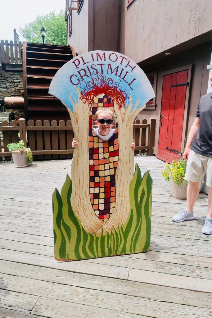
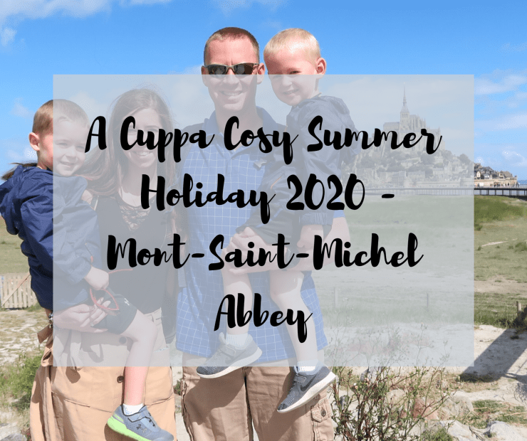
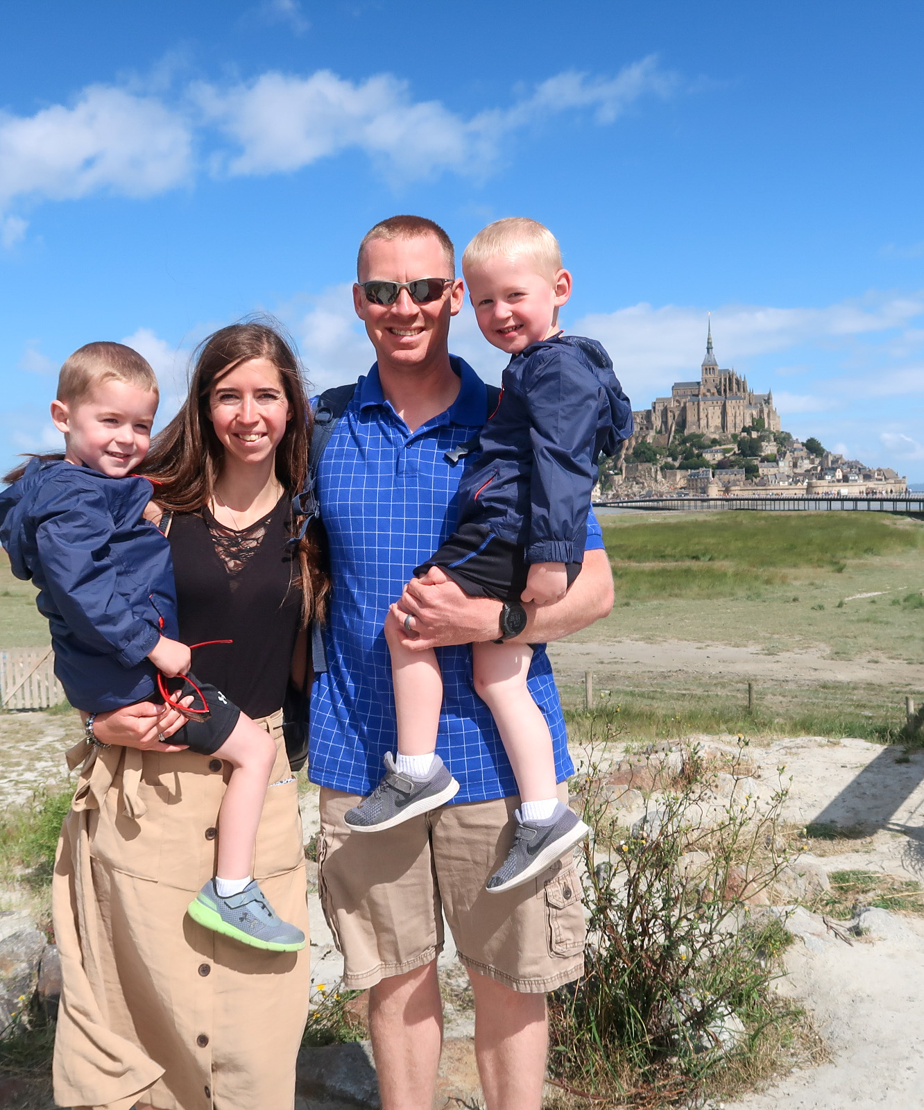
It is time for the second part of our few days in Boston (you can read the first part HERE). As much as I had thought that I wouldn’t write too much about the history, I found myself getting swept away in it all. So, here we are, a second post. Todays post is going to be all about The Freedom Trail located within Boston. We split the Freedom Trail into two days, doing half each day, but it is completely feasible to do it in one day if you’d like. I always appreciate when a city puts something like this together (and trust them when they do) as they usually have the best directions to hit everything you want to see- Luxembourg City did this very well too.

The Freedom Trail is a highlight of a trip to Boston as it is a 2.5 mile red line that wanders through the city, taking you to all the important spots in Boston history. Dating back to 1950, it allows you to view museums, meeting houses, churches, and other buildings that hold a special significance to the city. Anything from churches and cemeteries (with Samuel Adams, Paul Revere, and others gravesites) to a plaque on the side of a building signifying the first book store, The Freedom Trail will give you a little bit of everything. The tour (or at least the direction we went with) starts you off in Boston Commons. 

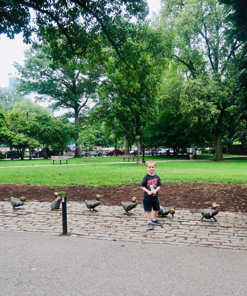
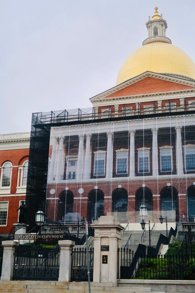
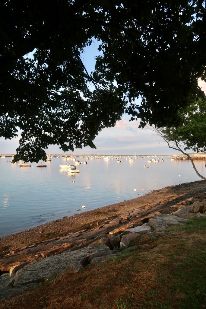
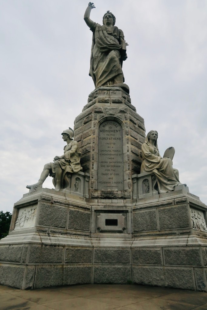
Boston Common is America’s oldest public park, dating back to 1634. The Puritans purchased the grounds from William Blackstone, it was originally used as a common grazing land for local livestock. It also became a spot for public punishments (featuring everything from stocks and pillory for theft to the hanging of witches and others). During the Revolution it served as a training and camp ground for the British. Today it serves as a public park (the smaller park across the street is where you can find the famous ducks) and a place for rallies and marches, as well as live music and festivals. Towards the end of the park there is a monument to Robert Gould Shaw and the 54th Regiment. This memorial honors and commemorates the first all-Black volunteer regiment during the Civil War. Most of them died during an assault in South Carolina, but they are forever memorialized here.** You also get a glimpse of the Massachusetts State House as you exit the Common. This has been the home of the state government since it was opened in 1798. 

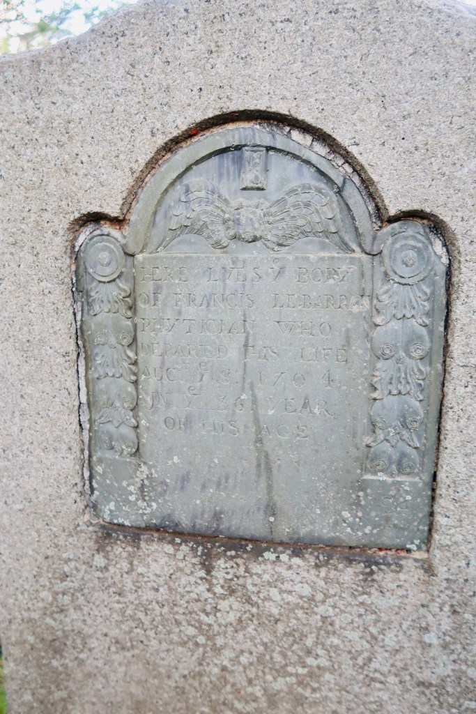
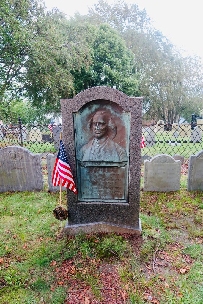
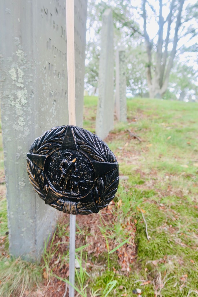
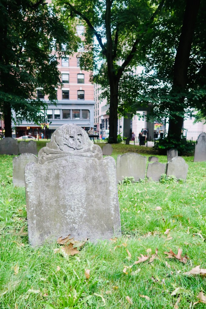
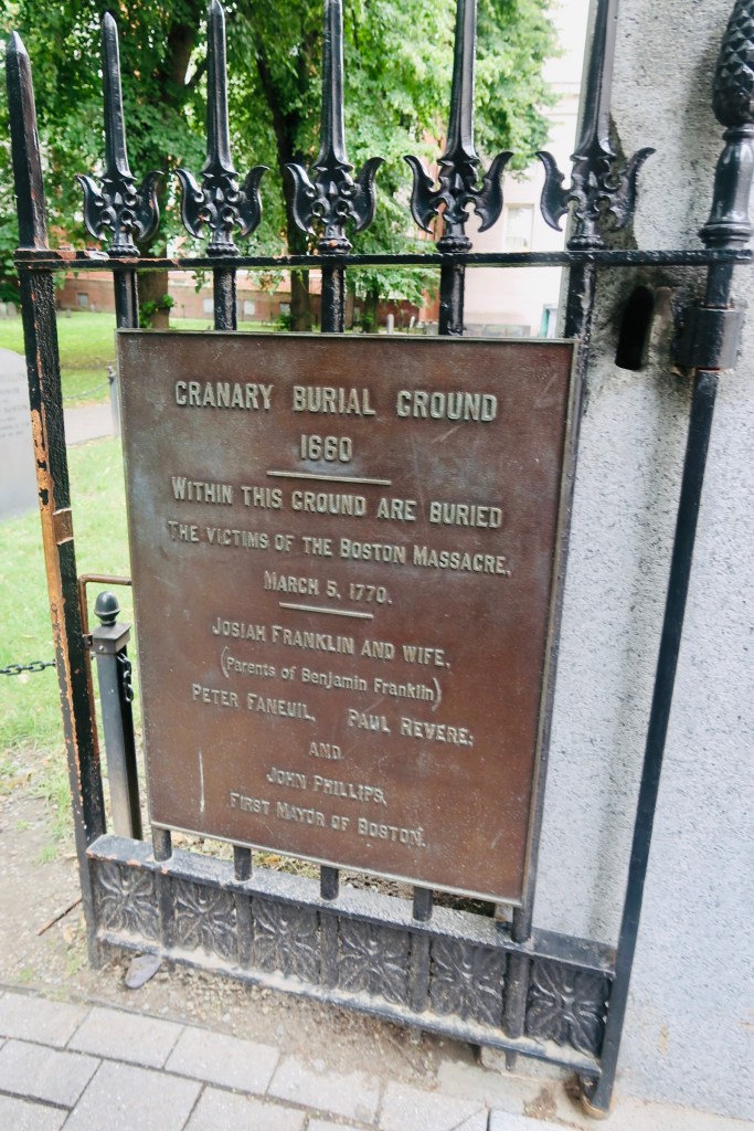
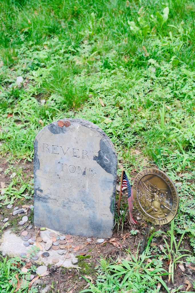
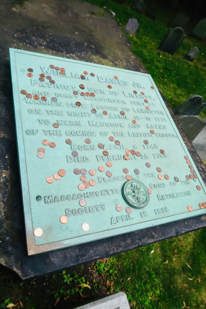
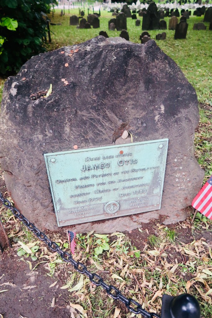
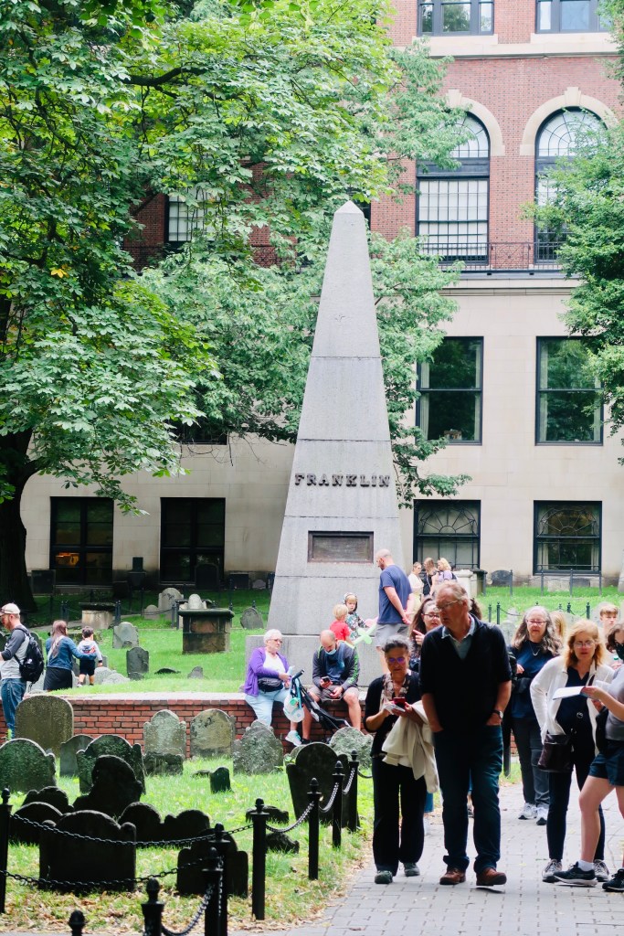
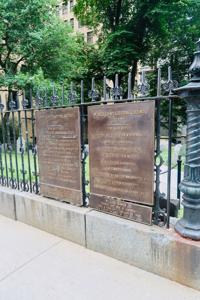
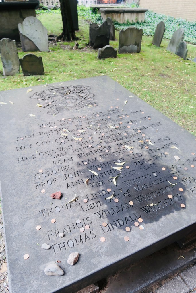
The next stop on The Freedom Trail that we made was to the Park Street Church and Granary Burying Ground. The church dates to the early 1800’s, but the burying ground is the real attraction at this stop. This cemetery is the final resting place for some of the key players of the founding and fighting for the colonies of America. This is the final resting place for around 5,000 of Boston’s own, though there are only markers and knowledge of 2,300. Notably buried here are Benjamin Franklin, Paul Revere, John Hancock, Samuel Adams, and a memorial for those massacred at the Boston Massacre. On these headstones you won’t find religious markers, rather these motifs of skulls with wings (to symbolize flying to heaven). Keep an eye out for grave markers- similar to those in Plymouth, there are metal markers signifying when the person participated in a momentous occasion, such as the Boston Tea Party. You are also able to go to another church and burying ground- the oldest in the city. We didn’t end up going in the church, but we did have a peak at the cemetery. Similar to Granary, this boasts several “big names”, the first woman off the Mayflower, Mary Chilton, William Dawes Jr, messenger sent to warn that the British were coming, as well as many others. 

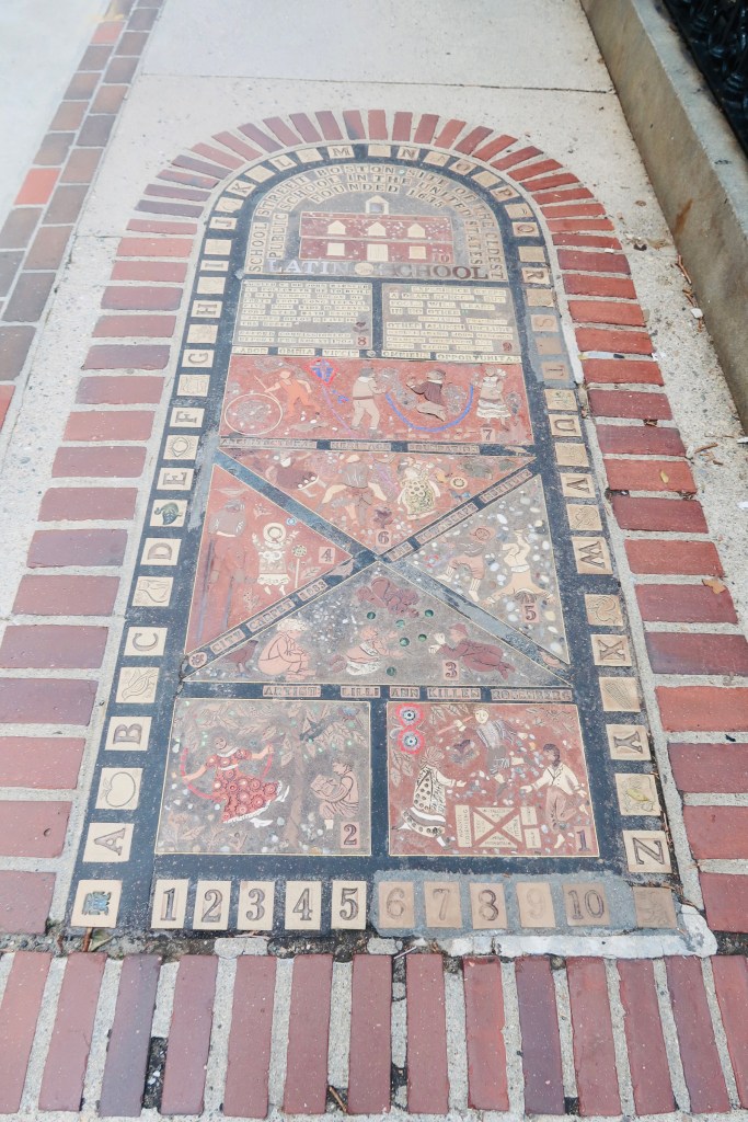
The next few stops on the trail are “bunched” together in that you have the first public school of America (which boasts educating 5 of the signers of the Declaration of Independence), a statue of Benjamin Franklin (who actually dropped out of the school just mentioned), and the Old Corner Bookstore, which is the oldest commercial building in the city (it’s now a Chipotle). 

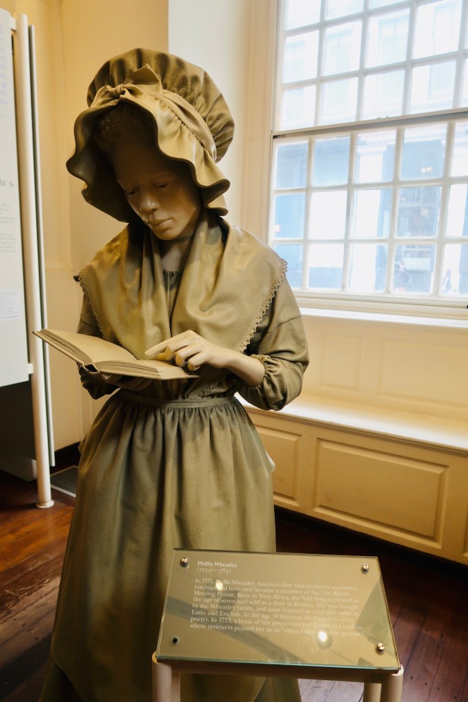
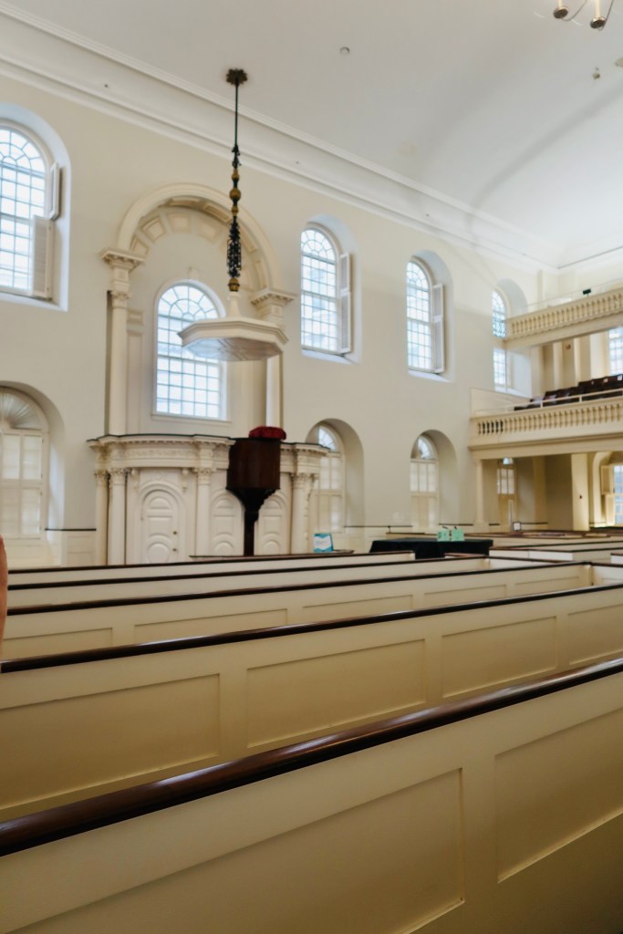
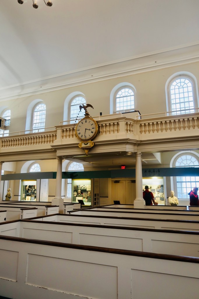
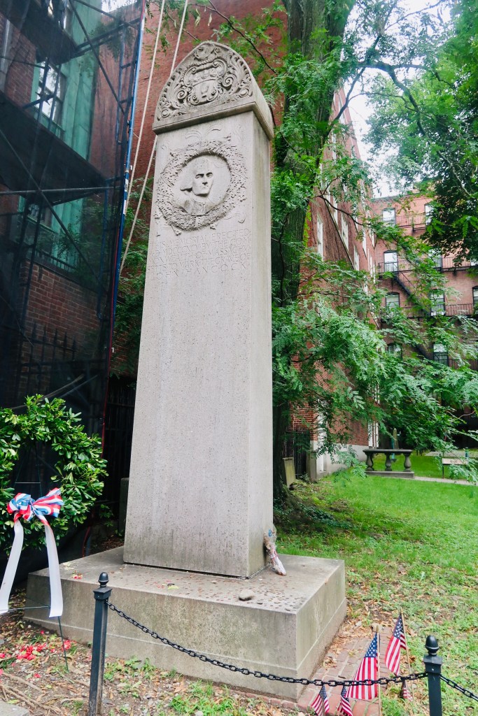
From there we headed over to the Old South Meeting House (this deviates slightly from the trail, but as I said, we split this in half so there was some deviations here and there). The Old South Meeting House is “the room where it happened”. It was the center piece to debate, to sermons, to public meetings. The largest building in colonial Boston, this was originally built as a Puritan meeting house. The congregation boasted members such as Samuel Adams, William Otis, William Dawes, Benjamin Franklin, and Phillis Wheatley, the first women and enslaved women to publish a book. The building also served as THE site, where the Boston Tea Party was decided, with 5,000 men in attendance debating the tax and what to do about it.  It now is recognized as the first in what are now regular history conservation projects. But the road was not easy, the building was actually sold in the 1870’s and it took a group of 20 women to save the building from being demolished (which also makes it the first building to be saved due to historical significance- lots of history in just one building). It has been a museum since 1877 thanks to their efforts. 

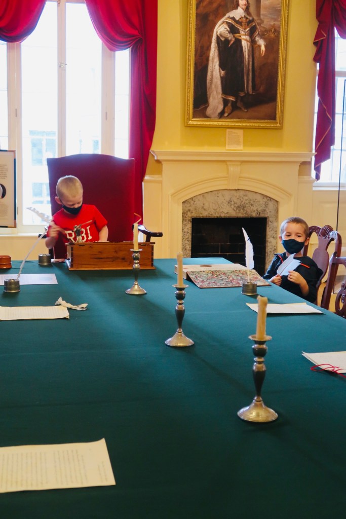
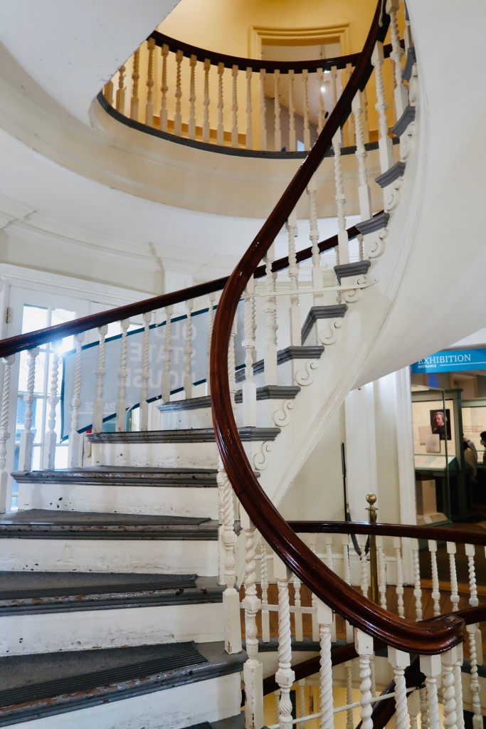
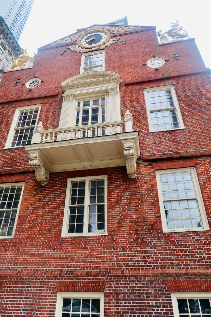
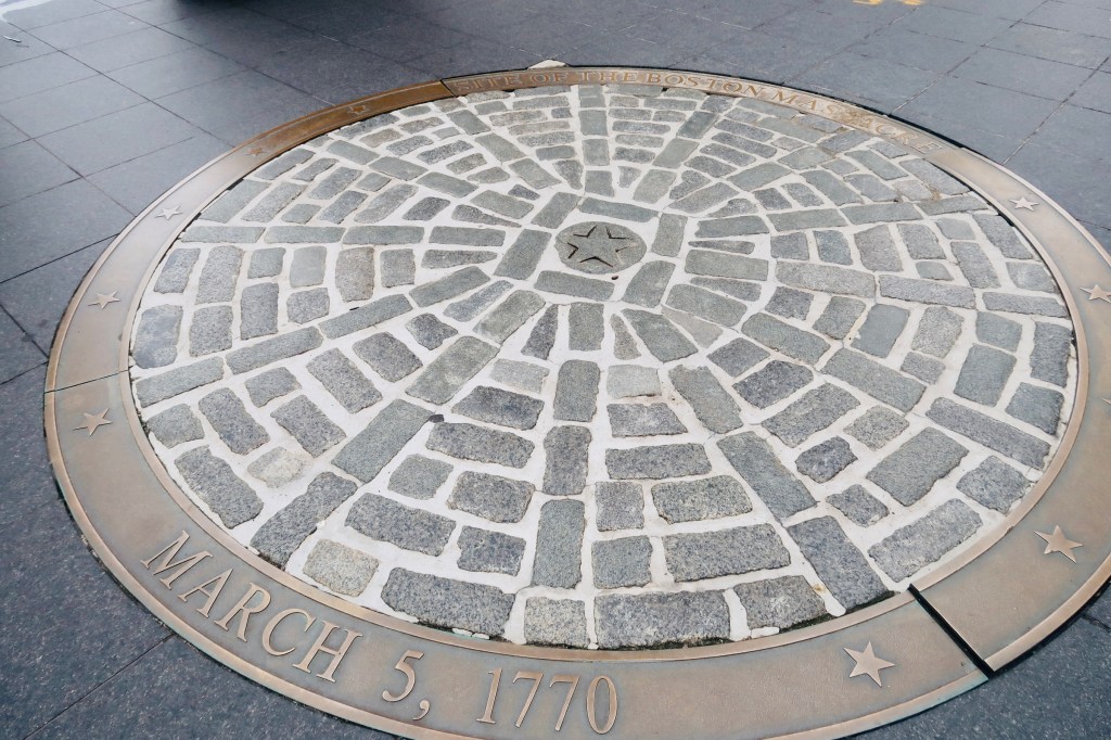
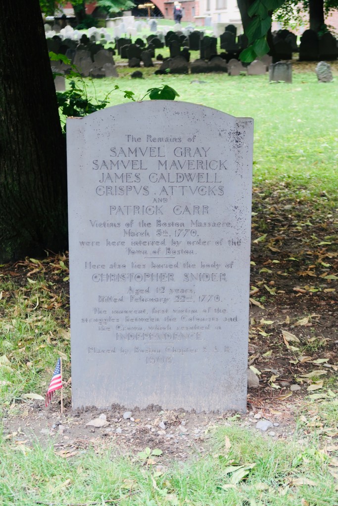
We made a last stop on our first day of the Freedom Trail over to the site of the Boston Massacre and the Old State House. The Old State House is the oldest surviving public building in the city, dating back to 1713. It now serves as a multi functional museum, documenting not only life in Boston, but the revolution, the Boston Massacre, and has a hands on second floor exhibit for kids to see what certain aspects of life were like. The boys especially loved this as they got to play “King” and “Governor” and dictate things. Right in front of the Old State House is a marker for the location of the Boston Massacre. Taking place on March 5, 1770 the Boston Massacre was a fight between the Redcoats and the people of Boston that ended with the death of 5 people. The tension between the two groups of people had finally boiled over and this tragedy became a turning point leading to the fight for independence. 

The next stops on the Freedom Trail are to Faneuil Hall/Quincy Market. I talked about Quincy Market in my previous Boston Post (HERE) and we didn’t actually get to properly go into Faneuil Hall during our time in Boston. Faneuil Hall served as a meeting place for public speech and commerce. You were able to protest, loudly, you could conduct various forms of business, you could swear an oath of allegiance. Basically it was a center of politics, conveniently located right next to the markets and commerce place. 

And that was the end of our first half of the Freedom Trail. I am noting this BECAUSE I feel like, if you want to split it into two days, that is a good place to split it. Most of the above attractions are within the same are of Boston, with convenient and easy walking distances. Then, the below would be the other half of The Freedom Trail. Again, you can do it in one day if you like (and public transport is actually decent if you need it), but this would also be a good stopping point for the day. 

**I also want to note, that there is an African American portion of The Freedom Trail. This trail takes you through the sections that the freed African Americans would have lived, their meeting house, the various monuments (including Phillis Wheatley) and other spots. You can find the trail right off of the Robert Gould Shaw Memorial at the end of the Boston Common. 

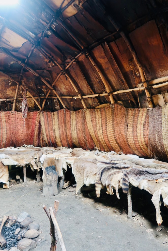
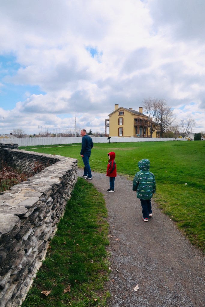
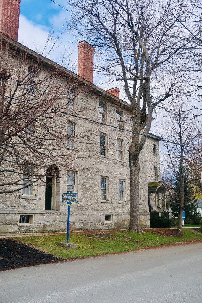
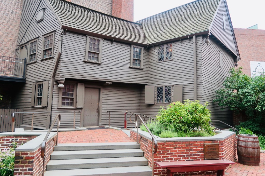
The second half of the Freedom Trail gets a little bit more into the battles of the city. Starting at Paul Revere’s home, you are able to get a good glimpse into how folks of his stature, in his time, would have lived. Built sometime near 1680, his home is the oldest remaining structure in downtown Boston. It is also the only “home” listed as part of the Freedom Trail. You are able to walk through the home, see the kitchen, the sleeping areas, AND see quite a few of the artifacts from his life. You can also see the famous Revere Bell (as we always seem to forget the Paul Revere actually was a craftsman by trade). THis is a quick but easy stop to make and a great way to start off a second day of the trail. 

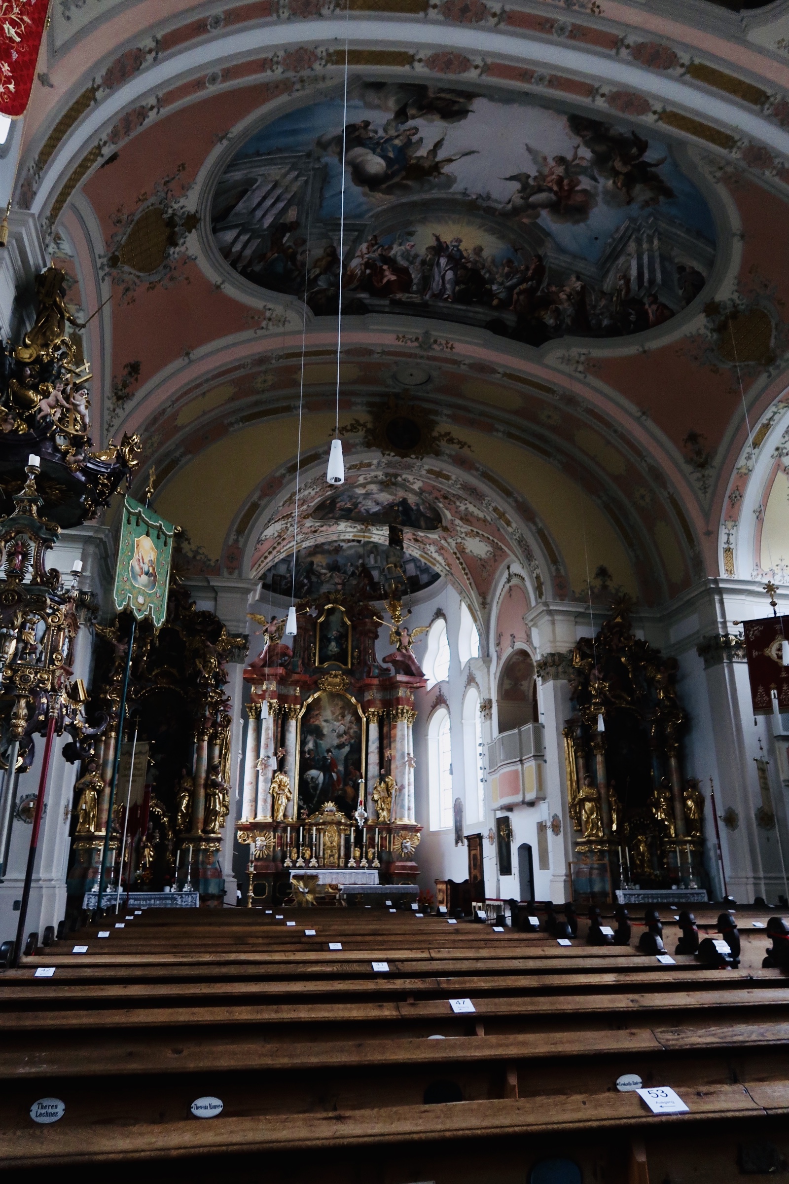
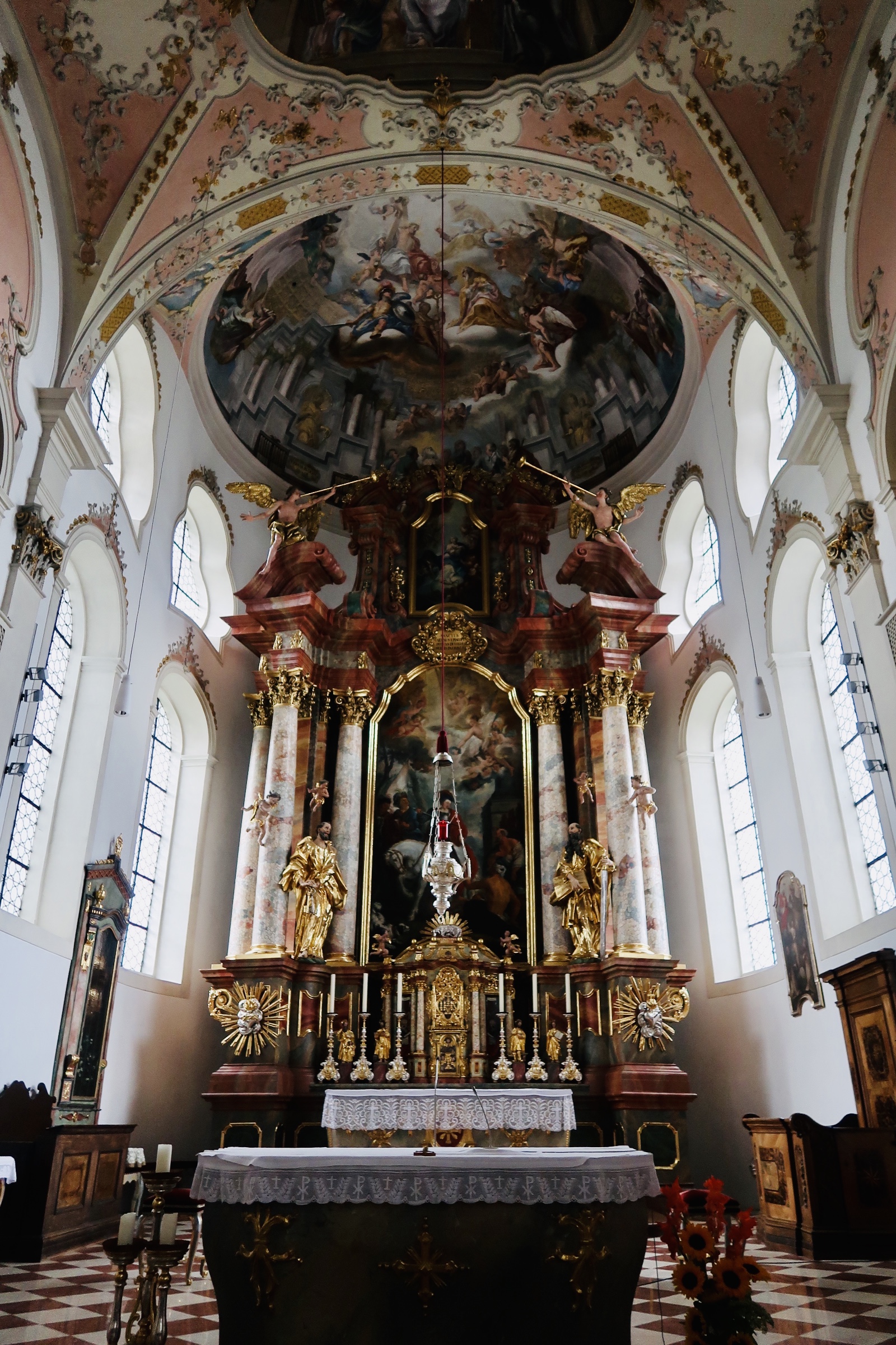
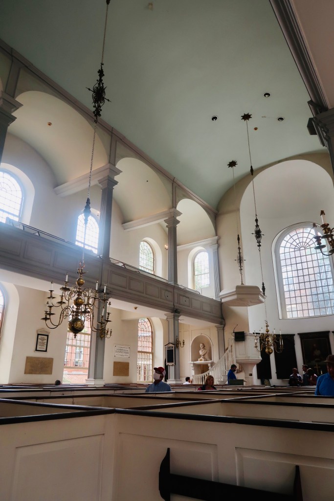
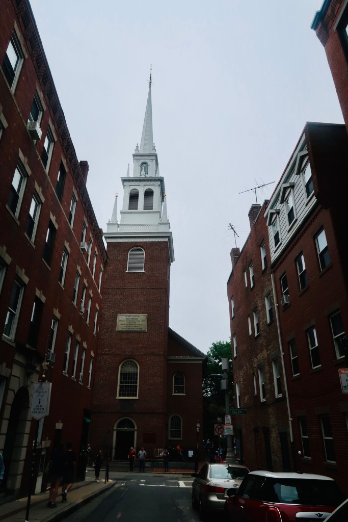
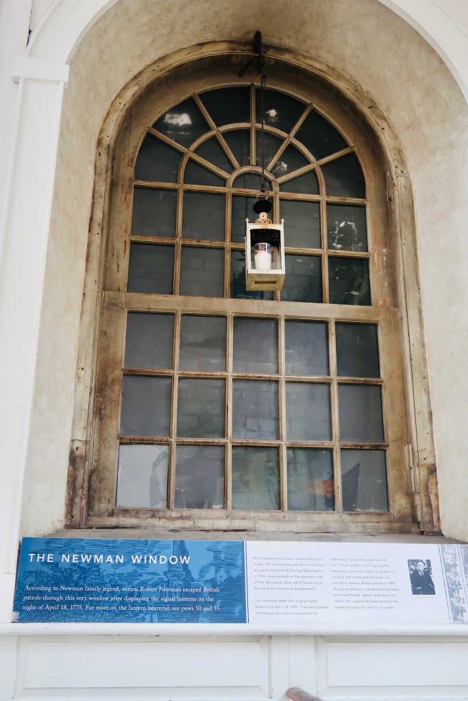
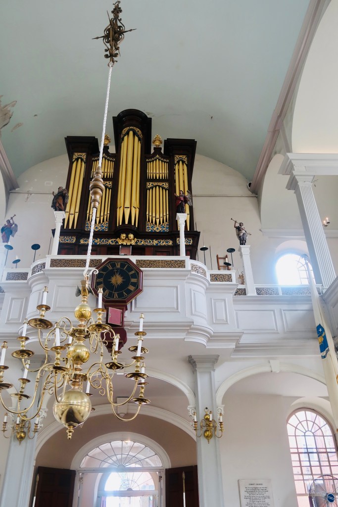
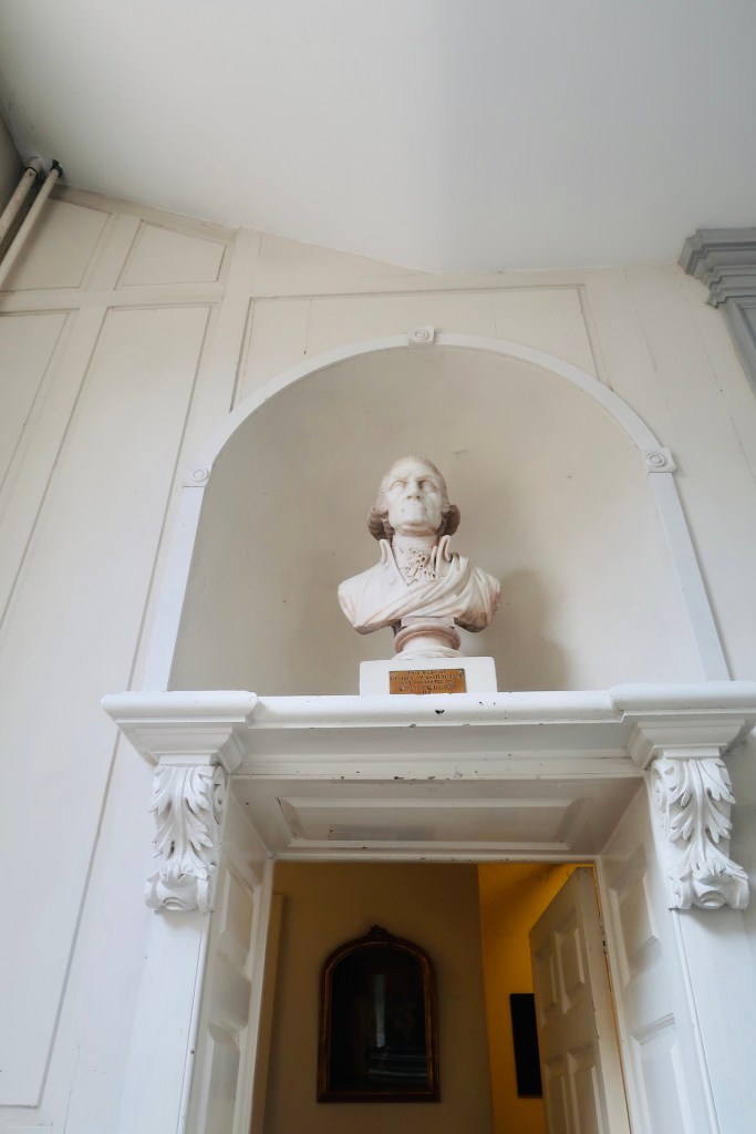
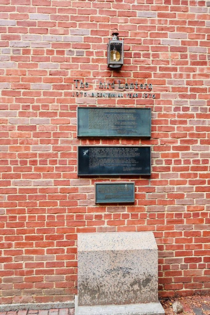
From the house, you then head over to your third and final church The North Church. This church plays an important role (maybe even more important than the other two) as it was THE church that the light was put up in to signal the midnight ride. Dating back to 1723, inside the church you are actually able to see one of the lanterns that was placed in the window for the ride. You are also able to see the bust of George Washington that Lafayette said was the best representation of him. Right around the corner from the church is Copp’s Hill Burying Ground. This was, by and large, the burying site of many of the craftsmen and merchants that lived on the North side of Boston. A couple notable people buried are two of the ministers involved in the Salem Witch Trials, the founder of the Black Freemasonry, as well as the man who hung the lanterns on the night of Pau Revere’s ride, and a builder of the USS Constitution. This particular burying ground was also a marker for the British to aim at during the Battle of Bunker Hill (which we ARE getting to, I promise). 

Speaking of, the next stops that you can make are entirely up to you. You can either go up to Bunker Hill at this point (which is what we did), OR you can go down to the USS Constitution. We chose to go up first, then back down, and at the end we took the Ferry back to the “main” part of Boston. It is entirely up to you how you want to walk this part. 

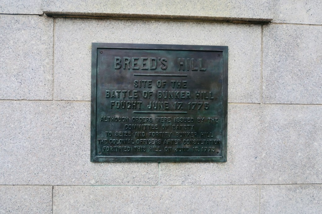
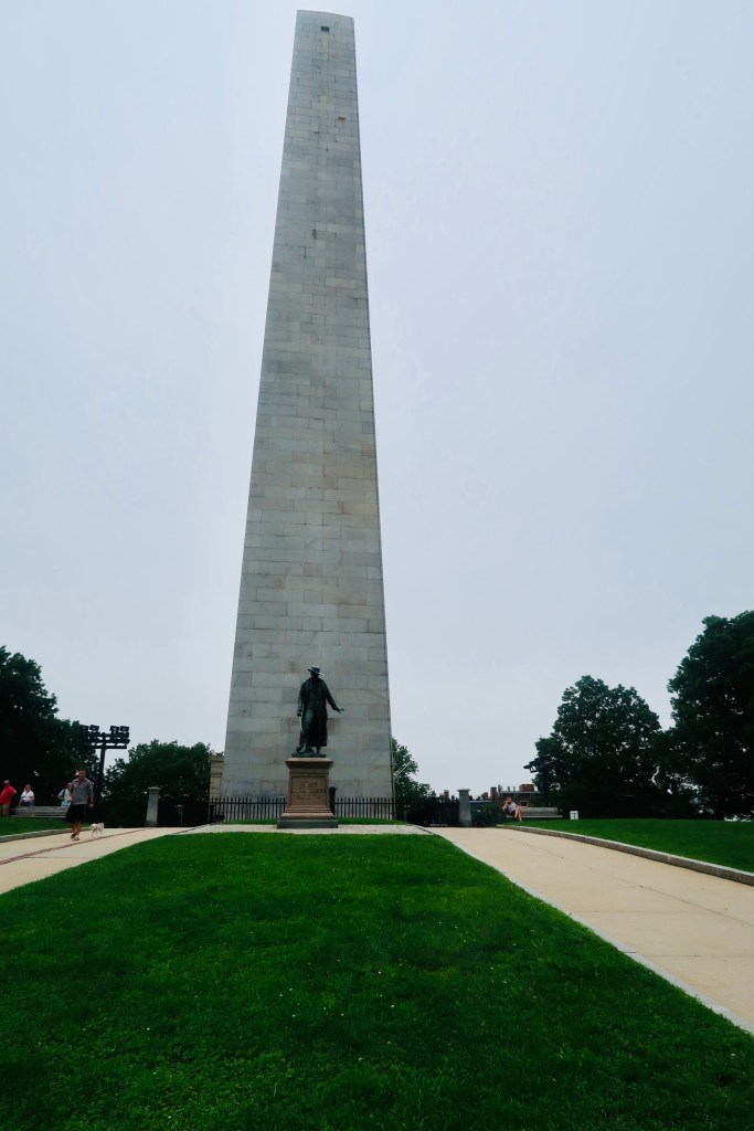
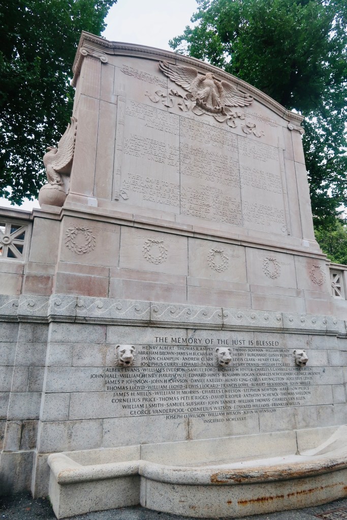
The Battle of Bunker Hill was the first battle of the Revolutions, and while the British technically won (after three assaults) it did prove that the colonists were not going to go down without a fight. The order of “Don’t fire until you see the whites of their eyes” is believed to have originated in this very battle. The monument was started with the laying of the first stone by Lafayette (excuse me, The Marquis De Lafayette) in 1825. It was completed in 1842. 

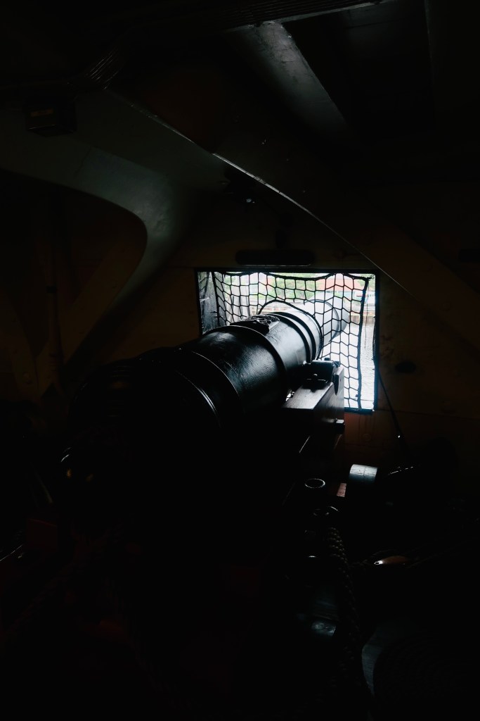
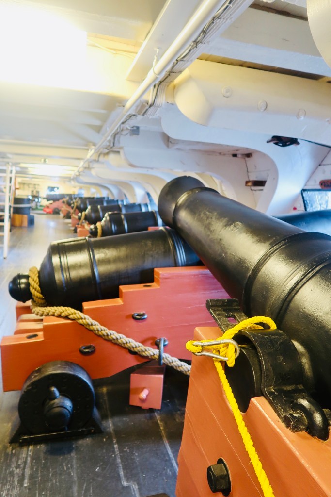
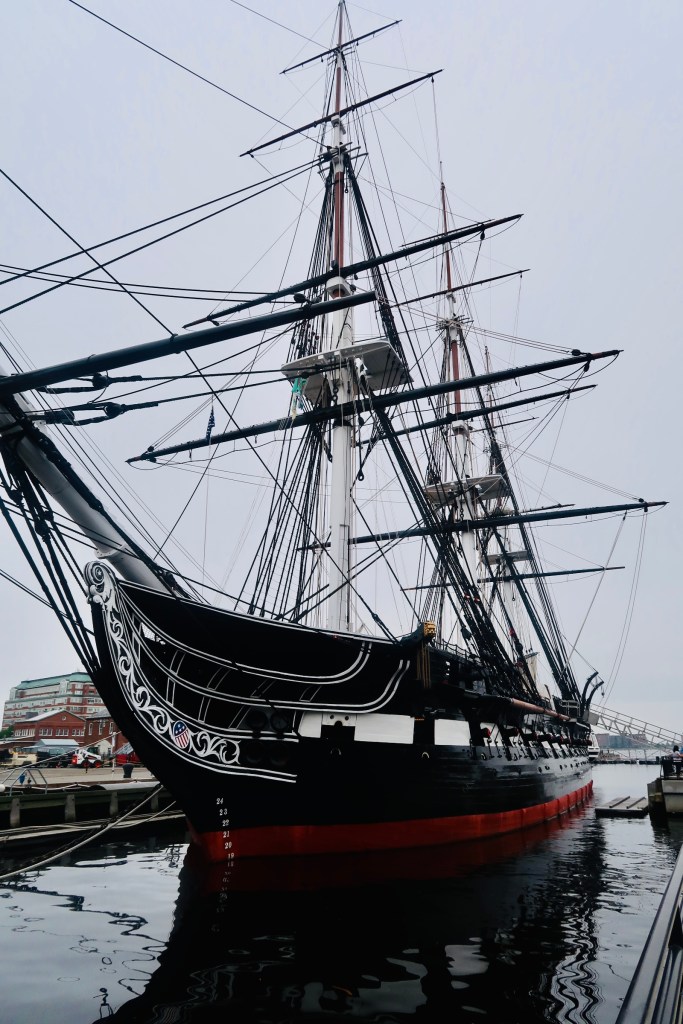
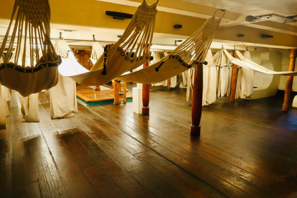
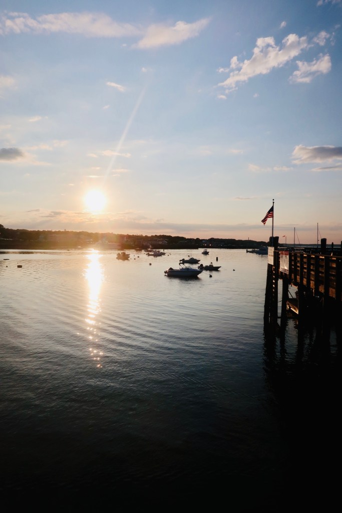
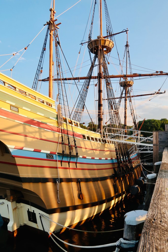
The final stop (for us) on the trail was at the USS Constitution (and then the USS Cassin Young DD 793). The USS Constitution is the oldest, still afloat, commissioned warship. It was launched in 1797 as a three-masted heavy frigate, one of six authorized by the Naval Act of 1794. The ship is known for the War of 1812 and the defeat of 5 British Warships and where the nickname of “Old Ironsides” was given. The Constitution was retired in 1881and was designated a museum ship in 1907. It is still a fully commissioned Navy ship and is manned by active duty Navy personnel on special duty assignment. 

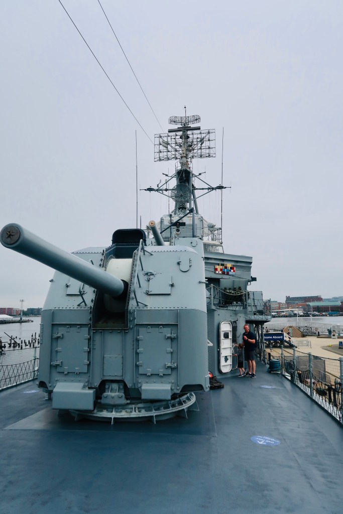
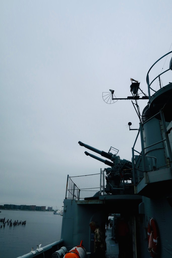
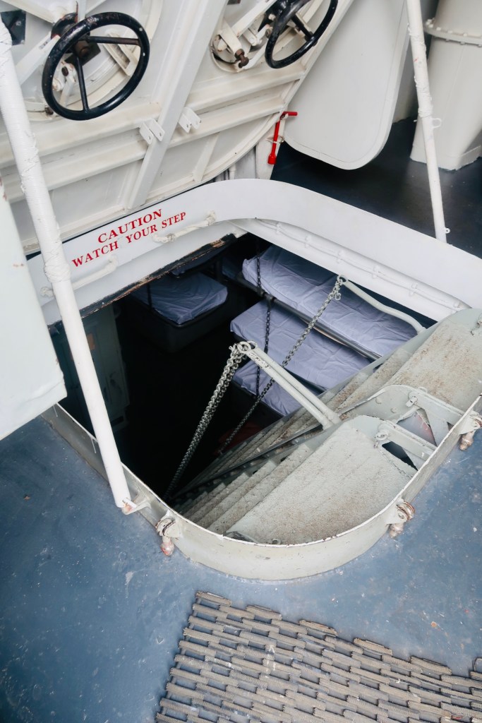
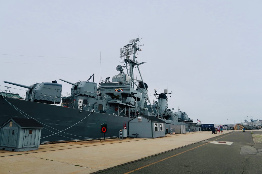
The USS Cassin Young is a destroyer from World War II. It was launched in 1943 and is only one of four of the Fletcher Class destroyers still afloat. The ship served in both World War II (where it was damaged in two kamikaze attacks) and the Korean War, being retired in 1960 and serving as a memorial ship ever since. The ship was intended to serve as an escort to the larger ships and defend them from attack. Unlike the USS Constitution, this ship has been permanently loaned to the National Park Service and it maintained and operated by them rather than The Navy. 

And that wrapped up our time in Boston! Boston was a definite highlight for our entire family. The boys loved the history, the boats, the endless exploring and my husband and I loved the pace of the city (and obviously the history). I don’t know that we’d ever be “city people” (most are just too crowded and busy for us), but Boston was such a nice surprise! 

A Cuppa Cosy Summer Holiday 2021 – Plymouth MA

It is time to talk about our annual summer holiday and travels! This year we decided to do a “USA history” tour of sorts, starting in Plymouth Massachusetts, then heading up to Boston, MA, a quick stop in Salem, MA and ending in Portland ME. Honestly, the trip was overall so relaxing and enjoyable. I don’t know if it was the amount of time in each stop, or if it was just the fact that the boys are older, we are more “travel experienced”, and that we haven’t traveled (thus the excitement is greater), whatever it was, this really worked for us. A quick overview of our trip, we did two nights in Plymouth, three in Boston, two in Portland. 

We arrived mid afternoon in Plymouth on our first day, prior to the check in time at our hotel, so we decided to just head over to a first stop. We started at Plimouth Patuxet. 

The Plimouth Patuxet or Plimouth Plantation (the original name) is what’s known as a living museum. Started in 1947 it features two central locations, plus the Mayflower II and the Grist Mill (in separate locations), one a replica of the village of Plymouth from 1627 with first person historical “actors” and the second is a replica of the Wampanoag village as it would have stood in the 17th century along with guides to help visitors understand life for them. It gives visitors an insight into not only what life would look like and be like, but a chance to learn about some of the people who would have lived in the Plymouth Colony.

Most of us know the history of America, the Colonies, etc., so I’m not going to focus too much on it, but I will say that there is a big difference between the colonies of Jamestown (the first) and Plymouth. Jamestown was founded by entrepreneurs who were seeking new land to develop, live and to expand fortunes. Plymouth was founded by a sect of Puritans (later as we all know as Pilgrims) who were fleeing religious persecution. They did not actually sale directly to the “America’s” though, they first went to The Netherlands to avoid the persecution. That didn’t end up working and they ended up making the journey towards the “America’s”. 

The Patuxet was really neat to walk through and I found it to actually be quite respectful to both the Wampanoag, the Patuxet, and the Colonists. The boys really appreciated the first person actors and being able to be involved in this living history (even though they truly couldn’t comprehend the entire grasp of it). 

We spent a couple hours at the Patuxet, then headed over to check in to our hotel. We stayed at the John Carver Inn for two reasons, one being its location right off the main street of town, and the other being the very cool pool that it offered. I will say, that while we loved the pool (which has a makeshift Plymouth rock holding the hot tub, and a slide within the “mayflower”), the hotel rooms were a bit dated. There isn’t anything wrong with that and we enjoyed our stay, just something to note. After checking in, we decided to just go venture out on the town.

Wandering along the main streets of downtown Plymouth offered a variety of breweries, small boutiques, and tourist shops. We ended up stopping at Tavern on the Wharf for dinner that first night, watching the sun light up the water as it started to set. From dinner, we continued to walk along the bay, watching the sun set slowly over the bay. Walking along the bay puts you right at the Plymouth Rock. This is when I would recommend seeing because a) you get to see the sunset on the water, and b) it tends to not be as crowded. 

So, Plymouth Rock. I want to start with the fact that there is no writing from the Pilgrims in regards to Plymouth Rock. It wasn’t recorded until ~1715 when it was used as part of the town boundaries and was simply a “great rock” and there wasn’t even a claim to it being the landing place until 1741 (~120 years later). Second, the rock itself (as it stands today) is quite small. It is not even the full size of the “original Plymouth Rock” due to its being moved around and pieces being taken, bought, and sold. Today it stands at about 1/3 of the size that it actually was. There is also a crack in the rock where it was broken in an attempt to place it in the town square, the two portions were put back together and the date was stamped in the 1770’s. So, it’s cool to see, but also a bit anticlimactic in a way. 

We finished out the evening with a  stop at Burial Hill, which was located right behind the John Carver Inn. Since there was still daylight (this cemetery sits much higher than the bay), we decided to take a little wander through the cemetery and see some of the oldest gravesites in our country (documented- there are much much older sites obviously from the indigenous peoples). Burial Hill was originally the site of the Pilgrims first meeting house and was first used as a burial spot in the 1620’s. There are Pilgrims and Mayflower passengers buried in the cemetery, as well as various revolutionaries and soldiers. Any person that has a history tied to a battle/war, the Mayflower, or the colonists has a medallion placed next to the grave marker (some of these still stand, some have been destroyed over time by the elements). 

The next morning we started out somewhat early, to get some breakfast from Munchies & Milkshakes. Robert had found this spot and read reviews about donuts and baked goodies, so we figured why not give it a try. I can tell you, it did not disappoint. We took our donuts to a bench overlooking the Mayflower II and the bay and had a lovely little picnic. Then it was off to tour the Mayflower II. 

As the same organization owns all three “Pilgrim”/Plymouth related attractions, you are able to purchase one ticket for all three locations, which is what we did. I can’t say that it was a cheaper option or a good bargain deal, but I can say that it was definitely easier when it came time to visit the other locations. We walked right into the Mayflower II and were able to get on the boat almost immediately. 

The Mayflower II is a reproduction of the original Mayflower. It was built in the 1950’s in partnership between an English builder and the Plimouth Patuxet. It was a partnership to honor the alliance between the United States and the United Kingdom during World War 2. Considered a generic reproduction with modern additions (like electric lights and a ladder) it sailed from Plymouth, Devon recreating the historical journey of the Pilgrims, landing at Plymouth Massachusetts after about 2 months. It has journeyed through various ports and cities on the East Coast both for tours and for restorations, but in 2020 it made a permanent return to Plymouth in honor of the 400th anniversary (lucky for us!). 

I do think that this is a very worthwhile attraction to see. Not only does it put the voyage in perspective and the conditions and turmoil that the Pilgrims faced during their voyage, but it also is neat to check out. The “crew” on board is a mixture of modern day guides and first person interpreters and you are able to see just about every area of the ship, including the mooring boat that they would have used to send expeditions from the ship to the mainland to find a settlement space. 

From the Mayflower II we walked the opposite direction (away from Plymouth rock and towards the shipyard area) to walk the riverfront. The town has a rocky area that you are able to walk a bit out into the bay waters and see the town from the water (in a way). Now, you are walking on rocks that have been piled up and around coming out of the water to form a walkway. It’s not a “sidewalk” or anything of that nature, just a man made path. We walked about halfway out and decided to turn back (as it’s just an outcropping to see the view). 

At that point in the day we were reaching the peak of the sun and heat, so we decided to head back to the hotel and spend a bit of time at the pool. This is something we don’t often do, but we had partly booked this hotel for the pool, so we figured we should take advantage of it. It was a lot of fun and allowed some of that sun and heat to pass over us. 

After a brief lull, we headed back out, this time to the Plymouth Grist Mill. This Grist Mill is a working mill recreated on the site (and similar to) the Jenney Grist Mill, which was one of the first operating mills from the Pilgrims in Plymouth (built and operated by John Jenney who came over on the Little James in 1623). The Mill was originally built in 1636 and remained in operation, though passing through different hands as owners passed away or sold, until it burned down in 1840’s. The property stood as it was until the town went through some re devolopment and mill was rebuilt/reproduced in 1969. It is a fully functioning mill processing what, rye, barley, and corn (which is ground on the primary millstones). You are able to watch the mill at work if it is the time of year for it to run, otherwise you are able to tour the mill and the workers will show you how everything operates. A Very kind tour guide turned on the outside portion for the boys to watch. 

I will say, this was another neat stop to make, BUT if you can’t fit it in or you are wondering which of the three attractions you don’t need to visit- this can be cut from your itinerary. It’s a short visit (which worked out really well for us), but I wouldn’t say it provided much “first hand” insight. Cool to see, but not necessary.

The final stop we made in Plymouth was the National Monument to the Forefathers. Originally known as the Pilgrim Monument, this is thought to be the worlds largest solid granite monument standing at 81 feet tall. It is dedicated to and commemorates the Mayflower Pilgrims and their ideals. The idea dates back to 1820, but the cornerstone was not laid until 1859 (after plans started almost 10 years earlier). It opened in 1889 and features a total of 5 figures. The top one is known as “Faith”, with the four buttresses featuring “Morality”, “Law”, “Education”, and “Liberty”. These are then broken down further on each buttress to give more ideals for each overarching concept. The front and rear panels both have quotes engraved, with the side panels containing the names of those on the original Mayflower. 

We wandered from the monument, which is tucked up on a hill back in a neighborhood, back down to the main street and stopped for dinner at the Waterfront Bar & Grill before heading back to the hotel to pack and leave the next morning. 

And that wraps up the first stop in our 2021 Summer Holiday. I will say, I’ve only ever been mildly interested in the Pilgrims tale (more so in a respectful manner of history), so while this was a cool spot and town was pretty, this wasn’t a highlight for me. It also wasn’t for the kids (minus the pool), but that’s because they much preferred the next stop on our destination…

A Stone’s Throw – 2 Day Trips

Sackets Harbor

Sackets Harbor was our first day trip and our first little exploration after moving to upstate NY. It’s a small bay town that sits on an inlet of Lake Ontario. Founded in the early 1800’s, it’s been on the list of Historic Places since the 1980’s for its well-preserved buildings and historic district. Aside from views, it’s most known for its support during the War of 1812. The Navy used Sackets Harbor as a major shipyard and turned the quiet little town into a major city, the third largest populated in the state at the time. Shortly after the war a selection of local businessman helped support the building of the first US Steamboat, Ontario. 

In Sackets Harbor you are able to walk the battlefields from the War of 1812 that take you alongside the lake as well as through the town (depending on which route you take). You can, when open for the season, walk through the various buildings that talk about life at the time. You can also walk-through Main Street and feel that old small-town vibe, popping into various little shops or cafés as your day goes on. 

We walked through a portion of the battlefield (we have plans to go back and bike ride the entire path), walked through a bit of the harbor, and then along Main St. We stopped in to the Junk in you Trunk antique store, which was one of the coolest little spots we’ve stumbled upon. They had everything from modern to antique, local businesses, and nationally sourced small business. We also stopped in Tea Thyme; a small tea shop that made all my tea loving dreams come true. I picked up a couple samples to try out. Overall, I think it would be one of those spots where you can easily spend a Spring day.

Wellesley Island (Thousand Islands)

Original called Wells Island (renamed Wellesley to honor the 1st Duke of Wellington in 1815), Wellesley Island is located partially in Canada and partially in America. It is one of the largest of the Thousand Islands, it is home to not only a thriving community, but also two State Parks, a nature center, and several golf courses. 

We spent a day visiting a section of the Wellesley Island State Park. This State park in particular offers a life guarded beach, nature center (with the cutest little chipmunk), hiking, hunting, fishing, snow shoeing/cross country skiing, boating and a marina, as well as a variety of camping spots and options (everything from primitive to cabins to rv’s). We hiked from the Nature Center over to Eel Bay, through the Narrows, and an inter trail or two through the woods. It was seriously one of the prettiest spots, reminding me so much of Eibsee and Konigsee in Germany. We stopped for a snack on one of the rocky inlets, resting, watching wildlife, and enjoying the sun and water. 

We did also walk briefly through the nature center, where they have educational materials about the different wildlife located on and around the island, as well as a little chipmunk that was attacked by a dog. 

I can foresee this being one of those spots that we return again and again, hiking different trails and doing a little boating and camping. We drove around a little after our visit to look at the different amenities and were very impressed by the sheer variety of options. It’s an incredibly family friendly area, however someone without kids would enjoy it just as much. Both of these day trips are within a “stone’s throw” and make us very excited to be able to explore more or our area. We seem to have a good combination of historical small towns and nature trails, which, in all honesty, is our happy spot of living locations. We are very excited by all of the hike and outdoor activities that are around and, with the weather starting to shift, we are looking forward to getting some more h

Auschwitz I & Auschwitz II-Birkenau Concentration Camps

***Disclaimer at the beginning of this post , there may be content in here that is painful to view . Please be cautioned***

We recently spent a morning visiting Auschwitz I and Auschwitz II-Birkenau in Poland. This was our third concentration camp (fourth overall site as we also visited Lidice), we had done Dachau Concentration Camp and Kaufering VII, a Dachau subcamp. Visiting Auschwitz was different from the first due to its history and the information we learned after the liberation. Similar to my previous Concentration Camp posts, I don’t truly have the words for what this experience was like. There is nothing to truly do it justice, so instead of writing a whole bunch of words that will not come close, I am going to let the pictures tell the story. Maybe I’ll share my personal thoughts/experiences/tips in a later post. 

A quick note on our visit before anything else. We went early Sunday morning (an 8:30AM tour time) and took a guided tour. While I would recommend visiting in the early hours, as it is emptier and quieter, whether you take a tour or not is completely your choice. As someone who is Jewish, was raised in the faith and still maintains the faith (to an extent and for another post entirely), I am incredibly familiar with The Holocaust and the concentration camp history. My husband is familiar with the history as well. I don’t know that I learned any new information, BUT the guide helped put things into perspective and really walked you through the barracks and locations. The tour guides (at least ours) do not mince words. Everything is in exacting detail, which can be something to take note of. We did take our boys (aged 4 &3) and they were incredibly respectful throughout our entire visit (I don’t know that I am really going to talk about this decision- to each their own in this instance). 

If you do choose to visit, please note that the two camps are not truly within walking distance of each other. Auschwitz I does have a bus that runs between the camps OR you can drive. If you take a tour, you will start at Auschwitz I and then take the bus over to Auschwitz II-Birkenau to continue. Both are necessary to visit. 

I’m going to start with some brief history of the camps before I get into the photos. This will brief, if you are wanting a full breakdown, I would suggest any of the many books and survivors’ experiences (I find that a combination of both will be best). You can also see the Auschwitz website here for an introduction, however I would highly encourage you to do some reading in addition. It will allow you to get a true feeling for the time, the life, the camp. 

Auschwitz was established in 1940 (the first transport to arrive was actually mid Jan 1940) in the suburbs of a small city called Oswiecim. This city was annexed to the Nazi’s (The Third Reich) and later the residents and city was relocated as a way to hide what was happening within the camp. The original reason the camp was created was to house the Polish prisoners who were being arrested in large numbers. It was initially intended to simply serve a similar purpose to those the Nazi’s had already been setting up since the 1930’s (such as Dachau). True to its’ initial plan, Auschwitz did remain in this function of prison camp, even with the addition of the extermination centers. Auschwitz is actually 3 different camps. Auschwitz I was the “main camp” and held around 15,000-20,000 prisoners. The second was Birkenau, later known as Auschwitz II-Birkenau, which was the largest part of the complex and the main center of the Jewish population of the area, as well as the main extermination camp. The Nazi’s built up this second camp in 1941 (and this was when the residents were relocated) and, in 1944, it held over 90,000 prisoners.  The final camp was created from the largest sub camp (of which there were 40), Buna with 10,000 prisoners. It opened in 1942 and is not able to be visited (I believe it no longer exists).

In total, 1.3 million were sent to Auschwitz (across the board), within 1.1 million of those people dying. While the majority of the deaths were Jews (of the 960,000 that died, 865,000 died upon arrival), there were also Poles (non-Jewish), Roma, Soviet POW’s, and others. If the prisoners were not sent to the gas chambers, they died of starvation, disease, medical experiments, or from many other causes to include individual executions. The camp was liberated January 27, 1945, a day now commemorated as International Holocaust Remembrance Day, by the Soviet Red Army.  Auschwitz has become a symbol of the Holocaust and all of its atrocities and the location was named an UNESCO World Heritage Site in 1979. 

Most people know about Auschwitz and Dachau (and Treblinka or Bergen-Belson or some of the other known, but smaller camps). As I said with visiting Dachau, it is one thing to read/hear/talk about these places and the atrocities that occurred, but it is something wholly different to walk them. To walk these paths. To see the tons of shoes, or suitcases, or hair (so much hair) taken from the victims. To walk from the rail car to the chambers. To feel the weight of those who came and died before you. I am not going to mince words; you don’t need words. You need images. So, I’ll be giving you the general gist at the start of pictures (and you can hopefully see the captions under the pictures to tell you what’s what), but nothing more than that. 

***PLEASE NOTE THERE WILL BE IMAGES THAT ARE DISTURBING TO VIEW. PLEASE BE CAUTIONED***

So, as I’ve already mentioned, we started our tour at Auschwitz I. It’s important to note that this particular camp was for polish prisoners, military/command barracks, and was used for Nazi propaganda. This is not a camp that the Jews or…well anyone who wasn’t a polish prisoner, or a consumer of the propaganda would see. 

Within Auschwitz I there are displays set up to show not only how certain aspects of the camp were run, but also in memorial of the victims who were murdered. 

You are also able to walk through the gas chamber and crematorium of Auschwitz I. These were not the main locations of the mass extermination, just temporary. These are the only chambers and crematoria that you are able to see as the Nazi’s destroyed the main complexes. 

From Auschwitz I, we headed over to Auschwitz II-Birkenau. This was the main camp for the Jews, Roma, and anyone deemed “undesirable”. This was where they were brought (again, they didn’t see Auschwitz I, just this). Those that lived through transport were then selected for either the gas chambers, hard labor, or medical experiments.

The two main gas chamber and crematoria complexes were exploded by the Nazi’s as they attempted to hide these atrocities, but the remains are here (and you are able to see how they were operated above).  

Finally, at Auschwitz II-Birkenau we were able to walk into one of the barracks that would have been used during the camps operation.

The one that we walked in was actually used for isolation of women prisoners who were selected as unfit and were to be sent to the gas chambers. If this barrack was full, they would be placed in the yard and the gate was locked until they were taken to the gas chambers. 

“For the dead and the living, we must bear witness” – Elie Wiesel

Interlaken-Oberhasli District, Switzerland – A Long Weekend

We recently just spent a long weekend in Switzerland. Ok, I need a moment already, just from typing those words. Never in my wildest dreams did I think I would utter that sentence. Never. 

Ok, shock over. We recently spent a long weekend in Switzerland, and it was glorious. Where do I even begin? My husband’s only requirements for the trip was to be able to see/be at the top of the Alps, so we picked a spot right near Interlaken, in the heart of the mountains and lakes. With COVID-19 restrictions we were restricted from traveling to some of the major cities, and we wanted to be a bit…off the way. When a local friend posted about a hotel she stayed at right on Lake Brienz, I knew that was where we needed to be. 

One little, teensy, note to make about Switzerland before we get into the meat of this post. If you know anything or have heard anything about Switzerland it is that it is an expensive place to visit. This is not an exaggeration. You will need to plan accordingly for this visit and budget if you need. There are certainly ways to make it a “cheaper” trip, but it will never be inexpensive. For us, I knew that this was going to up towards the more expensive trips we took on our time here and I was 100% ok with that. It was more important to me that we did what we wanted to do and enjoyed our time without worrying about the cost necessarily. With that being said, there were a couple of things that we DID NOT do, which I will get into later. 

Before we got to Switzerland though, we made a stop at KZ-Lager Kaufering VII. This is a European Holocaust Memorial in Landsberg Germany and is the largest remote area (sub camp) of Dachau Concentration Camp. There was a total of 11 of these sub camps of Dachau and this one has the actual remains of the tube style barracks. In total these camps saw 30,000 prisoners, with at least 14,500 prisoners dying over the time the camp was open. Exact numbers are not known as the records do not match up (one study found upwards of 44,000+). The camps were intended to put prisoners to work on an armament project, without any consideration by the guards for the health and safety of the prisoners. During the war crimes investigation, it was discovered that these sub camps were the worst in Bavaria and the prisoners came to refer to them as “cold crematorias”.     

We were not able to walk inside the camp and see the buildings and cemetery up close, but you could still get a feel from outside the fence. This is the second concentration camp we’ve been to (Dachau Concentration Camp being the first and hopefully a visit to Auschwitz soon) and I will never be able to fully verbalize the experience. So, once again, I will let pictures say what I cannot. 

After that, we headed off on our Switzerland Adventure. We stayed at the Hotel Seiler au Lac. Not only is the hotel itself incredible (you can request a lake front room, all of which have balconies looking right out to the water- swoon), but the staff were incredibly helpful and went above and beyond our needs. We opted to have breakfast at the hotel (included), which was handled excellently with COVID restrictions. We did also opt to have dinner at the hotel restaurants (one night at each- two restaurants attached to the hotel), and both meals were delicious. This particular hotel is located in Bonigen, Switzerland, a quick distance away from Interlaken (you can walk or take a bus- passes were offered by the hotel), and only a 20-30 minute drive to either Lauterbrunnen or Grindelwald (Berne is about 45 minutes away if you want to go there as well). 

Our first evening was mostly spent wandering around Lake Brienz before settling into our hotel and grabbing dinner at the Pizzeria attached to the hotel. 

We set off late the next morning to head into Interlaken. 

Here is where I am going to clarify some of our choices in activities. There are a couple of things that I base “what we do” on, the biggest factor being the weather. It was a wet and rainy morning in our area of Switzerland, so we knew going to Jungfraujoch (the top of Europe- aka the highest point of Europe) was going to be hit or miss. The second factor, less so than weather, is cost. This is really only specific to Switzerland as things are, generally, more expensive in the country. We made the decision to pass on heading up to Jungfraujoch as the potential for bad weather combined with the cost was not worth it for us. Instead we chose to top some of the smaller peaks, and this was just as incredible as anywhere else we could have stopped. 

So, back to our day. Chances are, if you’ve tried to take a train or summit one (read: many) of the Swiss Alp peaks, then you’ve gone through Interlaken. Not only is Interlaken the central city between Lake Brienz and Lake Thun, but it is also a main transport gateway to the Alps in the region. You’ve got the two lakes, then the River Aare which flows between them (and therefore between the city). There has been a city in this location since the 12th century, but it was originally known as Aarmuhle (changed to Interlaken in 1891). It started out as the home of a convent and monastery, but as it continued to grow, it became a large city. It started to become known as a resort town in the early 19th century, with a railway opening in the 1870’s (and more following in the next 20-30 years). 

We spent most of the rainy morning walking throughout the town seeing all the beauty that is offered in the valley. I think one of the best things to do sometimes is to just walk around the streets. We didn’t have any “set ideas” of spots to see until the weather cleared, so we just walked. We stopped in for a light lunch and during that, the weather started to clear out. Faced with breathtaking blue skies, snowcapped peaks, and a new look at Interlaken, we decided to head up to Harder Kulm. 

Harder Kulm is the top of Interlaken. Rising 1,322 meters above Sea Level you are able to get an incredible view of Interlaken, the peaks around the city (opposite), as well as the two lakes, Brienz and Thun. There is a viewing platform that you can stand on for a truly breathtaking experience. You don’t even have to worry about hiking up if you don’t want to (though you certainly can), there is a funicular that takes you to the top in just under 10 minutes. You are also able to go up top in the evening, and I believe there is a hotel located right above the restaurant if you would like to stay. 

We finished out the day at an indoor playground for the kids. Most of our travel is not necessarily based on our kids in terms of places we visit (maybe I’ll talk about different traveling styles in a blog post?), but we saw that there was a neat kids play park and we had a bit of time to kill between finishing up in the center of Interlaken and heading to dinner. So, we let the kids go a little wild and run off all the pent-up energy for a little while. They really enjoyed it and it was nice to be able to do something just for them on our trip. 

Our second day we decided to go over to Lauterbrunnen. It was a tough call as to whether we wanted to go to Grindelwald of Lauterbrunnen, you can’t really go wrong with either option, but I wanted to be able to see the waterfalls that Lauterbrunnen is known for. Honestly, I don’t think you could really go wrong with anywhere in this particular region, so explore it all if you can!

Lauterbrunnen as an area is first mentioned in the 13th century, with the name Lauterbrunnen being mentioned in the beginning of the 14th century. It has an early history of battles and rebellion between the villages and the Interlaken Monastery, ending in the 16th century. The villages that make up Lauterbrunnen were actually very poor. The area started out as a mining area, but all of the profits went to the noble families, and the working-class people remained below the poverty line. It got so bad at one point, that most villagers moved away, joining regiments and emigrating to the United States of America (settling in the Carolinas). At the end of the 18th century, Lauterbrunnen started to gain more traction when mount climbers would start expeditions in the town, and once the road was built from Interlaken to Lauterbrunnen, tourism exploded. Lauterbrunnen has inspired many a writer and film maker (with Goethe and Tolkien both referencing it in their own works, and the 1969 On Her Majesties Secret Service being filmed in the city). 

Lauterbrunnen is really known for its waterfalls and mountain peaks. It is one of the largest nature conservation areas in Switzerland and easily one of the prettiest spots we’ve ever visited. The valley is home to 72 waterfalls, the largest being Staubbach Falls which are one of the highest free-falling waterfalls. Another set that you can visit up close are Trummelbach Falls, which are a natural waterfall phenomena situation behind the rock face. 

We started the morning off hiking through the valley to get to Trummelbach Falls. You are able to park right at the waterfalls if you’d like. HOWEVER, I would highly recommend parking in one of the bigger “in town” parking lots and then walking through the valley to the falls. It was an incredible semi sunrise hike (it definitely wasn’t sunrise, but the light still hadn’t reached in to the valley when we started walking) and you see so many more of the waterfalls this way, as well as get the chance to see some of the local cattle life and ranchers (we got to see a minutes old baby cow on our way back from the falls as well as buy local cheese from a little self-service booth). It’s all flat ground and we really loved being able to soak in all of the natural beauty. 

So, we started at our furthest out point, Trummelbach Falls.

Trummelbach Falls are the largest subterranean water falls in Europe and can carry up to 20,000 tons of meltwater from the glaciers of Jungfrau. They are incredibly loud (thundering loud), cause the mountain to almost tremble at the power, and are the most incredible thing mother nature does. If you’ve read my Garmisch-Partenkirchen post, you’ll recognize a pattern of water going through rocks makes me just swoon and feel overwhelmed with amazement, and Trummelbach Falls was no different. We were lucky with our timing as we were able to see all 10 chutes of the falls (at a total height of 200 meters), whereas during certain times of year you are only able to see the top chutes. They do not recommend this activity for younger children (in fact they don’t typically allow children under the age of 4 in) and I would be careful walking through the paths- it can get very slippery. 

From there, we walked back towards town with a stop at Staubbach Falls.

Staubbach Falls has a height of almost 300 meters (297 to be exact) and , in addition to being the highest in Europe, are the most famous of the waterfalls in Lauterbrunnen. The waterfall inspired Goethe’s poem, Song of the Spirits over the Waters and disperses water as if it were dust. You are able to climb a portion of the rockface to be “under” the waterfall; HOWEVER, I would not recommend this for young kids. I was the only one who went up the rockface and, once I reached the end, was glad my boys did not head up. It is a really cool experience though, and if you can, I would recommend it for adults.

The entire valley is one for the nature lovers and reminded us just how incredible the world around us really is. So much beauty and a place I’m glad we spent a whole day in. 

From the falls, we decided to head up the mountain towards Murren. From the base of Lauterbrunnen you are able to take a gondola up the mountain to Schilthorn, then either hike or board a train towards Murren. We chose the train (much to the boy’s excitement) and were treated to a narrow-gauge railway and breathtaking views.

Murren is a traditional mountain village at 1,638 meters above sea level. From Murren you are able to see Eiger, Monch, and Jungfrau mountains around you. I think this is a great alternative, if you just want to get up in the mountains, but don’t necessarily want to do the Jungfraujoch. There is an element of “off the beaten path” and an actual look at what life is like up in the alps, even though during the summer this is one of the more popular alps spots.  

We finished out our day in Lauterbrunnen with a hot chocolate made in a local coffee shop before heading back to our hotel and our dinner reservation. 

And that wraps up our long weekend in Switzerland! Easily one of the most incredible places we’ve visited, and it definitely makes my top 4 places we’ve traveled. I’ve used a lot of words in this post (2319 at this point to be exact), but none really can come close to what this region was like. 

A Long Weekend in Garmisch – Partenkirchen

We recently took a little trip “to the mountains”. The Garmisch- Partenkirchen area is an area on the Austrian border in the Bavarian Alps. This area is a great one for hiking, mountain climbing, skiing, and just feeling right in the heart of the alps and nature. It has something for everyone. We took a quick weekend getaway and explored some of the top sites. 

Garmisch and Partenkirchen were two separate cities for quite a long time, up until 1935 when they were forced to “merge” for the Winter Olympics in 1936. Partenkirchen is the older of the two as it dates back to Roman times and A.D. 15. Garmisch was not mentioned until 800 years later. The two cities have quite the history between the land, the plague, and the witch trials. Not to mention, the Winter Olympics of 1936 (the first year Alpine Skiing was competed) and then World War II when the town held a major hospital for the German military. The towns have distinct differences, with Garmisch being more “modern” of the two and the area is now referred to as Garmish-Partenkirchen OR GAP (although many people try to simply say Garmisch).

So, upon our arrival to Garmisch-Partenkirchen, we decided to start with a trip up the mountain, to the highest peak in Germany, Zugspitze.

The highest peak of the Wetterstein Mountains, this is one of the most incredible viewpoints in the region. The German/Austrian Border runs right through the peak, so you can head for lunch at the peak in Austria (or Germany) and see the beauty all around. The peak was first reached in 1820 by Josef Naus, Maier, and Johann George Tauschl. If you choose to climb, you have three routes to take, however if you’re like us, you can also choose from three different cable cars to “ride” up to the top. We took the Seilbahn Zugspitze up which provided us with some incredible views both on the way up and down. 

Once we came down, we walked down to Lake Eibsee. Lake Eibsee is one of those lakes that I feel like are beyond words. Created by a rock fall, the water is crystal clear, the deepest, prettiest shade of blues and greens that you could dream of, and provides the peace and clarity that only being by the water can provide. It is actually considered one of the purest lakes in the Alps. Similar to Alpsee at Hohenschwangau/Neuschwanstein or Forggensee in Fussen, this is a level of beauty that just seems to need to be seen (and then can’t be captured perfectly because you need to see it in person) and just held in your soul. We walked around a bit of the lake and found another little “hide away” lakes that was also incredibly gorgeous.

From there we headed in to town and over to our Hotel. We stayed at Reindl’s Partenkirchner Hof and I would highly recommend a stay here. The hotel was beautiful, and the room was incredible. They had offerings throughout the day, could arrange several activities for guests, and the location was great. From check in, we wandered over to the site of the Winter Olympics Ice Rink. Fun fact about me, I was a competitive figure skater for about 12 years. Seeing the history of the ice rink was awesome and seeing the location was really cool. We headed more into the Altstadt side of town and found a little restaurant to eat some dinner. We ate at a restaurant called Zum Wildfchutz and the food was delicious. I got a bread/pizza concoction and my husband got a meat dish. We also sampled the 2020 Oktoberfest beer from the Hacker-Pschorr brewery, which was also delicious (I think I’ve just decided that German beer is the only beer for me- especially the Oktoberfest brews). 

After the massive meal, we felt like walking a little bit longer (to walk off a bit of that delicious meal) and found ourselves in a church, Pfarrkirch St. Martin. This is one of those gems that you could very easily miss just by not walking in. I find churches to be some of the most incredible stops to make when traveling as they are all different in unique ways. Yes, the structure and such can be similar, but each church is still incredibly unique. And this church was breathtaking.

This particular church is first referenced (and an initial church was built) in the 18th century, with mentions going back to around 750. The current church was renovated starting in 2007 to repair the entire building (from the roof to the flooring). The ceiling paintings were painted by Matthaus Gunther. When we walked through an organist was playing the organ, which only added to the special feeling that we were experiencing. That was the perfect end to our day. 

The next day we spent our entire day in the Partnach Gorge area. In its most basic (read: I am not a geologists and I don’t understand a vast majority of that) sense, the Partnach Gorge is a 702-meter-deep gorge that has been incised by a mountain stream. In some places the gorge is over 80 meters deep. The gorge was initially used by locals in the 18th century as a way to transport firewood, as well as a rafting stream (until the 1960’s). In 1912 the gorge started to be developed for tourists to visit and has undergone changes as the landscape changes (there was a rockfall in 1991 that changed the path), and the walk is…incredible. 

Sometimes we experience, or visit somewhere that we cannot put into words. Somewhere that just connects with every fiber of our being, and the experience of visiting that place just transcends everything else. That was Partnach Gorge for me. It was just incredible. The rush of the stream, the rockwall all around, it was an experience that I will never forget. Not to mention, the actual water itself was a gorgeous blue/green that you think only exists in highly edited photos. 

However, to back up for a minute (I got a little excited and ahead of myself), we started the day at the Olympic Ski Park. We didn’t climb the stairs to the top of the jump, but rather stopped on our way to the gorge (as you have to pass through to get to the walking path for the gorge). So, the Olympic Ski Stadium.

The 1936 Winter Olympics were only the fourth Winter Olympic Games and set quite a bit of records and history. You are able to climb to the top (although we did not do this) and you are also able to see what the skiers would have seen (and still do- there are two annual competitions held in this stadium). If you are into the Olympic sites and history, you are also able to visit the bobsled track which held the “most dangerous track” title for quite a long time. 

Now, after the Stadium and after you walk through the gorge, there are two different routes to get back to the gorge entrance (I’m actually pretty sure there are more than two, we just chose between two that we mapped out). We let our older son Colton choose the route, and he chose the “road less traveled”.

This path meant climbing partially up the side, then back down, and back up again. It was quite the hike, but so well worth it as the scenery of the Alps is unparalleled. Not only do you get the views within the Alps, but you are also able to see the gorge from above (though you can see this whichever path you choose- there are definitely easier paths to take). It was quite the way to spend our day and I loved every minute of it. 

Our final day on our weekend was our “head home” day, but we incorporated one final stop on our way home to Schloss Linderhof (or Linderhof Palace). Now, I’ll devote an entire post to Linderhof (just like I will for Heidelberg Castle, Cochem Castle, Burg Eltz, and all the rest- they ARE coming I promise), but I’ll give some bare bones here to hold you over till that post.

So, Linderhof. Ludwig II was quite the dreamer and builder. He commissioned a lot of different monuments and statues (Walhalla, Liberation Hall, Neuschwanstein, and many, many, more) and he turned these ideas into realities fairly quickly. Not long after redesigning rooms in his Munich residence and laying the foundation stone for Neuschwanstein, he started plans for Linderhof (all of this took place 4 years after he crowned King). His initial plans didn’t come to fruition, however what did was incredible. The original building was the Foresters house, which was used when the King (Ludwig’s Father, Maximilian) and Crown Prince would go on hunting trips. The palace was remodeled and rebuilt in various stages, but ended up being the only palace Ludwig II saw completed in his lifetime. 

This palace easily jumped to almost the top of my favorite castle list (it’s battling up against Hohenzollern Castle if you’re wondering) as both the building itself and the location is perfect. Ludwig II loved the concept of the French palaces (and Versailles in particular) and this most definitely reflected that love. It’s ornate, it’s incredible, and the attention to detail, to making smaller rooms appear larger, while still trying to keep them “cozy” is just wonderful. Not to mention the garden and the exterior and something to behold as well. What a way to end our weekend. 

A Girls Weekend- Heidelberg

After months and months, I finally was able to do my little girls’ getaway! Back in March I was supposed to go on a girl’s weekend to Prague. This was something that we had planned, booked train tickets, an Airbnb, and some things to do while we were there. Then everything shut down in Europe and we had to cancel the entire trip (and any hopes of doing any girls things at all that weekend-even locally). In the grand scheme of things, it wasn’t that bad, but it was definitely a bummer for us, and I’ve been waiting since then to be able to do a little get away. So, when a free weekend popped up, I took it and one of my best friends, Kim, and I headed out to Heidelberg.

Heidelberg is a university town in south-west Germany, right on the Neckar River. The city itself has been designated a “City of Literature” and has quite a scientific hub as well within the university. The city also serves as the site of the remains of the earliest signs of human life in Europe ( a jawbone was found in 1907 dating back 600,000-200,000 years ago). Heidelberg as a region dates back to the 5th century BC, with the Celtic people and then the Byzantine/Roman Emperor Valentinian building homes in the location. In the 1st century AD a Christian church was founded inside the Celtic Fortress, with a Monastery and Abbey being added in the 12th century.  The actual founding of Heidelberg is considered to be in 1196. Heidelberg then went through two changes of “rulers” first the house of Hohenstaufen, then the Duke of Bavaria, Ludwig I acquired the city. In 1386, Heidelberg University was founded and, finally, of the upmost importance to me, Heidelberg’s library was founded in 1421, making it the oldest (public library) in Germany. So, a lot happened in the town’s history, long before our more modern history.  

A couple other random facts about Heidelberg, before I get into what we did on our 24 hrs…

Heidelberg went through quite the religious battle (as did most of Europe at one point or another), concerning Lutheranism and Calvinism. In fact, it played a leading role in the conflict, hosting Martin Luther shortly after his Ninety-Five Theses. Heidelberg was also a key player in the beginning of the Thirty Years War, after Frederick V was overthrown in 1621 by the House of Habsburg. Heidelberg has seen several different countries invade, including Sweden and France. And, during World War 2, Heidelberg was a stronghold for the Nazi Party (the NSDAP-National Socialist German Workers Party). The local populace was very much on the side of the Nazi’s and the university served to build an amphitheater and hold rallies during Hitler’s rise. While Heidelberg wasn’t targeted by bombings or other air raid actions, the old treasure bridge was destroyed (3 arches) by Germans fleeing in March of 1945. One final note, Heidelberg has one of the largest American communities outside of the United States (and I can definitely see why), along with an overall large population of expats from around the world. 

Ok, so now that we’ve got the history of the city out of the way (seriously- that was much longer than I had originally intended), let’s talk about what we did. We basically spent 24 hours wandering the Altstadt (Old Town), just reveling in being in an old German Town. The fact that it’s home to so  much history gives it a certain…feel and we just wanted to soak that up. 

We started off at Heidelberg Castle. I’ll be doing a full castle post on it, but I’ll touch on some of the basic information in this post.

The castle was first mentioned in the early 2nd century when the Duke of Bavaria (Louis I) received it from the Hohenstaufen Emperor. From that point on, the castle became two castles, upper and lower. The Upper castle was destroyed by a lightning bolt in 1537. The present castle was expanded in 1650, to then be damaged by war and fires, before another lightning bolt struck in 1764. It was incredible to walk through the walls of the castle, then along the ramparts overlooking the city, and finally just outside the main walls along the side of the complex. It has a real feel of history and tells a multitude of stories. 

From the castle, we checked into our hotel, and headed to the Old Bridge. The Old Bridge is actually the Karl Theodor Bridge, an arch bridge that crosses the Neckar River.

The current bridge is actually the ninth built and is dated back to 1788. The bridge location has a storied history (it had to have been with Heidelberg being on its’ ninth bridge) of bridges being destroyed by mother nature and wars alike. The medieval bridge gate on the Old Town side of the bridge dates back to the original town wall, however the tower helmets were added with the new stone bridge in 1788.  

A fun fact, on the gate side of the bridge there is the statue of a monkey (it’s ok if you don’t see the monkey until you read that it was a monkey- we originally thought it was a cat) which has quite the story attached.

The original monkey dates back to the 15th century and was placed within the tower to represent mockery against the tower’s representation of fear and respect. The monkey had a mirror in one hand (to encourage critical self-reflection) and his other hand on his…rear end. This was turned so that his rear end was facing across the river towards Mainz; which in turn was how the people of Heidelberg told the Bishop of Mainz that he had no power in Heidelberg. The 15th century version of an…eff you. The current bronze statue was installed in 1979 and legend says that if a visitor touches the horns, they will return to Heidelberg, the mice will provide fertility, and the mirror will provide wealth or good luck.

Our hotel was right at the Altstadt side of the bridge, so we were on it…a lot. We walked across to the other side of the Neckar and wandered down the water a bit before heading back over. We got some dinner right off the bridge and then wandered down and around the main street of the Altstadt. It was fun to just wander the streets and take in everything. 

Our final stop of our trip was a stop into the Church of the Holy Spirit, a church that dominates the main square of the Altstadt (and the steeple dominates the entire city).

The first mention of a church on this site is from the 13th  century, then in the 14th century another Gothic Church, and finally this church during the 15thcentury. The construction took around 150 years to complete, however it was interrupted for a period of time, and has been rebuilt once due to being set on fire by the French. The church did have the Palatine Library; however, the collection was taken during the Thirty Years War to the Pope and are now, on the whole (only about 885 manuscripts were returned) in a dedicated section at the Vatican Library. 

One of the things that I really liked about the church was how there was a little market set up on the direct outer walls of the church. Market stalls were set up within the walls of all different varieties, which reminded me of something straight out of a Ken Follett novel. The church itself was incredible and not what we were expecting at all. The walls and ceiling had a pink hue to them and the church itself had a simple elegance to it. 

The only thing that we did not get to do, but wanted to was walk up the Philosophers Walk. This is a walk (or hike) that offers scenic views of the old town from the opposite side of the river. It was a tradition of the philosophers and professors at the university to walk and talk along the path. If you hike a bit farther up you can see the ruins of the Monastery, the amphitheater, and the Celtic fort.

Overall though, we had such a wonderful time and I really recommend a trip over to Heidelberg. It, once again, reminded me just how much I love Germany and the German Old Towns. There is not a bad choice to make anywhere within the Altstadt and even just sitting along the river is incredibly peaceful. 

A Cuppa Cosy Summer Holiday 2020- Cochem

Our last stop on our Summer Holiday was back in Germany in a small town called Cochem. This is the weird part of the blog posts as I am going to do a general blog post today on Cochem and the couple of things that we did, but one of our reasons for stopping in Cochem, was its vicinity to a couple of castles we wanted to see. I’ll be giving full details on the castle’s in separate blog posts, but wanted to get this last stop blog post out for you. We really enjoyed the time we spent in Cochem (2 nights) and it really solidified how much we’ve fallen in love with Germany (which I’ll talk about at some other time). Regardless, after leaving Belgium, we crossed the border back into Germany and headed straight over to Cochem. 

Cochem is a small town (total population ~5300) on the Moselle River.

It has had settlements from the 1stcentury onwards, was an Imperial estate in the 13th century, and was granted town rights in the early 14thcentury. It’s been under the rule of Germany, France, and Prussia. During World War 2 there was an underground subcamp of the Natzweiler Concentration Camp with 13,000 prisoners at its height. It’s important to note that Cochem is located along the Mosel River which happens to be an area of Germany that produces, and is known for, wine. German Wine is typically a Riesling wine as that is the most widely planted grape, although they do produce a variety of white wines. (Luckily for me- I love a good Riesling so I was in the very right place ha-ha). 

The first place we stopped at, the minute we arrived in Cochem, was the Reichsburg Cochem, or Cochem Imperial Castle. As I said, I’ll be doing a whole separate post on Cochem Imperial Castle, but I’ll include a brief overview here as well.

Reichsburg Cochem dates back to around the 12th century when it was occupied and declared an Imperial Castle. In the 17th century the French King Louis XIV overran it and then destroyed it. In the 19th century a businessmen from Berlin purchased in and then reconstructed it. It is now owned by the town of Cochem. After a tour of the interior, we headed to our hotel and over to dinner. We stayed at Hotel Zenthof which was another perfect spot, right off the main bridge connecting the two sides of the river, and a view of the castle out the front. We had dinner right on the waterfront and watched the sunset with a lovely glass of Riesling for myself and a beer for my husband (this is the aforementioned moment where we just realized how perfect Germany has been for us). 

The next morning, we were up and off early (only stopping at a local supermarket to pick up some pastries for breakfast) to head over to our second castle, Burg Eltz.

Again, a full dedicated blog post is coming, but this is a medieval castle located in the heart of the hills above the Moselle River.  First dating back to the 12th century, this particular castle is still owned by the same family that lived there at that time (it was actually 4 families and quite an interesting tour!). We had the dreamiest morning walking along its walls and corridors. 

From there we went to do a little…adrenaline push. In Hunsruck there is a 360-meter suspension bridge (its height is 100 meters up) that you are able to walk across. The Geierlay Suspension Bridge was first suggested in 2006 and rejected, then re suggested in 2010 for a second look.

Modeled after the Nepalese suspension bridges (which means that it is “unstiffened”), construction started in 2015 (record time as the bridge opened 130 days later), and the bridge was inaugurated at the beginning of October of the same year. The bridge itself has a layer of local Douglas fir that you are actually walking on as you walk across the bridge.  Finally, the name was picked after an open competition and refers to the land and history of the area of the bridge.  The bridge itself is center to several hiking and biking spots, so you can definitely combine a hike with crossing the bridge.

Honestly, I am terrified of heights. Well, I mean really I suppose I am more terrified of falling, rather than heights, but the two go hand in hand. So, the idea of walking across this suspension bridge that moves with every movement (even more so in some areas than others) was not…appealing. As always, while I was on it I just stepped one foot in front of the other and just focused on that. I did, from time to time, look up to take in the absolute beauty that was around me, but on the whole it was an accomplishment to make it to other side breathing normally for me. And once I got to the other side? I felt like a bad ass ha-ha.

We decided to hike our way back to the car, rather than walk back across the bridge (this would have actually been preferrable, but my older son wasn’t keen on walking back across the bridge). The hike itself is gorgeous, taking you down into the valley before up the mountain side. It’s not a terrible hike, although I would recommend wearing comfortable shoes. 

A few things to note about the bridge currently (during Covid-19)- in order to maintain the appropriate health precautions, they are restricting movement on the bridge. This means that during the heightened visitor time (11-5 I think) they only allow foot traffic one way each hour. So odd hours going from one side, even from the other. This meant that we waited in line for about 2 hours to just make one pass on the bridge. One side is easily more packed than the other (as it would be) and the line wasn’t the most socially distanced it could have been. However, they grouped people together in groups of 10 or so that they would release on the bridge at a time, so it wasn’t a massive amount of people walking through at a time.  If you are going to go, I would recommend going outside of the popular visitor hours (I would recommend this regardless though). For example, I am looking at the webcam as I am writing this (10:26AM German time on a weekday) and there is hardly anyone on the bridge at this time. No lines, no crowds. 

And that wrapped up both our time in Cochem AND our Summer Holiday! What was your favorite stop? To recap on our entire Summer Holiday (or if you missed any) you can go along with us to LUXEMBOURG, PARIS (1 & 2), MONT-SAINT-MICHEL, NORMANDY, and BELGIUM. 

A Cuppa Cosy Summer Holiday 2020 – Normandy, France

We spent a total of 2 ½ days in Normandy (including our to “travel days” to and from as we did things on those days). You’ll have seen my post devoted to Mont-Saint-Michel already (if not it’s HERE), but we did so much more in Normandy than that. Normandy has played such a role in World History being a landing site and the beginning of the Allied Forces taking charge during World War 2, however before that it was just…an area of France. The beaches that were stormed were just beaches and the area is absolutely gorgeous. During our time in Normandy, save for the Mont-Saint-Michel reprieve, we focused very heavily on World War 2 history. My husband had a long list of places that he wanted to see, and we managed to see most of them. Not only that, but our children were able to learn and understand what happened during that war, but I’ll get into that a bit later.

Untitled Design 69

After checking in to our hotel (we stayed at an Ibis in Port-en-Bessin-Huppain which I would recommend), we decided to just hit the ground running and head off to our first spot. It only felt right to pay homage and respect to those who gave the ultimate sacrifice before anything else, so we started at the American Military Cemetery at Omaha Beach.

The cemetery was originally a temporary American cemetery established in June 1944 and was the first American Cemetery on European Soil in the war. The cemetery has 9,385 graves, most of those who perished in the D-Day Landings and following operations, as well as a Walls of the Missing monument that contains 1,557 names. There is a visitor center within the cemetery, although this was closed due to Covid and there was also a path from the cemetery to the beach, but that closed due to security a few years back. You are able to walk the entire cemetery, through several different pathways (should you choose to walk along the beach side, the center, or the roadside), the wall of the missing, and the monument that details out the landings and invasion.

From the cemetery we went over to Point du Hoc. We wanted to make sure we were able to walk the area before it closed (as the locations with centers have opening and closing times, the beaches do not-you can walk those at any time), so we passed walking the beach until after. Pointe du Hoc is a little west of the center of Omaha Beach and a Ranger battalion was tasked with attacking and capturing the fortifications. Pointe du Hoc is a wall. A rock wall.

The Germans had a completed 4 casemates that housed guns, an observation bunker, and anti-aircraft guns.  The plan was to land by sea, scale the cliff and capture the area. There were quite a few problems that arose during the attack, a timing setback, the ladders weren’t long enough, and the second wave of soldiers did not get the flares in time and wound up landing on the beach rather than scaling the cliff. Now you are able to walk amongst the paths of the original fortifications and see the various gun mounts, observation deck, and bomb craters from World War 2. The site starts with a large plaque detailing what happened, and pointing out information before you start walking through the path. It ends at the monument to the battle.

We went to two beaches while we were in Normandy, Omaha and Utah Beach. I’m not going to go into all the history of what happened at the beaches as we should all have a basic understanding of D-Day and, quite honestly, there is so much information about the pre landings, landings, and ongoing battles afterward that it would be too much for this one post. However, I will do a brief rundown as to what we saw at each and a little comparison.

We went to Omaha Beach first.

Omaha Beach is probably the most “well known” of the beaches, the one that is featured in a lot of the films/movies, and the one that is talked about frequently. At Omaha Beach you are able to see the remains of the temporary harbor that was built after landing during low tide, as well as the memorial. The memorial is located at the center of the beach and features three independent sections. It was an incredible bit of time walking the same steps that a soldier might have taken.

Utah Beach was our second beach, visited on our second day, and it was another incredible experience.

Utah Beach was different from Omaha in that there was a lot more artifacts to explore. Utah Beach had one of the Huey Boats, had the anti-tank obstacles, had some tanks, and the museum also has airplanes and other items from D-Day. Our boys were able to have a much better understanding of what happened as they were able to see and visualize what it looked like.  It was something special to, once again stand there, but then see and wander through the various areas that…really haven’t changed in these 76 years.

After leaving Mont-Saint-Michel Abbey on our second day in the region, we headed over to the Airborne Museum in Sainte-Mere-Eglise. Sainte-Mere-Eglise is one of the well-known towns from the various battles in France during World War 2. The town was under German control and the airborne paratroopers were to drop in the town during the night. What led was one of many firefights to liberate the French town. Over 3 days the Americans managed to maintain control of the bridges through the town, liberate, and continue to move forward. Sainte-Mere-Eglise is one of the French towns that continues to hold the American Military and the night of liberation in the highest esteem. The town is milestone 0 of The Freedom Path which is the path taken by Patton’s 3rd Army from Sainte-Mere-Eglise to Bastogne.

The Airborne Museum was born out of a desire to continue the memories of those who gave all and of that night that the town was liberated, and all of World War 2. This was one of those museums that you just have to visit. Beyond the typical artifacts and such that were used in the war (which were incredible) the museum has debuted an interactive iPad experience. They also offer a simulated jump experience that replicates what it would have been like to jump during World War 2 as well as what the ensuing battle would have been like. Excellent for both kids and adults as it’s a bit tamer than some of the other WW2 museums we went to (like Bastogne…but that’s another post).

The final place we went to on our final morning in Normandy was Longues-sur-Mer battery.

This is a World War 2 German artillery battery that is still relatively intact. On another cliffside, this battery is between Omaha and Gold Beaches. This is the ONLY battery in Normandy to retain all the original guns in their original positions. Walking the path, you are able to see the 4 casemates and the observation tower all fully intact, as well as walk through the guns in the casemates. I don’t think we could have picked a better spot to end our time in Normandy as this was just…incredible. To see the guns in the places they would have been, the cliffside as it was, the debris in the water, the view from the observation tower…there are no words.

IMG_7026.JPG

And on that note, we drove out of Normandy and over to Belgium.

A Cuppa Cosy Summer Holiday 2020 – Mont-Saint-Michel Abbey

I’m going to start our time in the Normandy Region off with our visit to the Mont-Saint-Michel Abbey. It wasn’t the first thing we did, BUT it was one (in a long list) of the most incredible things we visited. Our entire time in Normandy was full of incredible places, both in happy and heartbreaking times. 

Untitled Design 68

I’ll be honest- I’m going to give a brief rundown of the history of the abbey, a short breakdown of our visit, but I’m mostly going to just let the pictures speak for themselves in this post. It’s safe to say that this was hands down my favorite place we saw on our entire summer holiday. A place that I’ve heard about so many times, is featured on so many bucket lists, a place that you can only dream about, and a place that I can now say that I’ve been to and it doesn’t disappoint. 

Mont-Saint-Michel dates back to the 1st century (708 to be exact) when a bishop had a sanctuary built on the Mont-Tombe. This mount soon became a sacred point of pilgrimage and in the 10th century a group of Benedictines settled in the abbey. The village outside the abbey grew larger until it reached the edges of the rock island it is located on. Of course, the abbey hasn’t only been used as a religious spot, it was also used as a prison the in the 19th century. During that time, it was known as the “Bastille of the sea”. Finally, in 1874 it was classified as a historic monument and restoration work was able to begin. Restoration work is regularly done to continue to keep the abbey in the state it would have been during the Middle Ages and in 1979 it became the first property in France to be added to the UNESCO World Heritage Site list. The abbey is still, of course, in active use today as a religious site. 


An interesting note to make about the architecture (before I get into our visit) is that the concept of the abbey had to be somewhat redesigned to accommodate the pyramid nature of the rock. This makes it entirely unique; unlike any other monastery. The church stands on various crypts and a platform so that the church itself doesn’t collapse. The concept applied in order to make sure the entire abbey stood and stayed were relatively new and unheard of at the time as it met both the constraints for the monks as well as the constraints placed by the land itself. Walking through the tour you are able to see how this was done and where various platforms and load bearing spots are. 

Like I’ve already mentioned, I think this was one of the spots that I was most in awe and will never forget (like most of the Normandy portion of our trip). From walking the path to the bridge to cross the water, to walking through the tight alleyways with the shops and restaurants out to get your business (it’s not nearly as sinister as it sounds- promise), climbing up the rock until it opens up to the abbey itself was a memorable experience. The view from the uppermost point is the most incredible view, you really get the sense of isolation it could have been (as – at the time – it was only accessible at low tide). The abbey itself is an incredible feat. The architecture aside, the sheer beauty of the church, the intertangling yet separation of the various spots within the abbey was really neat to see. You are also able to see one spot that is an homage to the buildings use as a prison. 

IMG_7171 3

To be honest, we spent way too long contemplating if we would actually go. It was one of those situations where we would probably not ever get *this close* again, but it was just a bit too far. We didn’t know how long we would spend there and it was across the peninsula from us. The morning we decided to go it was a spur of the moment let’s just do it and have no regrets…and I’ll be honest- it was well worth it. The drive to the abbey is gorgeous, meandering through the French countryside and then along the shoreline leading up. The parking wasn’t bad at all (we did get there early thought), and the crowds were less than what I was expecting (but still more than we had seen previous). We only stayed for a couple hours at most before heading out, but those were hours very well spent. 


In terms of Covid and general tips…

I would purchase your ticket online, park, and then walk the path to the Abbey rather than take the bus (take the bus after your visit). The walk isn’t long and it’s stunning to see the rocky island get larger and larger in front of you as you get closer. We went mid-morning (our tour was around 11:30-45 I believe) and it wasn’t that bad. The shops are fun to look into and walking through all the little back alleys was neat. You get a real gist of what it would have been like to live there. They do require masks at all times once you enter in the abbey and the tour is, as many others, a very strict one-way tour. There is also an option to rent a room and stay overnight on the island (which I kind of wish we had done, but it’s totally ok). If you choose to just go for a day, I would plan on spending a few hours on the actual island.